
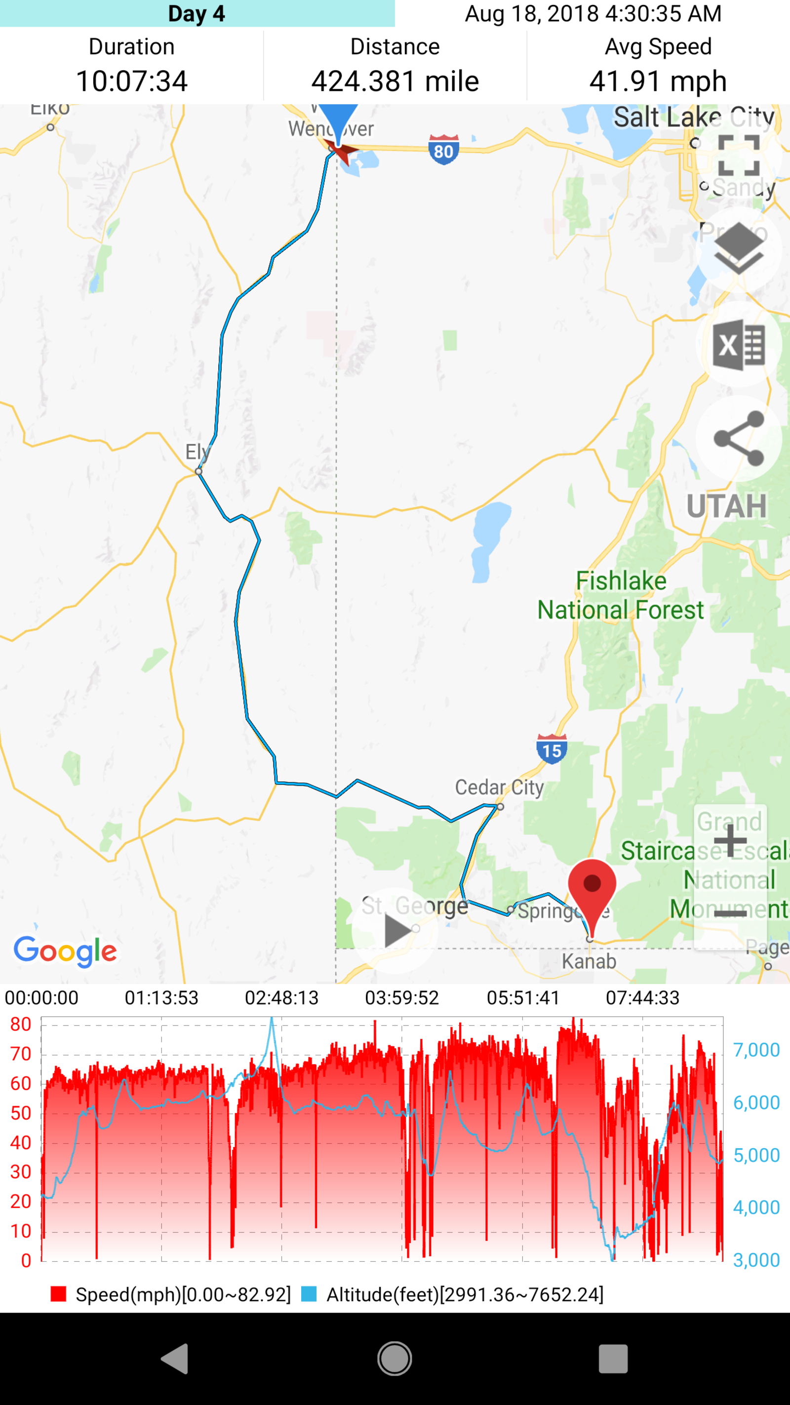
I started off day 4 saying goodbye to the folks who had traveled down to Bonneville with me. From here they would travel back up to Portland, and I’d travel south. I wasn’t sure from here exactly where I wanted to go. I had a general idea of places I did not want to miss, but didn’t have my day to day planned. I’d been told of some great roads east of Salt Lake, and that the roads southbound through Nevada were terrible, but I wasn’t feeling the interstate required to get east, so headed south through Nevada.
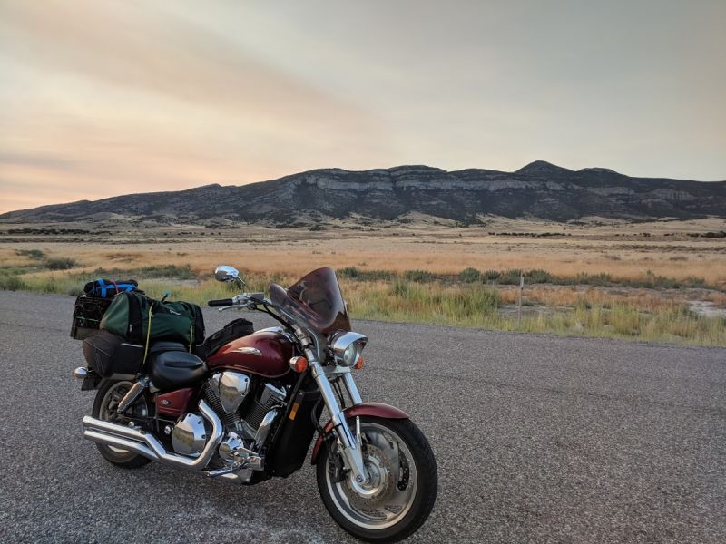
There wasn’t much in the way of corners... at all. Pretty sure there were multiple 20+ mile straightaways, but riding though here early in the morning was incredibly peaceful. From about 6am through 9am, I only saw 2 other cars going the other way, and none going the same way. For certain sections, it was just me and the bike as far as I could see. Multiple times I was able to stop right on the road to take photos. The mountains off in the distance the whole time made this road fairly interesting overall visually.
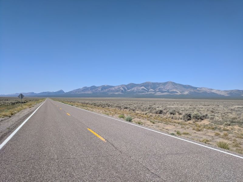
I realized later in the evening that this section through Nevada took me within 50 miles of Great Basin National Park. I hadn’t known, and there wasn’t any signage along the route. Oh well, next time although I can’t really think of a reason I’d be in this section of Nevada again.
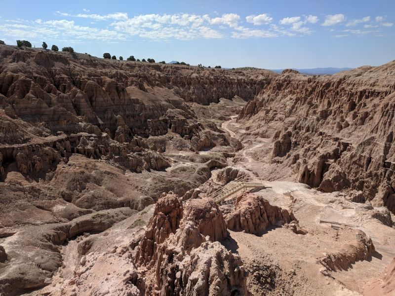
Somewhere just North of one of my planned fuel stops, I glanced a cool looking rock formation out of the corner of my eye. About a mile later there was a turnout for a viewpoint.
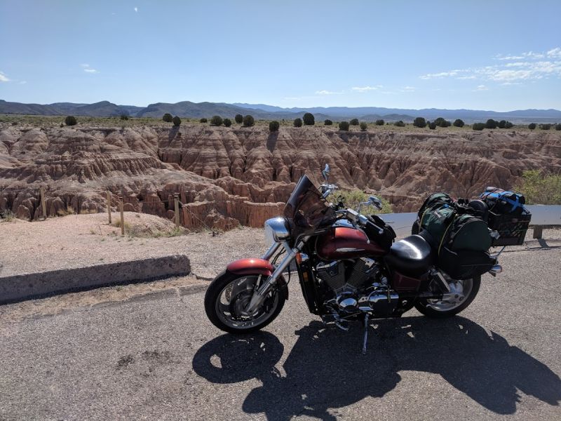
I’d stumbled across a place called Cathedral Gorge State Park, a neat rock formation in Middle of Fucking Nowhere County, Nevada. There was a set of stairs hidden behind a gazebo that lead right down into the gorge. I took about a half hour break here and had lunch down around the rocks. Only one other group of people came through the whole time, so I pretty much had the place to myself.
I got back on my bike and before long was crossing over back into Utah. A short section of I-15 later and I took the exit leading toward Zion. I figured I’d look for somewhere to camp in Springdale and hit the park the following morning. I started to see the rock formations as soon as I turned on to Ut-9.
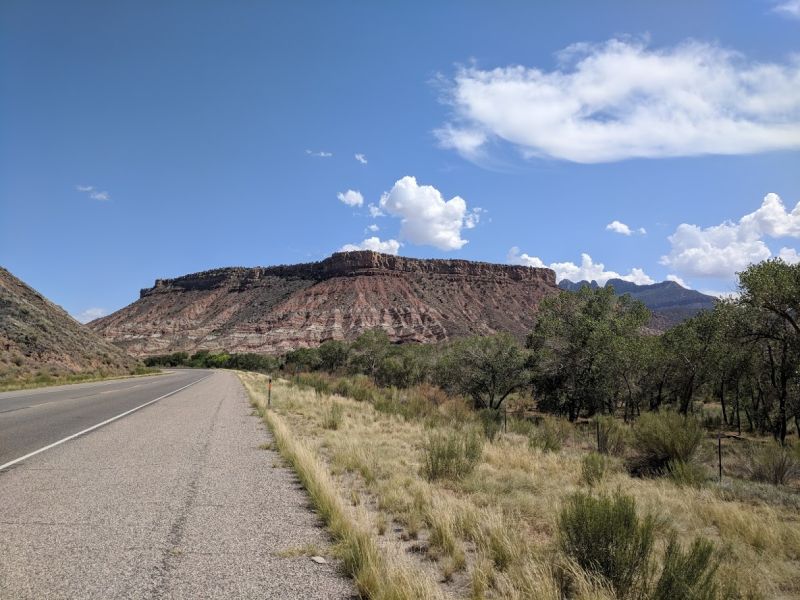
Riding through this area was beautiful, not a whole lot of cars on the road so I was able to take it slow and enjoy the scenery. You don’t see rock formations like this in the Northwest.
I eventually made it to Springdale and quickly realized it was a pretty tourist trappy area, not exactly the vibe I was going for, so I pressed on (that’s what I get for not doing any research :P ). The views kept getting increasingly breathtaking the further East on UT-9 I went.
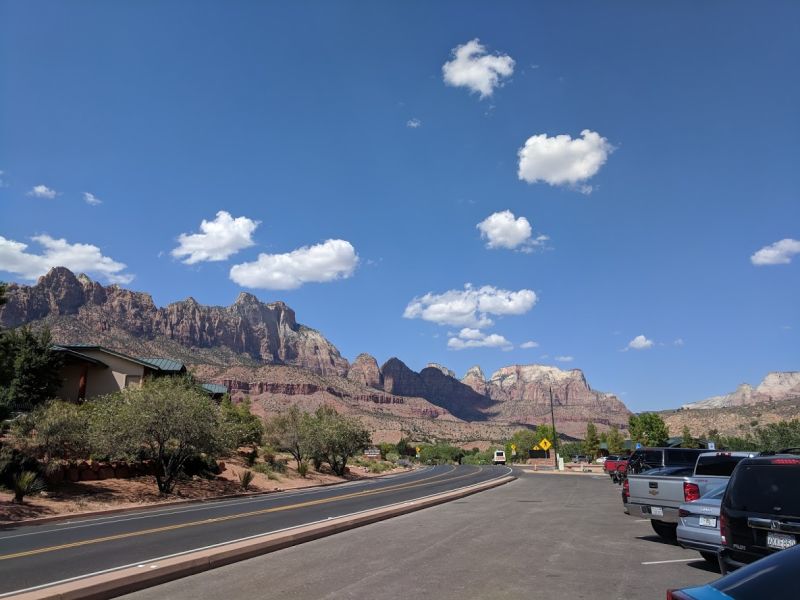
Shortly after leaving Springdale I arrived at the ranger station and the park entrance. Waiting in line to get in, I became aware that it was well above 90 degrees. I’d been moving for some time, so hadn’t realized just how hot it had become. I hadn’t been drinking enough water throughout the rest of the day and get my first nosebleed from dehydration of the trip. As soon as I got into the park I drank about a half gallon of water to make up for that. I hadn’t been quite prepared for how quickly the desert takes fluid away.
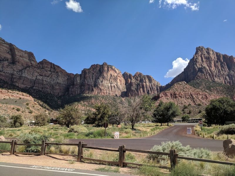
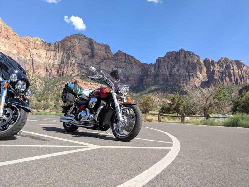
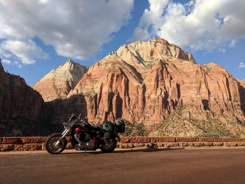
Even the parking area of Zion was god damn beautiful. Giant red rock faces surrounded the whole area. It was truly breathtaking.
Knowing full well that I’d be spending more time here than I should, and not wanting to search for a campsite in the dark, I called ahead to a town a little bit east and booked a room.
Zion had a shuttle system to take people around the park itself. The first stop I got off on to walk around was the court of the patriarchs, still probably my favorite viewpoint from the park.
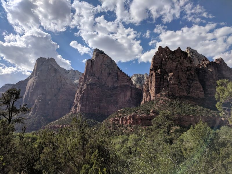
I take the bus in further to Weeping Rock, and the Temple of Sinawava. Both of these are much further in, closer to the rocks. As such, I couldn’t get great photos. The scale of this place absolutely needs to be experienced in person. You only get a feeling of how big it is from pictures, in person it’s incredible.
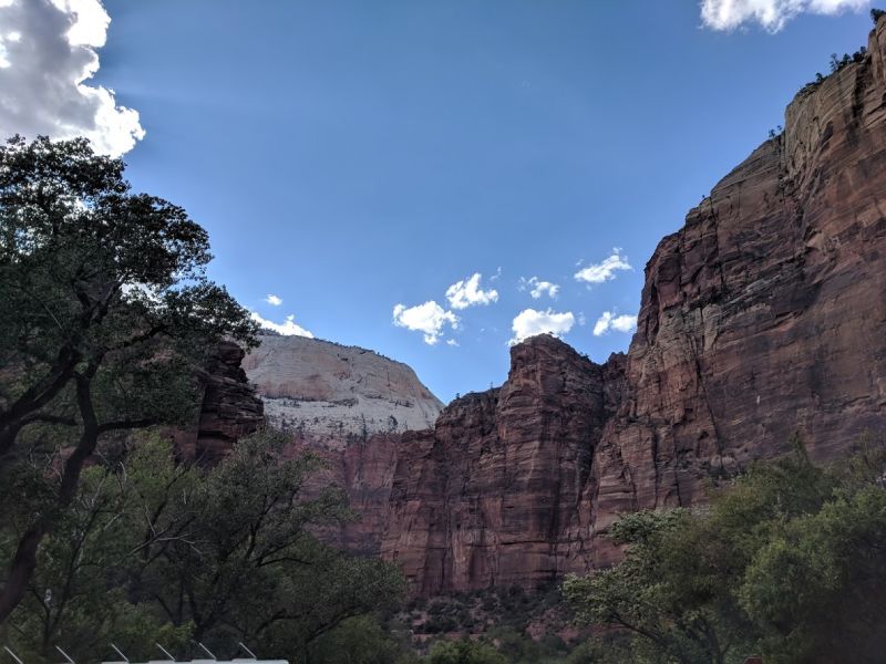
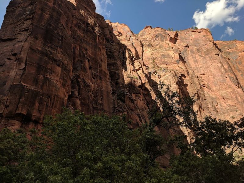
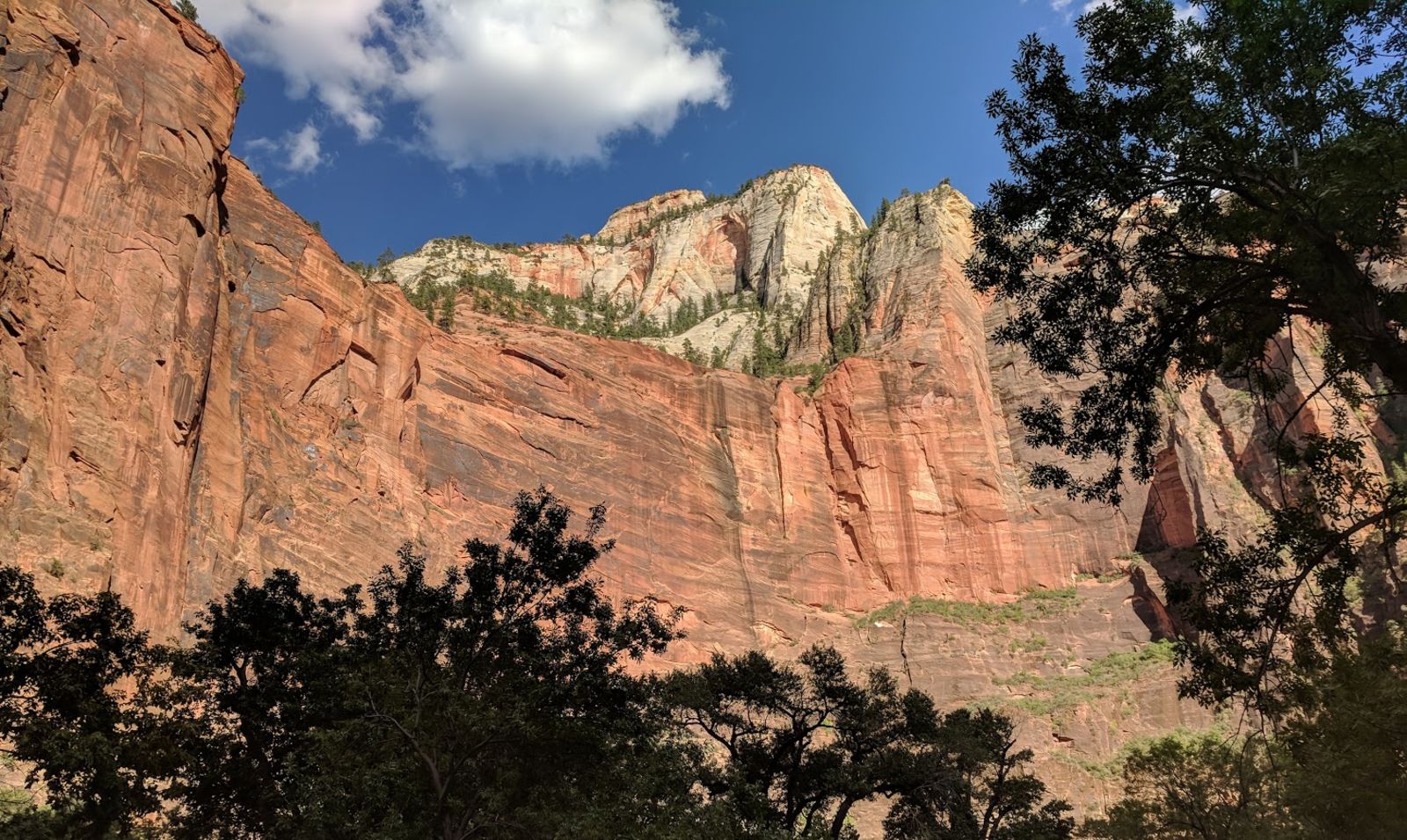
After wandering around and being absolutely wowed for about 4-5 hours, I headed out continuing East on UT-9. This had been one of the roads I’d been really excited to take because of how twisty it looked on a map, but to be perfectly honest, I took it at a snail’s pace and enjoyed the gorgeous scenery as much as I could.
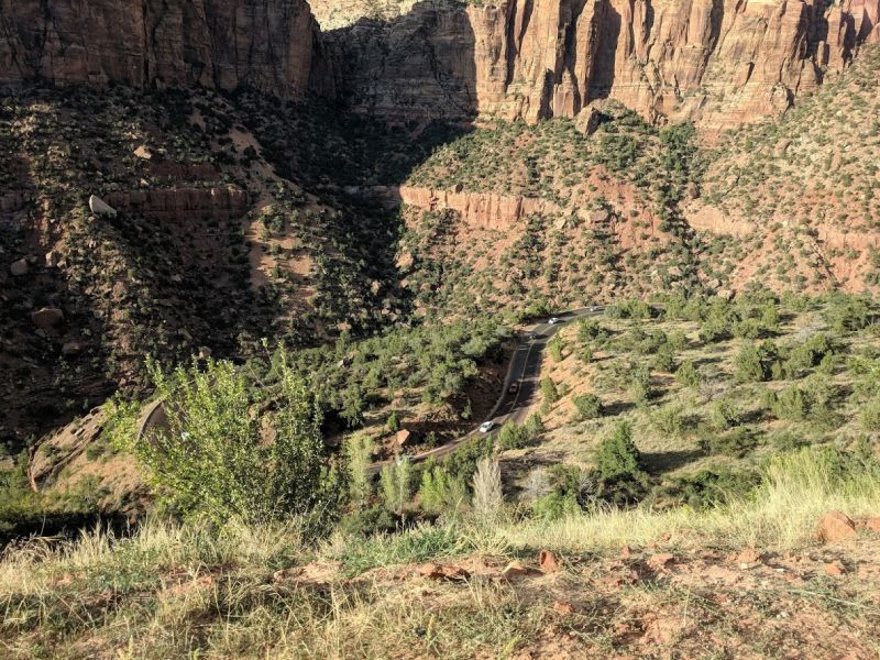
One of the few photos I was able to take that conveyed the size of these rock formations, was looking down at a section of the road through the park from a ridge about a thousand feet up.
Zion was amazing, I need to go back with a good set of hiking boots and spend at least a week here.
I headed Southeast from here, got to my hotel and mapped out a route to the Grand Canyon for the following day.
Total Miles: 1221
Total Miles for the Day: 424
Highest Elevation: About 8000 feet
Lowest Elevation: About 3000 in Zion
Killer Piece of Gear: Auto Tinting Visor
Best part of the day: Zion
Worst part of the day: Shortchanging Zion