
Originally, I’d planned to cross the valley at night and watch the sun rise from the Western side, but that seemed like a waste. Every other national park I’d been through had been impressive enough that it seemed a shame to mostly skip this one for fear of discomfort. I left Beatty around 6, just as the sun was coming up and headed in to the valley.
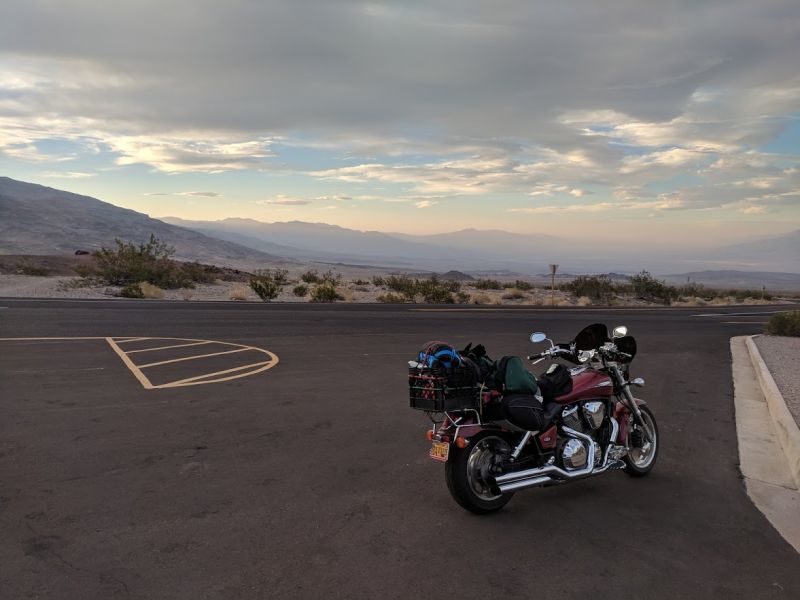
Overnight low in the area was 93, and it started heating up as soon as the sun came up. When you first cross into the park, you come though an opening in the eastern mountains and start diving down 4000 feet into the desolate landscape.
I’d decided, since I was close by, that it would be be stupid not to at least head to Badwater Basin (the lowest elevation in North America). It was about a 75 mile detour, but I figured I’d still be able to get out of the valley before dangerous heat set in.
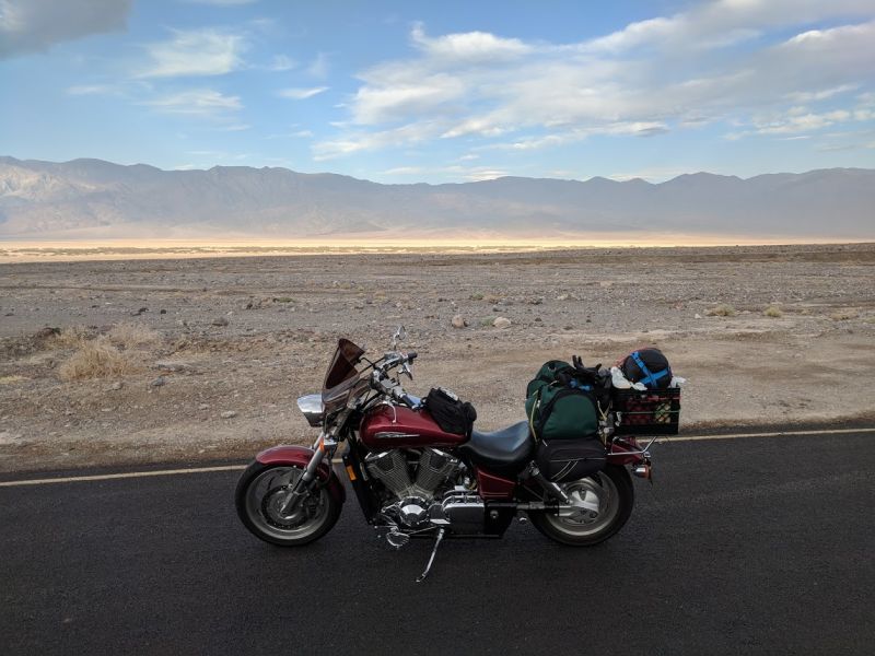
The landscapes in the area are unlike anywhere else I’ve been, it’s surrounded by mountains in all directions. The earth is dead and barren, there is barely any vegetation. There aren’t many people either, considering that the morning is the only time one can really explore the park in the summer, I was surprised to only see about a dozen or so other people the entire time.
I made it to Badwater around 8am, it was already over 100 and the sun wasn’t even at a high enough angle to shine directly yet.
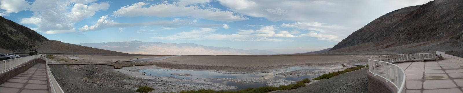
There’s actually water at Badwater, a small heavily salinated (hence “bad”water) spring at the area most shielded from the sun’s rays. All the area around it is a sand and salt mix on the ground.
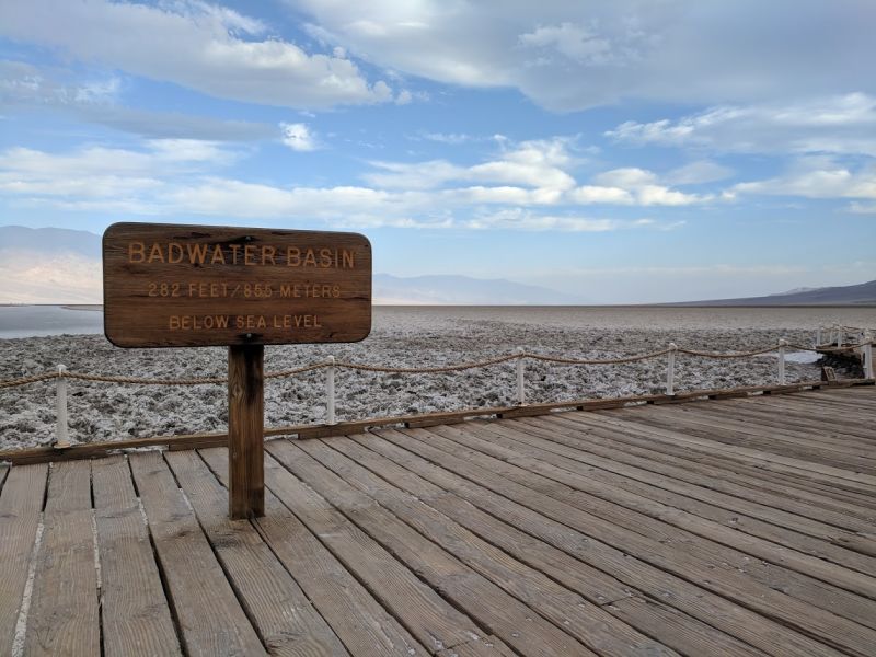
There is a small salt flat at the low point that extends out for miles.
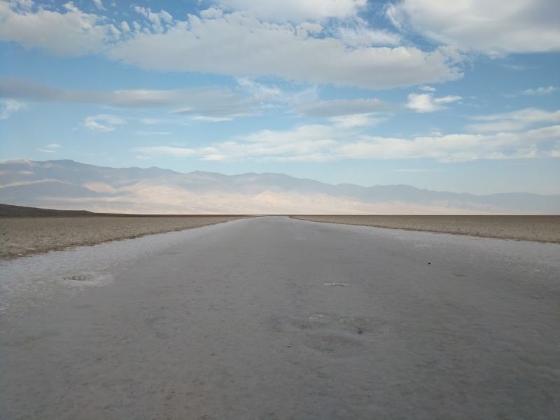
Technically, if you follow this for about 5 miles, you’ll get to the REAL lowest point in North America, but it was only a few feet lower than the sign, and walking out presented some issues...
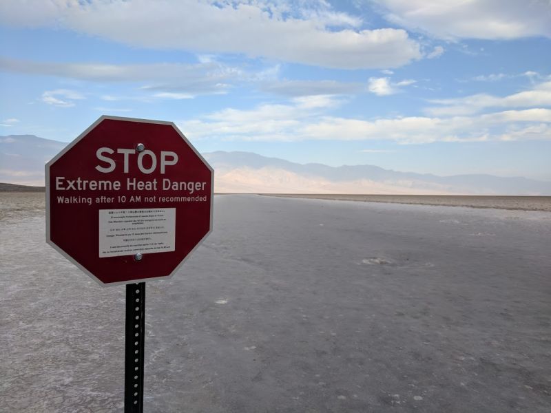
Yeah, those signs were everywhere in the park...
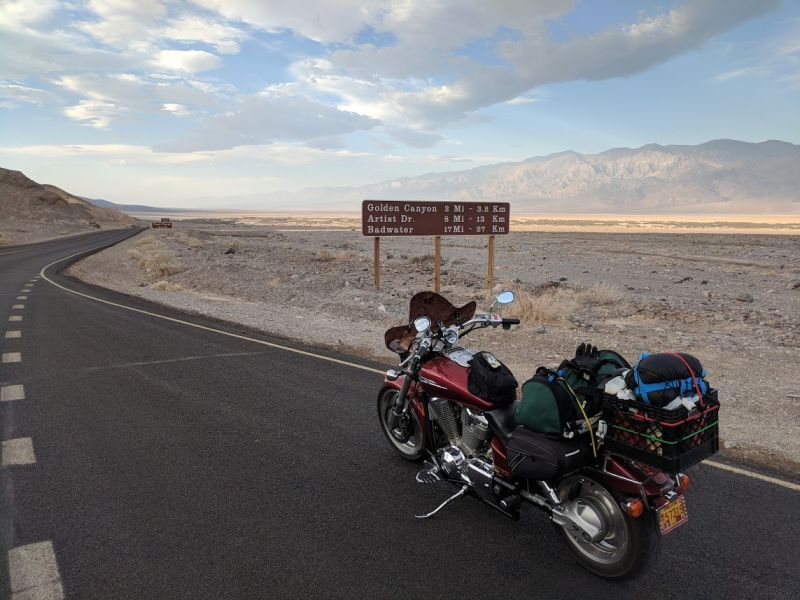
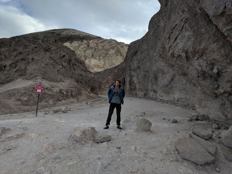
I only spent about 20 minutes of so at Badwater before booking it back North towards the cooler areas of the park. I stopped briefly at Golden Canyons.
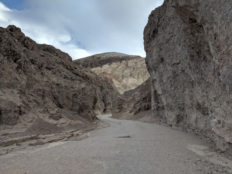
This area is supposed to be one of the more beautiful sights in the park, but getting there is a 4 mile one way hike. That would have put me right in the danger time of day, so I only went up the trail about a half mile. The right time to visit this area is definitely winter. At this point it was 10am and past 105.
I stopped for gas in the aptly named Furnace Creek, this is the place than has recorded the hottest air temperature (134f) and the hottest ground temperature (201f) ever. I took a really quick walk around the visitor center, and one of the park rangers told me I was crazy to be there on a bike in the summer. When I left, the sun was fully out and the thermometer outside was showing 110. I got back on the road I’d intended to take from the beginning. Right away there was a sign “Avoid Overheating: Turn off AC Next 30 Miles”.
Speaking of overheating, for those that haven’t ridden, motorcycling is a constant object lesson in convective heat transfer. When ambient air temperature is below body temperature, the faster you ride, the more heat your body transfers to the environment. However, when air temperature approaches body temperature, the trend reverses. Here in the valley, the faster I rode, the more heat was transferred to me from the air.
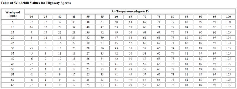
Here’s a handy table. It doesn’t go up high enough, but you get the idea. The hottest temperature of the day I saw was 112 indicated in Stovepipe Wells.
There was a surprising amount of really good riding roads going through the Towne Pass area. They look arrow straight on my maps, but in real life that’s not true. There’s great scenery too (I rode through where they filmed Tatooine!), but for obvious reasons, I didn’t stop much for photos with the ever increasing heat.
A little after noon, I arrived at the Father Crowley Overlook on the Western edge of the park.
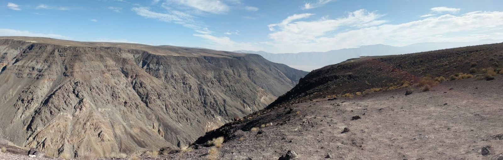
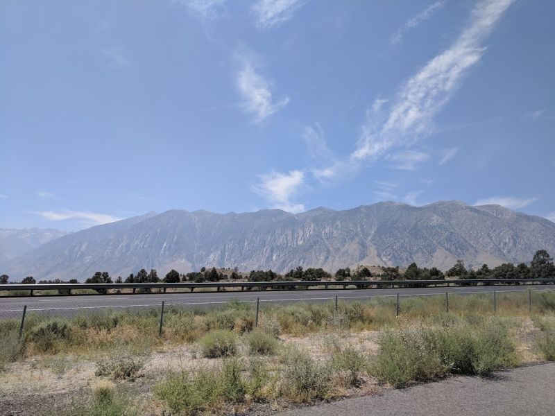
I’d initially planned to be here for sunrise to beat the heat, but I’m glad I diverted and explored the park a bit. From here, it was a quick jump to the other side of the mountains and out to 395 in California. This is where I saw the Sierra Nevada Mountains for the first time of the trip.
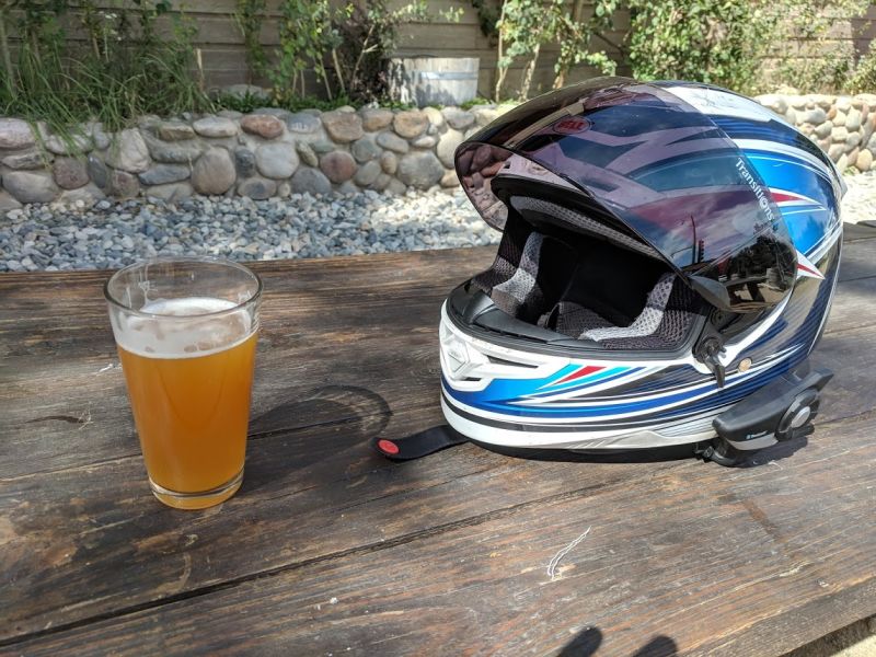
Refreshed by the 20 degree drop in temperatures, I pressed on North, trying to get as close as possible to Yosemite for the next day. I stopped for a coffee in Bishop (and mostly to access some wifi), where I planned out my overnight. I’d hoped I could camp in Yosemite, but it sounded like I wouldn’t have much chance of finding a late notice spot at one of the established campgrounds, so I decided to try a USFS site a little bit south of the park in Mammoth Lake. I got into the town around 4pm, grabbed a beer at the local brewery, and then set up camp for the night.
I was a little worried about the next day, I’d be crossing over Tioga pass. This would be the highest elevation of the whole trip, about 1000 feet higher than the Grand Canyon, and the bike had already been acting up quite a bit at 9000 feet.
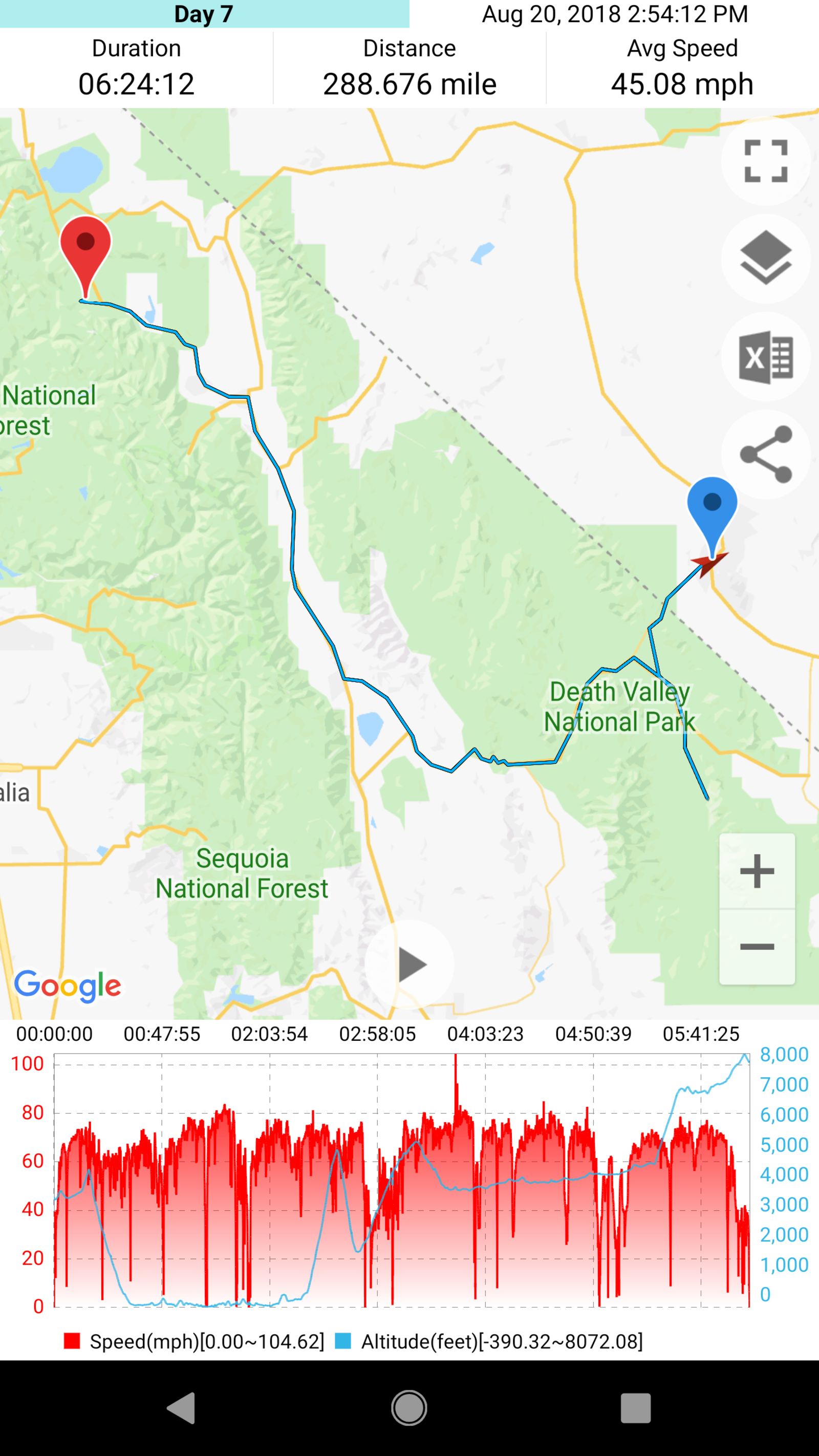
Total Miles: 1992
Total Miles for the Day: 289
Highest Elevation: 8300
Lowest Elevation: -282
Killer Piece of Gear: Mesh Jacket, I actually wore gear all day
Best part of the day: Unexpectedly fun roads in the valley
Worst part of the day: Inescapable heat