Decided for my road trip I’d stay close to home, so last night and tonight I’m staying at the Canyon Inn at McCormick’s Creek State Park, about an hour west of Indianapolis.
If you don’t care about pretty roads, feel free to jump to the end where I have a couple of vehicle identification requests.
(All photos unedited because I just got back to the Inn and who’s really going to read this anyway?)
Unlike those of you out west, where public lands abound, those of us east of the Mississippi typically have two choices to go off-roading: private lands (either via an admission charge or just someone you know; I refuse to acknowledge that some assholes may go on private land without permission) or, in rare cases, state or national forests. (Here in Indiana we do actually have two state-owned recreation areas dedicated to off-roading, but that’s far from the norm.)
However, frankly, I’m tired of true off-roading (although someday I hope to get out west and explore) so instead I do my best to find public roads that lead to places rarely seen.
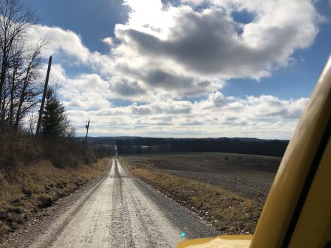
I went exploring today and found a few new-to-me back roads. Just west of here are some of the most remote “how can this be a public road?” roads I’ve found in Indiana, and I discovered a real gem today.
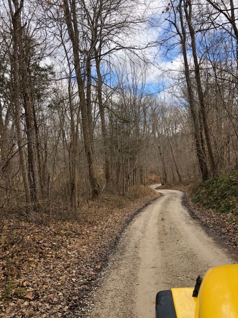
The most “how can this be a public road?” road in the area is (appropriately) Mudd Road. Today I found a strong contender, however, in Boles Road.
Boles Road stretches the definition of “useful” a bit because there’s no particular reason to take it, but it does connect two roads and there are a surprising number of homes and two small dead end roads off it, so there are several residents who have to navigate this road on a regular basis.
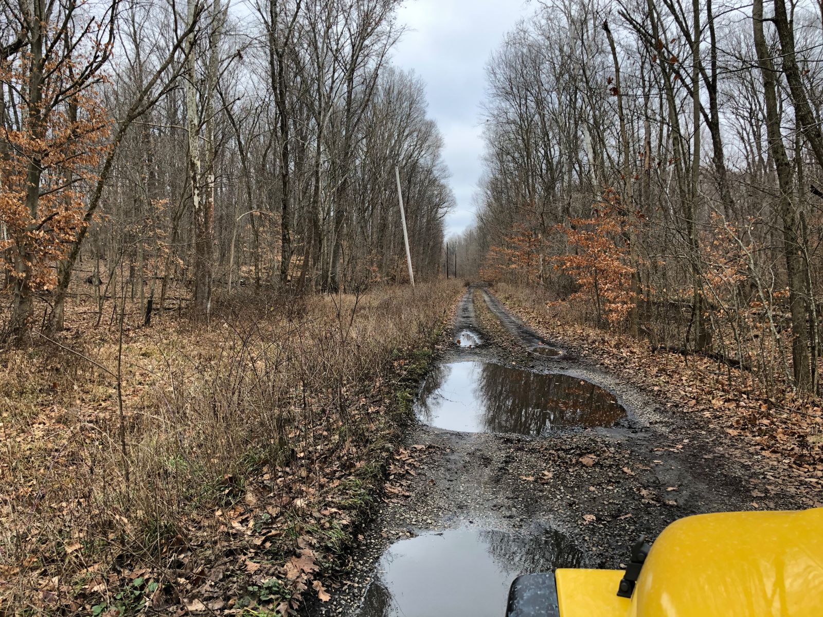
The most important criteria for such a road is that it must not be a dead end. Any dead end road in the middle of nowhere can be a disaster, but it takes a truly special public road to be both a mess and actually useful.
I also found a small cemetery dating back to at least the mid-1800s. Some odd stones, including (I just can’t help editing everything I see) years apparently incorrectly transferred to newer headstones.
I’ve thought about creating a new group on Meetup.com for people interested in exploring Indiana’s back roads, and I may include cemetery tours. There are certainly enough old, tiny ones worth visiting, although more than a few don’t have enough parking for a group of cars.
Incidentally, I’ve decided I desperately need an app that allows me to document road quality. I figure I can use OSM data, but I doubt there’s any app that does precisely what I want: rate and then use colors to appropriately display the ruggedness and a few arbitrary scenic qualities. I want something that will detect the road I’m on and automatically select the current segment: the stretch of road between the previous and next interchanges (but allow me to extend or shorten that distance). Ideally it would allow me to correct the OSM data; sometimes a road which OSM shows is no longer public, or is indicated as a dead end but isn’t.
If anyone knows of such an app, please let me know. I’m skeptical anything will quite do what I want, so I may have to dig into mobile development again.
Two identification requests.
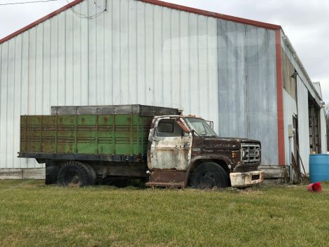
First, this tail end caught my eye. Maybe a Chrysler Imperial? The lettering seems to say Imperial but I don’t see any matches on the Wikipedia page.
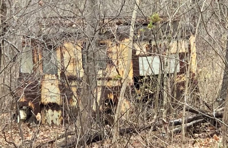
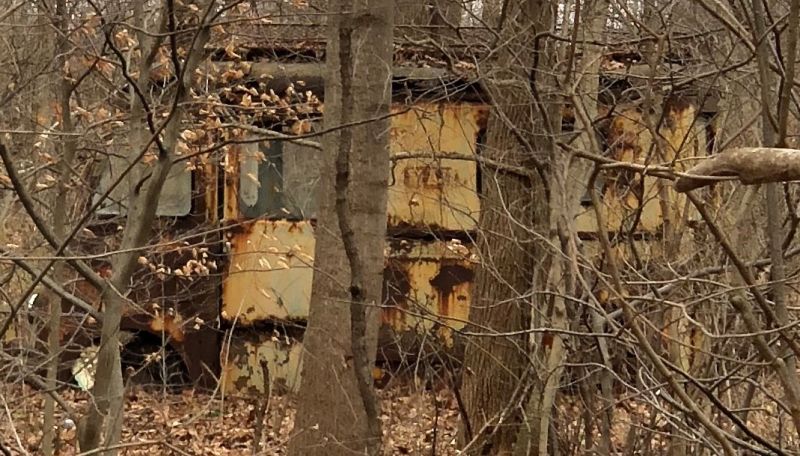
This will probably be much tougher. Off in the woods I saw what looked like an old panel van with “Mail” on the side. Any ideas?