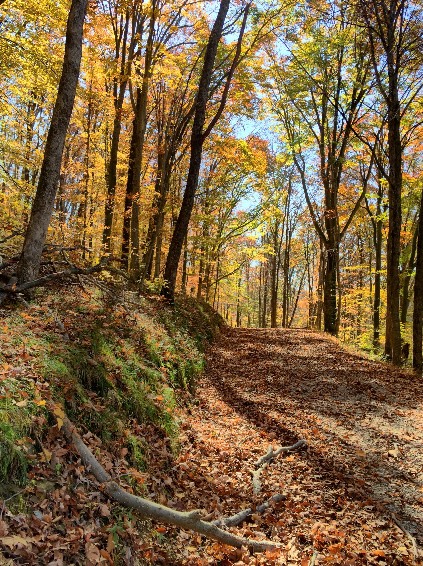
I love curvy, hilly, rural, gravel roads. The more of those boxes I can check on any given route, the happier I am. (Admittedly, I’d prefer dirt over gravel, but those are rare indeed, at least around here.)
I wrote recently about long-distance routes that various organizations have charted; I’d definitely recommend perusing that list for opportunities near you.
How do I find my own interesting routes? Glad you asked.
Websites
I have this vague notion that once upon a time the web was the primary way we interacted with the Internet. Remember printing maps from MapQuest? It sure seemed a lot easier than going to the AAA office and picking up a TripTik.
Speaking of, holy cow, I didn’t realize AAA had a TripTik website & app. TIL.
Curvature
The most interesting site I’ve discovered recently, Curvature, was shared here by JawzX2.
Curvature calculates the curviness (I had to find some other word than “curvature” yet again) of roads, which should appeal to most here, whether you like to drive fast or slow.
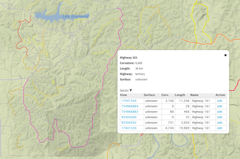
Alas, Indiana’s curviest road is hidden inside a Navy base, Naval Support Activity Crane. Somehow I failed to notice this as I prepared my map, and had to stop short of encroaching upon federal property.
But, that trip led to my serendipitous discovery of an original Jeep Gladiator, a J2000 pickup truck, so it’s all good.
Gravelmap
If you prefer a little less algorithm in your adventures, you can always check out Gravelmap.
As a pop-up helpfully informs you when you visit the site:
Gravelmap is a tool for finding and sharing gravel and dirt roads in your area, submitted and reviewed by people near you.
It’s designed for bicyclists, but why should they have all the fun?
USFS
If you’re fortunate enough to live near a national forest, the U.S. Forest Service offers an interactive map that’s a bit tougher than I’d like to use, but still worth your time.
By selecting “OHV > 50 inches” I can get an overview of all the roads the forest service offers.
Sort of. It doesn’t show any of the ones in my local national forest, but in fairness, there isn’t much of note to show.
Speaking of the roads that are available in my local national forest, the USFS maintains a MVUM (Motor Vehicle Use Map) for each location, retrievable from the forest’s website. They’re a nice complement to and augmentation of the interactive map, PDFs you can download for offline retrieval when you’re deep in the middle of nowhere.
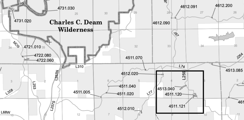
I typically find more forest roads in the Hoosier National Forest than are documented on the MVUM, but it’s safest to assume that if they aren’t on the map, they’re no longer allowed for use.
Road trips
If you haven’t already discovered these, they’re worth a visit when planning a more serious road trip.
Apps
Each mobile platform has good mapping apps, but I don’t pretend to be able to advise on the selection for Android. Please feel free to promote your favorite Android (or other) apps in the comments.
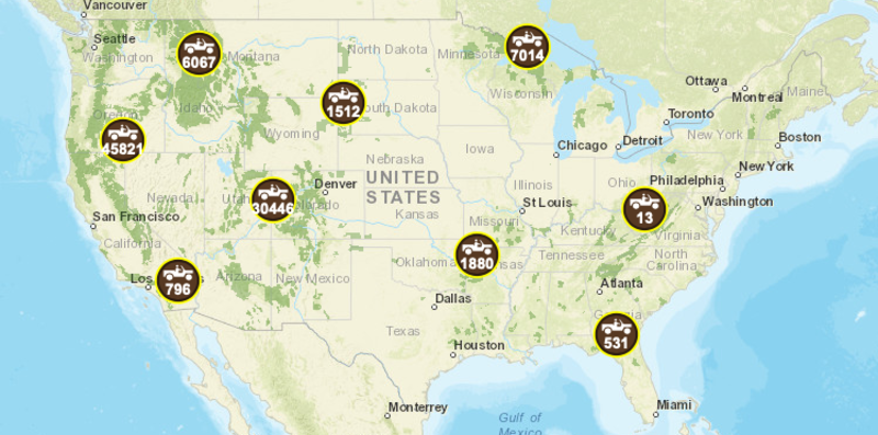
Gaia GPS
Gaia is a powerful app that allows you to create routes and record tracks. It has its share of quirks; perhaps most annoyingly there’s no good way to hide every other route than the one you’re interested in following.
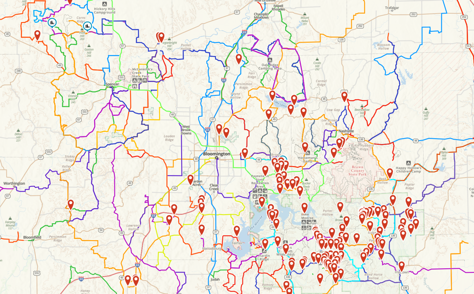
As you can see from the above map, one of my favorite parts of Indiana, the view can get a bit cluttered after a while.
Gaia has a very powerful layers feature which also allows me to look at property ownership; if I see an unmarked drive, I can usually figure out whether it’s public or private land without assistance, but Gaia provides a backstop. It can also help me figure out things like who owns that cool Gladiator I discovered.
Rego
Rego is an app that I truly cherish and fear mightily for. It was sold a couple of years ago, and I don’t see a lot of activity; I worry that it, like many iOS apps, is struggling to find a financial model that supports future enhancements.
Gaia and Rego have a fair bit of overlap, but for me they perform two distinct tasks.
As I indicated above, I use Gaia to create routes when I see something interesting I want to explore, and I use it to record tracks as I’m out and about.
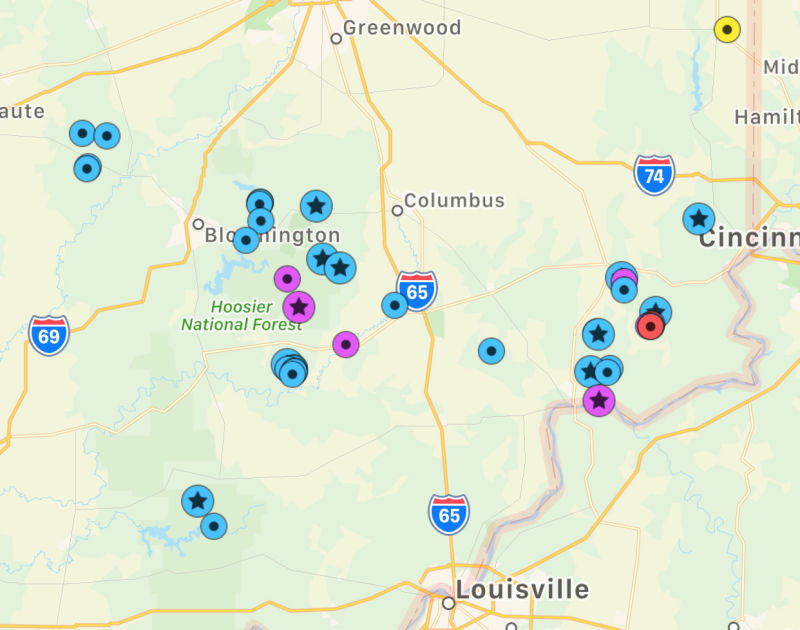
Rego is where I flag points of interest, both in advance for something like our recent Oppo rally, or as I discover them while exploring.
This, for example, is my database of water crossings.
Please, Rego, don’t go away.
Scenic
Scenic is a pretty nifty navigation app that focuses on motorcycles; as you can imagine, one of the features is defining the curviest route between two locations.
It’s regrettable that iOS doesn’t allow (or Scenic doesn’t support) viewing the navigation on the lock screen, which rather limits its utility, but often I’ll use it to look for a different route than what I’d usually take and then wing it from there.
Maplets
Maplets is a simple idea done very well: allow offline viewing of PDF-based maps, including where possible a GPS indicator of your current location on the map.
For example, all of Indiana’s state parks and most fish & wildlife areas have a downloadable PDF guide to the property that includes a map. Most of those are already available for download with Maplets, and whenever I find one that is missing or out of date I can drop a note to the developer and it’ll be fixed very quickly.
I’d really like to see behind the scenes on this app. I’d like to know what the developer has to do to convert a PDF to make it GPS-ready, and it’s bit tempting to start creating my own maps.
Offroadatlas
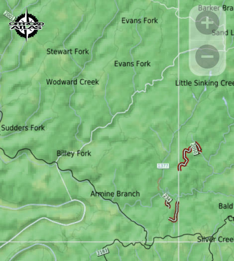
I described above the National Forest Service’s MVUMs; Offroadatlas leverages those and other data sources to provide a service similar to Maplets. I haven’t used the app much because, as I’ve mentioned, the Hoosier National Forest doesn’t really have forest roads worth navigating, but if I can ever get my (or another) Jeep sturdy enough to go back to the Daniel Boone National Forest in Kentucky, I’ll absolutely try it out there.
(Unfortunately, as I discovered while grabbing this screenshot, the app is very slow, borderline unusable. Hopefully that’s operator error or a temporary glitch in the matrix.)
Epilog
So there you have it. A few sites, a few apps, and Just Jeepin’s guide to happiness.
(Happiness, in case you’re curious, can be measured by the number of one-lane bridges you cross in a day.)
One last set of general mapping tips. When you’re looking for interesting roads on a map, look for:
- Roads named after an adjacent flowing body of water (or if the map shows them, that follow a body of water)
- Roads that don’t travel north-south or east-west
- Roads that zig or zag (duh)
Hmm, I expected that list to be a bit more profound. Guess it’s not that hard after all, so get out there and find you a road trip.