
My GPS picked up my practice maneuvers over the weekend!
Here I am learning how to tune in the VOR and follow the beacon to another airport:
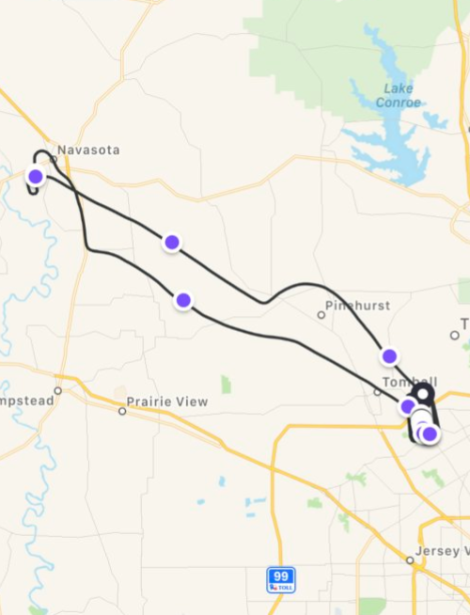
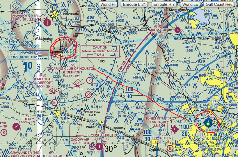
That big curve around Pinehurst was after I had set the VOR to the first navigation airway I wanted to follow and I was trying to find it in the sky. What’s a navigation airway, you ask? Each beacon is like a compass rose and navigation airways are defined radials which lead from one location to another. Think of them as virtual interstates in the sky. They are shown as straight blue lines on the navigation charts. The 110 degree radial from the Navasota beacon leads directly to/away from my home airport.
I thought it was pretty neat that my GPS shows me finding and flying the airway. On the way back, we followed the road, then used the airplane’s GPS to get going back to the airport and finally switched back to VOR for the final leg.
The best part was the detail it captured. Here I am flying solo, practicing steep turns and turns around a ground reference:
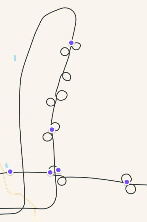
The purple points are the GPS warning me of sudden changes in speed, direction, or g-force. I’m better at turning left than right. I’ll have to work on that.