
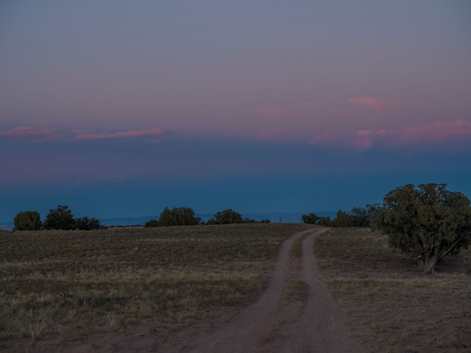
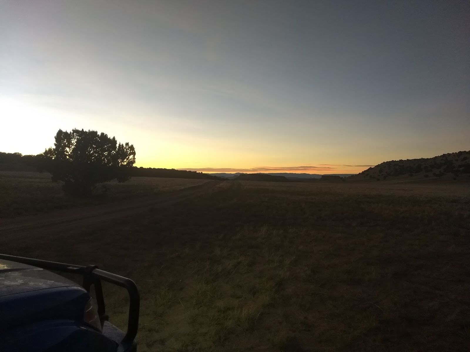
Morning
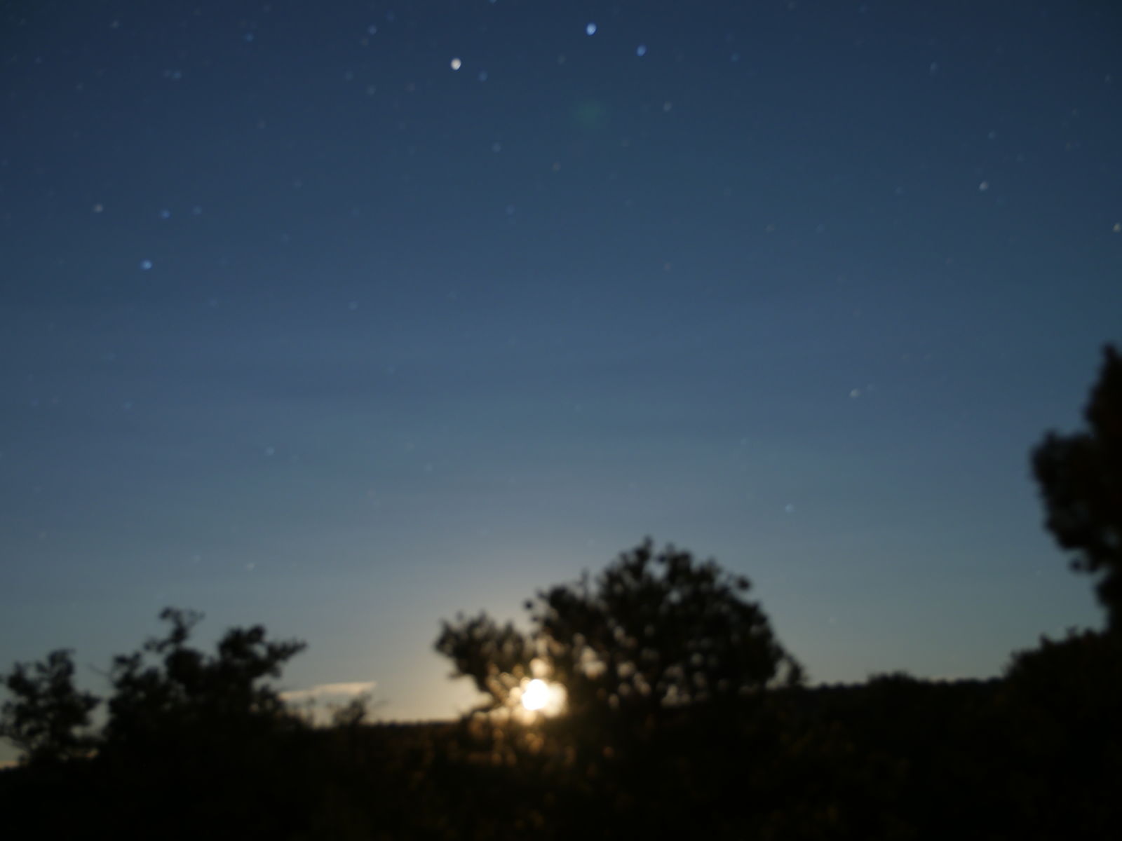
Its been cold at nights but frankly thats the way I like it. The only trouble with sleep has been a discovery that my pillow is too flat (solved on night 3 with the addition of my coat) and the moon laser beaming in my window at 3 am. Other than that Im pretty stoked for the day. Quickie breakfast and we are out to the freeway entrance in no time.
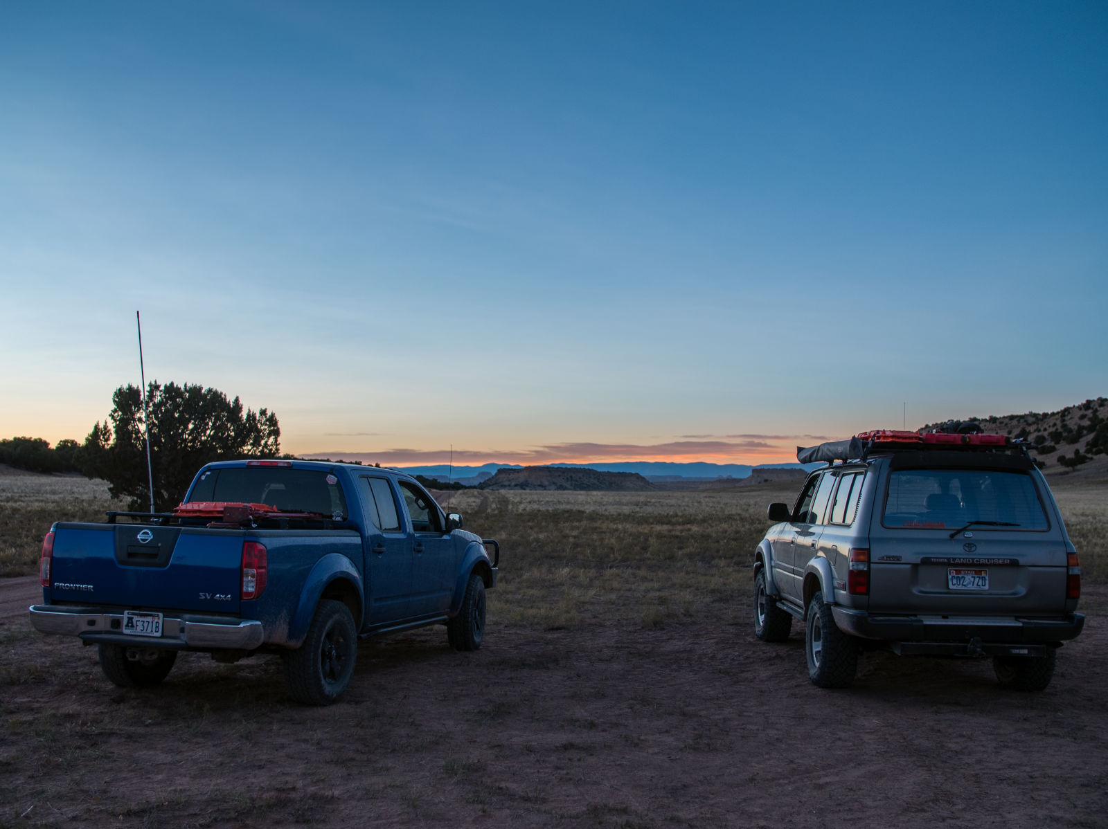
No cell service here tonight so we get our calls in where we can. Thanks electric Christmas tree. We are headed east this morning towards green river which means its time to air up.
So the last time I filled up was in Sandy. I filled 40 L in the rotopax and 25 gallons in the tank when I left Sandy. When we stopped in price Wade and Tom who had traveled further by this point than I decided to top off. I did not. I had 3/4 a tank and 40L on the roof, I would be fine. Last night I emptied my 40L into the tank for a net result of slightly less than half a tank, I could totally do the days adventures on half a tank, but I would have to go into to green river when we were done either way. I should have topped off, but I didn’t.
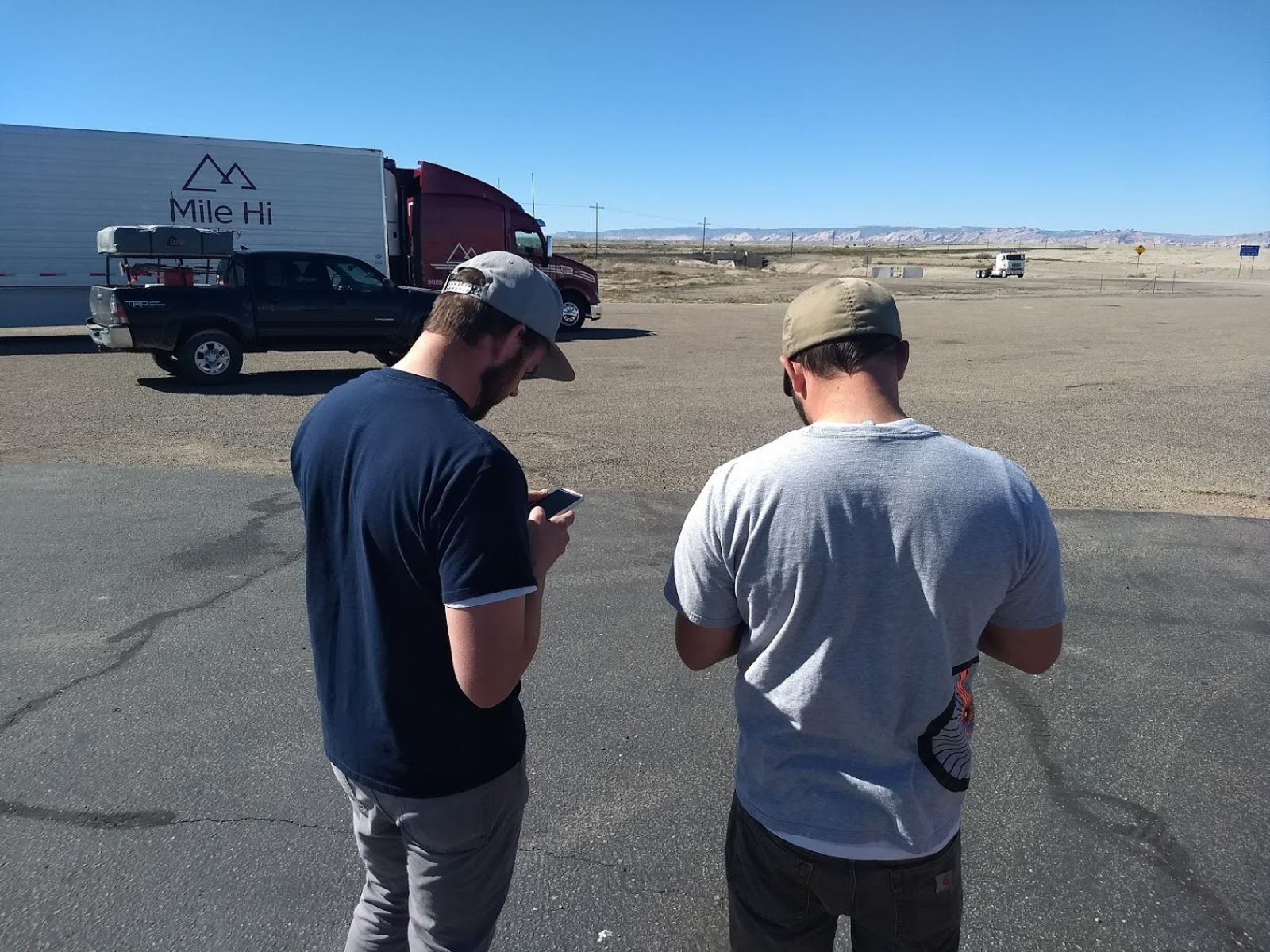
So here we are, again on our phones, in Green River. Checking maps and looking for ways to get off the freeway and onto dirt mainly. After topping off with fuel (plus an extra 20L for luck) and water we head off towards 24 once more this year. There is a road on the map that appears to take us west again and then north back into the swell near the start of Black Dragon canyon. As a bonus is goes past someplace called “the squeeze” I love places call “squeeze”.
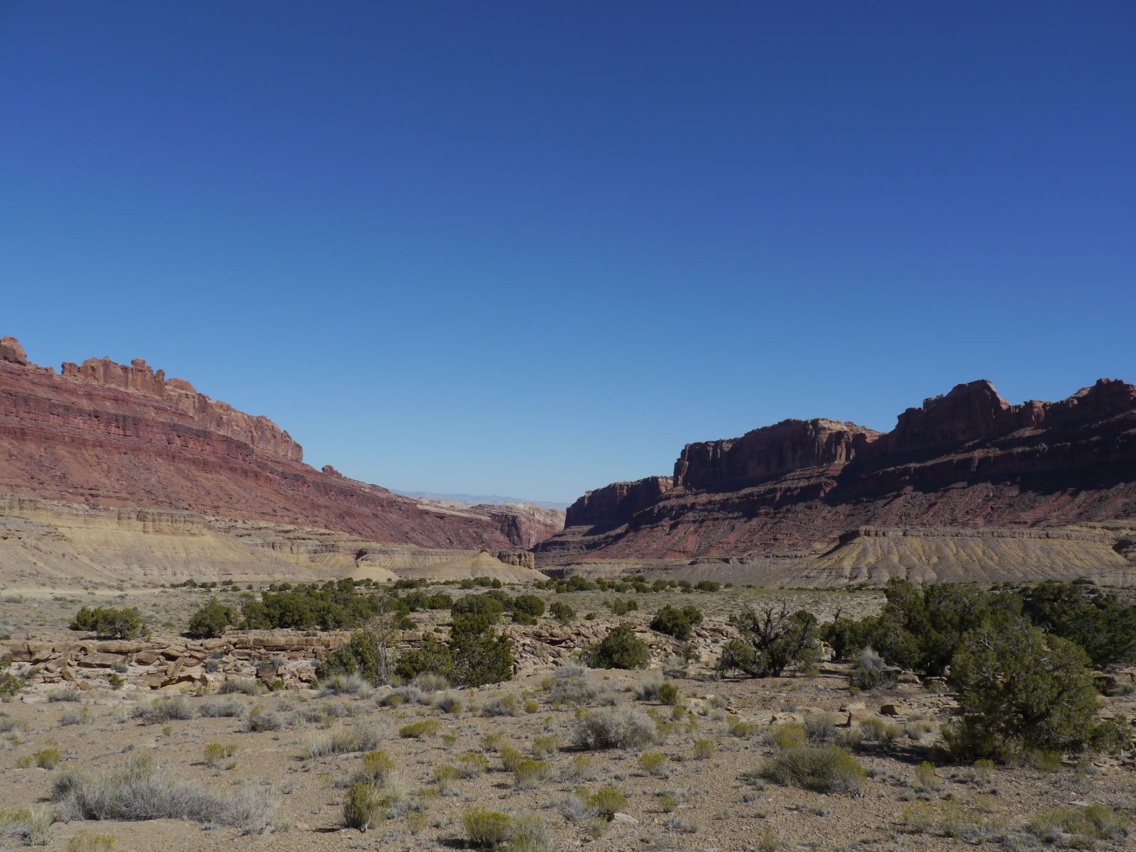
Based on the map we weren’t expecting much of this road but it turned into a surprisingly interesting, beautiful and eventful little drive.
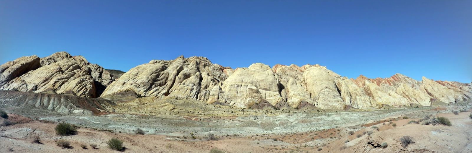
For starters the squeeze is neat! I wanna come back and see more of it.
Plus there is the old road, old bridge and private game reserve to drive though. No pics of those though, but they are in the video.
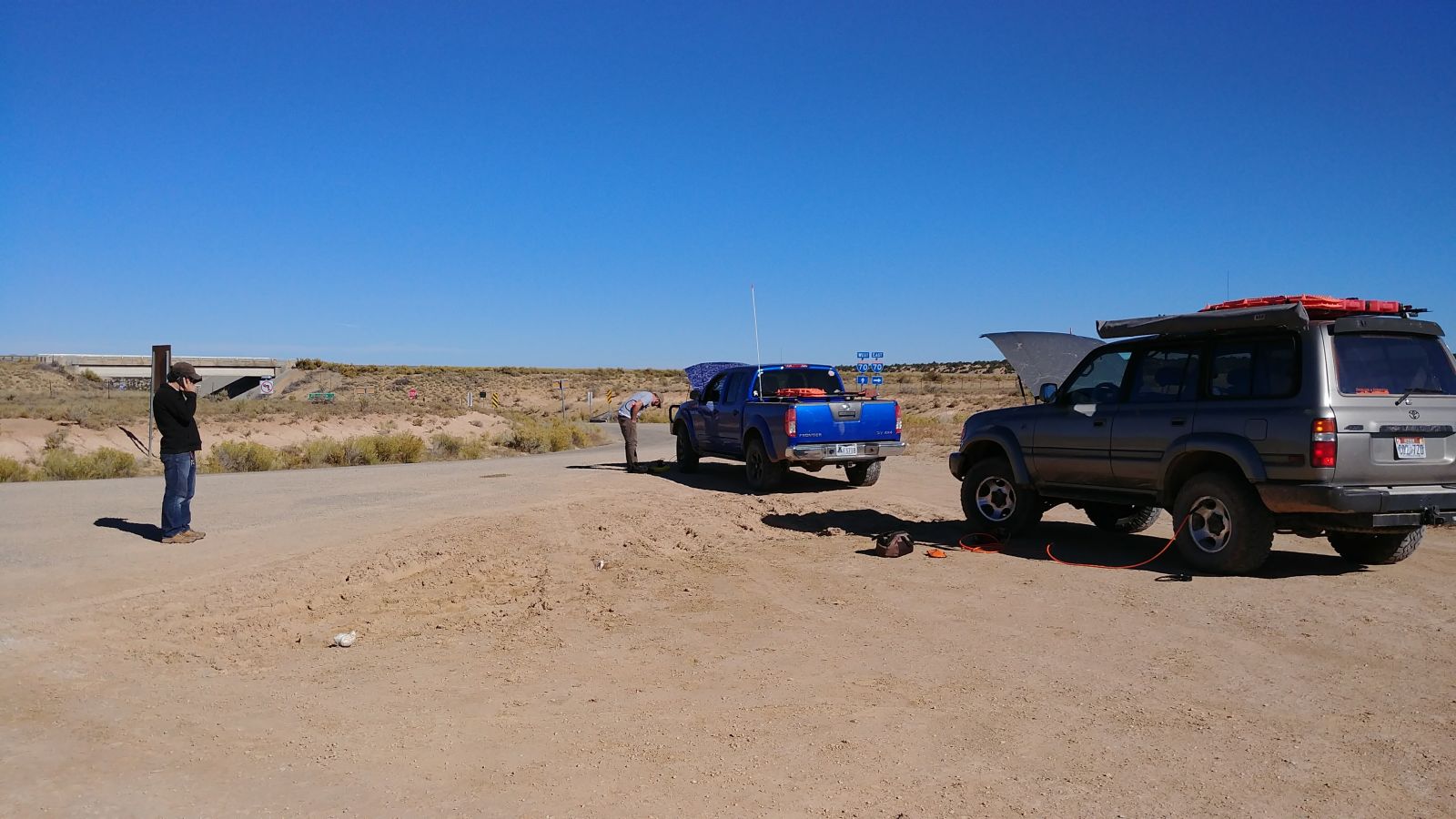
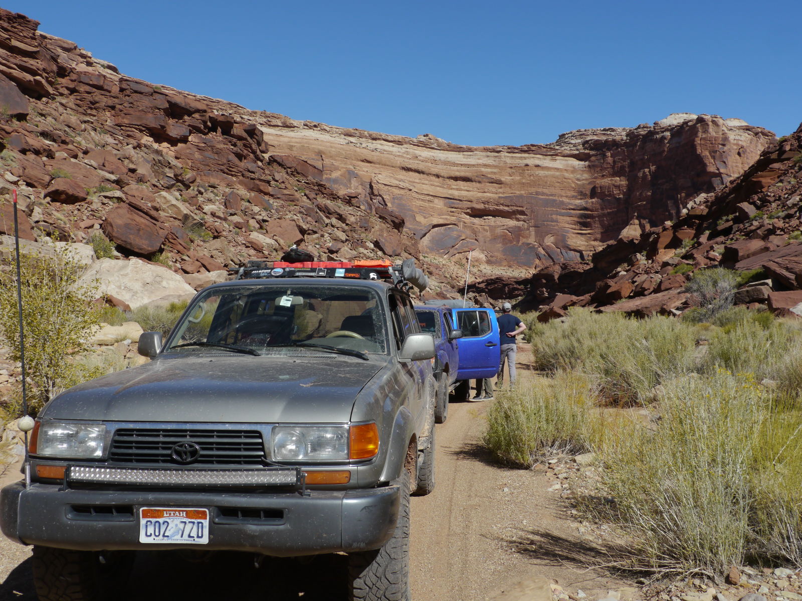
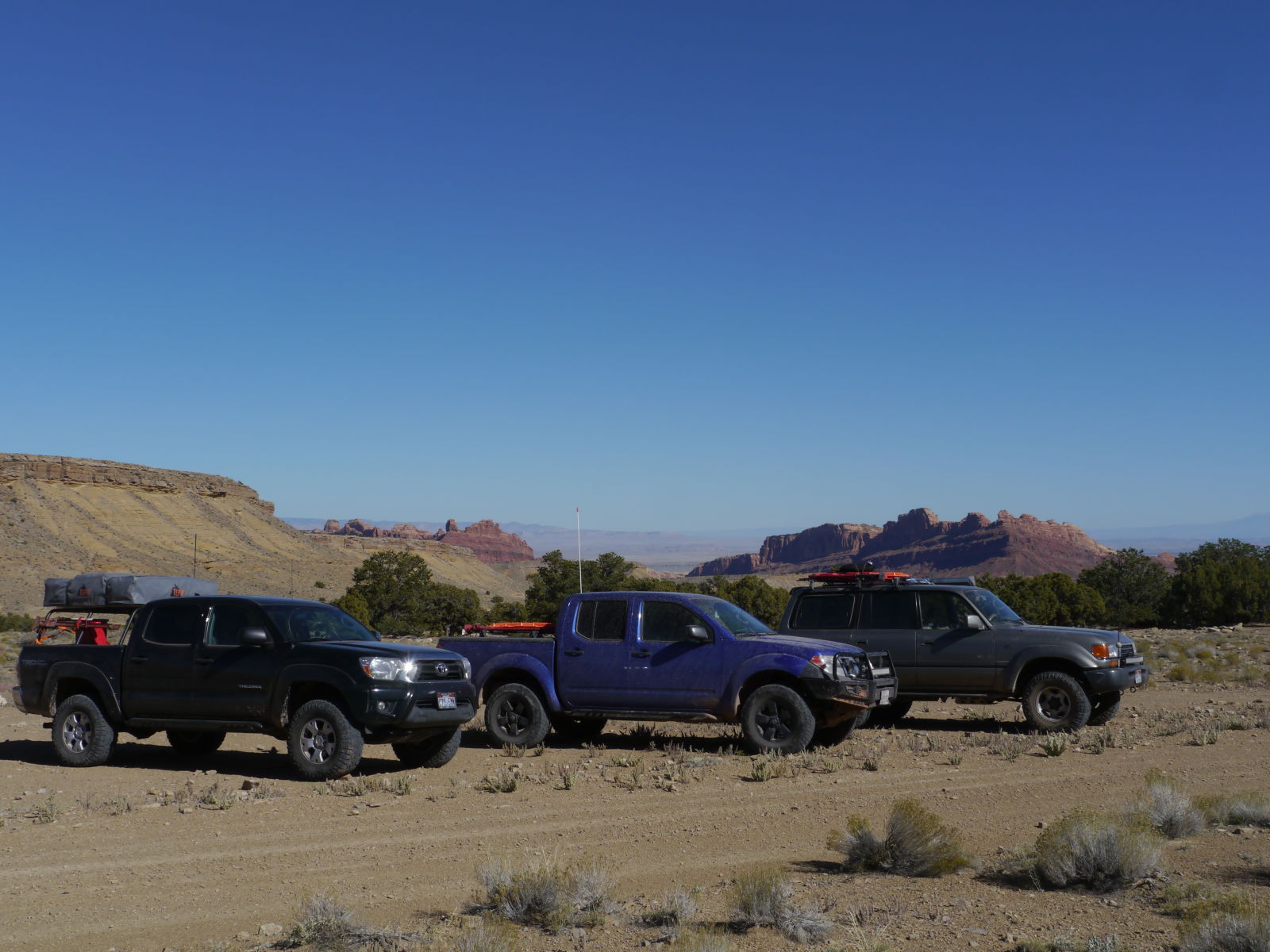
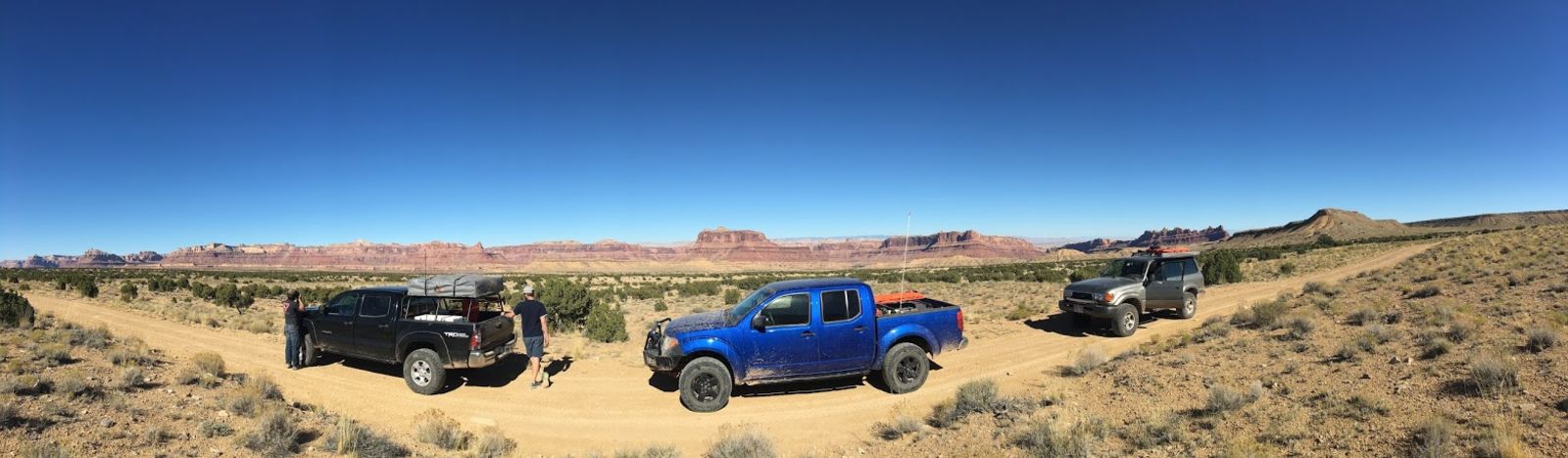
In addition we found an odd fellow in an outback with a dead battery tucked away in a corner. At the same time Tom’s truck stopped on the track with an electrical issue. Wade went to help subi and I turned around to help Tom. My wife was upset with me when I told her I didn’t go with Wade, on account of this being a likely murder setup I guess. Wade eventually did return to Tom and I completely unmurdered and we sorted Tom’s issue out, which was caused by his new battery having smaller terminals than the frontiers weird terminal clamps would accept. As a result he had been running terminal spacers for about a year and the positive spacer and called it quits. Using spare primary wire Tom had we sourced some copper and made some windings around the terminal clamp to fill in the gap and away we went...but...my drone was never happy around Tom’s truck again I had to move it away from his truck before it would connect to my remote. Strange.
We were glad to have come this way for the views, for the tunnel under 70, and for shaking down the electrics before the tighter canyon...but that other guy was probably even happier we went this way. It would have been a LONG walk to the freeway from here. Still he seemed oddly dismissive of the help and he didn’t wait for us to go with him back to the freeway to make sure he was good, probably sad he didn’t get to murder anyone.
BLACK DRAGON CANYON!
So intense sounding. Actually I had been a little nervous about this part mainly because all I had ever heard about it was that the middle section was a real Jeepthingyouwouldn’tunderstand trail. Even Bryce at Cruiser Outfitters was a little concerned when I told him Tom’s truck didn’t have a locker.
First thing’s first, lunch then pictographs. You can walk to the pictographs from where the parking lot is and that probably was a wise choice for the visiting blokes in their W210 estate but not too much concern for our trucks. Its neat canyon right off the bat. Huge, imposing cliffs and tight and winding.
To me the “black dragon”...as cool as it is to ponder the idea that it could really be something like a dragon...appears more to me like a person standing on rolling hills metaphorically or physically sending a message off into the distance.
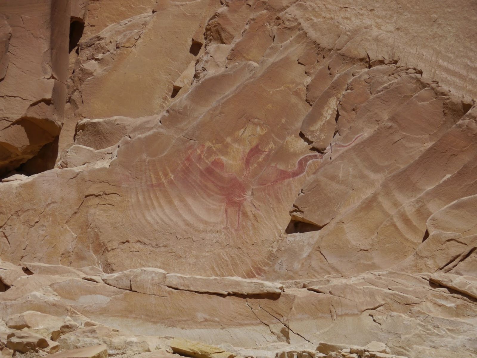
But what do I know. Could just be some doodles.
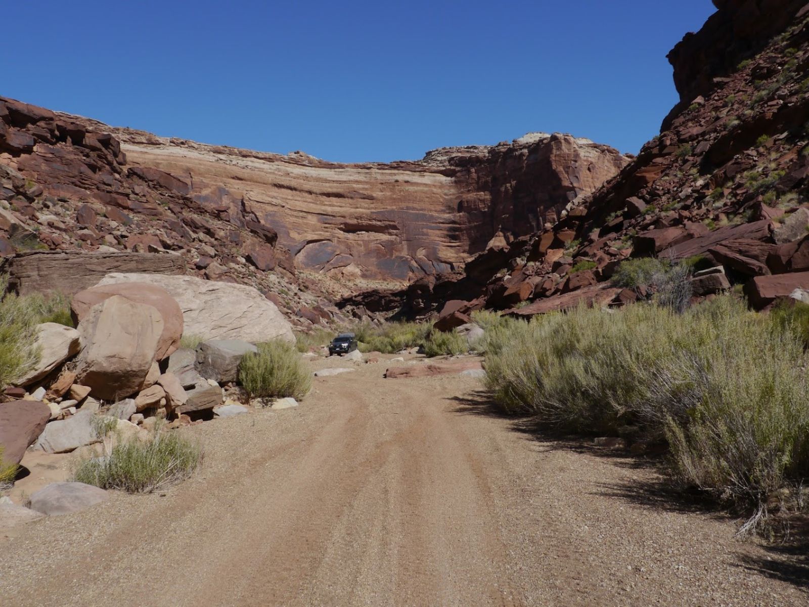
The canyon proper gets immediately tighter and more challenging. The challenge of the canyon is primarily because its in a prominent wash which means the trail is a mishmash of old and new as you dart from washed out section onto a bypass above the high water mark and back. Its ever changing and generally speaking, since its not its not being maintained between flood cycles I presume, getting worse with time. I don’t have a lot of pictures but it wasn’t hard, per se, just kept us on our toes for a good hour or so. My heart rate was up and my throat was dry near the end.
In regards to pics and video and I shall do better next time. I brought a gopro, but it was dead and I started to put a camera on the outside but it didn’t work. I fail. The canyon is worth doing though and if you are on this blog there is a good chance you will have no problems getting through, make sure your armor is up to snuff and you’ll be fine. There is also, I discovered, a alternate way to get to the canyon from either the east or the west.
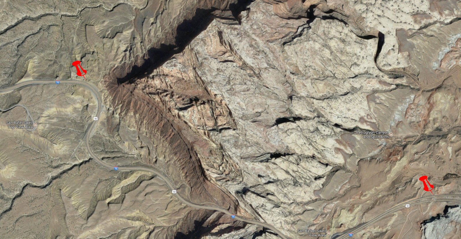
I can’t vouch for the east entrance, it looks pretty chewed up but the west entrance would have been nice to know about as it would have meant being able to get right off the freeway. Be advised though that neither of these are exits, they only work heading west and the speed limit on I-70 is 80 MPH. That being said if we had known about the west entrance we would have missed out, and one dude in a Subaru would have had a much worse day than he did.
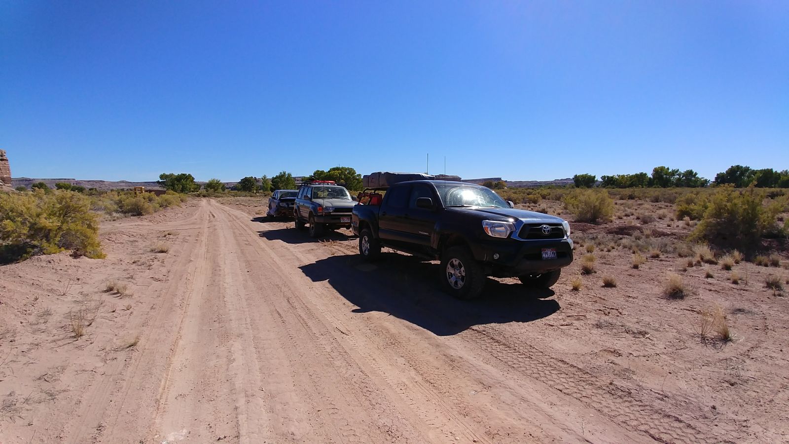
Past the canyon the road was far from the easy roads we had encountered to this point and as if by planning was exactly harder than day 2 and day 2 was to day 1. Wavy, rocky, tight and twisty it wouldn’t be a road for a novice 4x4 owner. It gave my new shocks a helluva workout and the temps were well above 200 F on the bodies.
From here we head due north to Sids/Swaysey’s leap. The road leading there is, at first, part of the sids mountain loop around jackass bench which is smooth and beautiful.
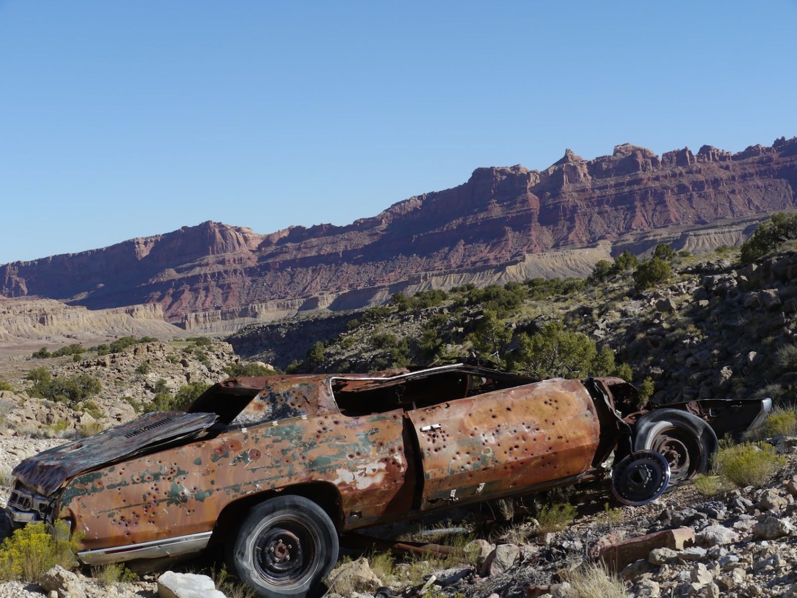
Turning north from there the road deteriorates, and becomes slower and somewhat tedious, with occasional sections of 4 low. A the end of the road, which gets much better near the valley floor, is a “wilderness study area” for a reason I can’t work out other than it containing a river. Which means that we walk the 2 miles on the perfectly serviceable road instead of drive it. I don’t mind the walk but we are a little tight on time and its a minor annoyance. Much like this 70's era Chevy(?) was to its prior owners. How they got it out here I will never know.
At the end of the walk is the leap and...well...let me temper your expectations like no one did for me. You are way above the actual interesting bits.
Don’t misunderstand, it was a pretty place to be but I was under the impression I was going to be able to see it much more intimately.
The story goes (one of them) that Sid bet half his herd that Charley couldn’t jump the gap on his horse. There used to be a bridge here too but thats been gone for a while. Now whats left is a very pretty technical canyon with a river slowly running through it. I would like to come back sometime and get access to the river from upstream (there is a road that takes you about 500 yards upstream on the banks) and float the river through the canyon. Helluva portage/return trip though.
Would I recommend doing the leap this way? No, I would do what I just outlined, get a kayak and float down to the canyon and see it and then kayak back to the car.
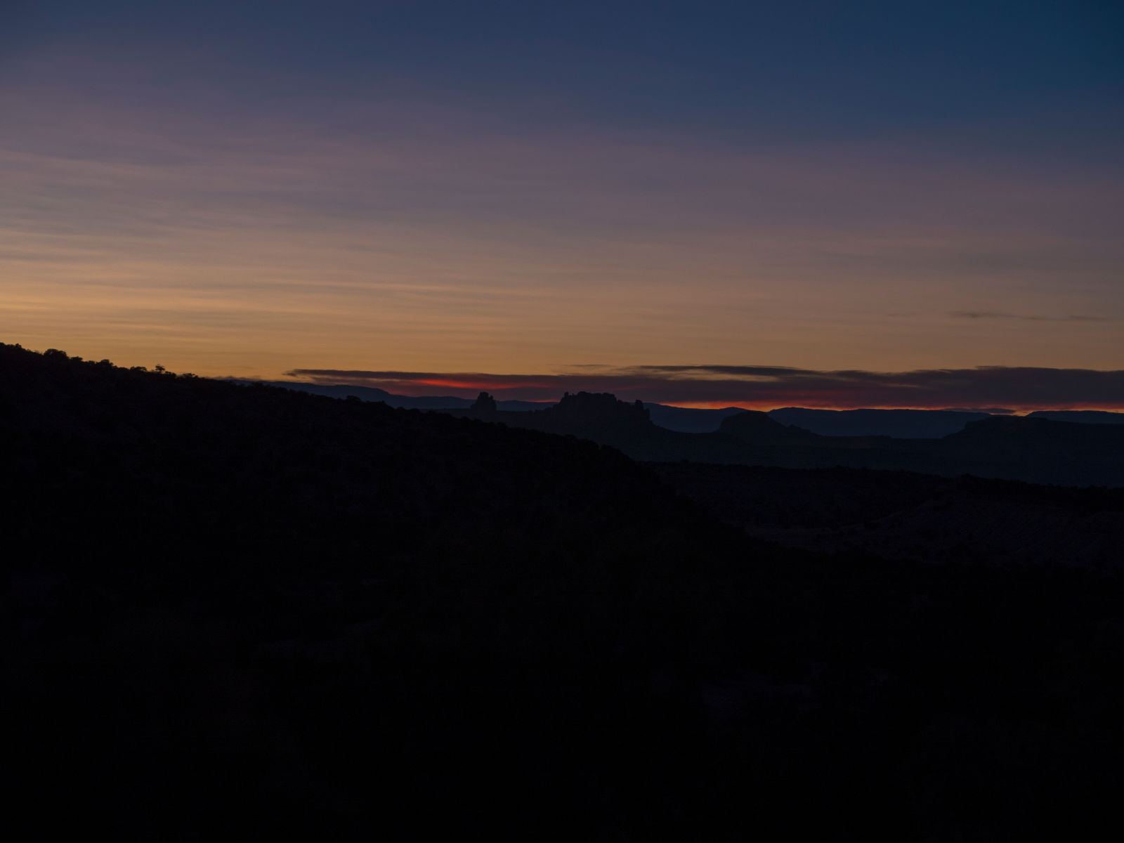
Back on the crap road, into the sun this time as we are battling the receding daylight of our impending winter. Being in the lead like Wade was had the perks of not having the vision problem exacerbated by dust, but we had the advantage of seeing where he went and eyeing his taillights.
Heading East/Southeast now on Jackass bench the dipping sun is making it particularly difficult to drive but man alive is this the right time to be here.
Yeah, this place is awesome. Too bad we can’t find a place to camp here. Oh well onward. The good news is that there are no shortage of excellent views as we drive further and further into a more civilized part of the Swell.
Tonight we dine around a 1 some match campfire sourced with locally sourced wood...with great effort and many flying chips. Light wind, another strong moon, good feels.
In the morning I’m eager to fire off my pistol. I don’t get to use it much so when I do I really look forward to it. We’d been looking for a suitable spot for a few days and this was as good as we were likely to get from here on out. We take some trash bottles and set up them a hundred or so yards away and take turns between bites of breakfast.
We hit nothing.
I mean a few left over clay pigeons and graze one bottle but yeah. At least Left Hand Luke Wade has an excuse since he can’t use his dominant right hand on account of the latest surgery.
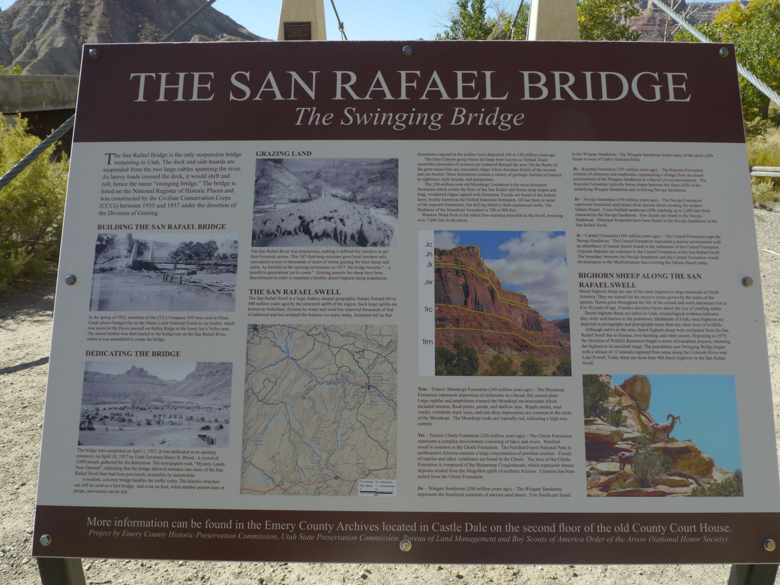
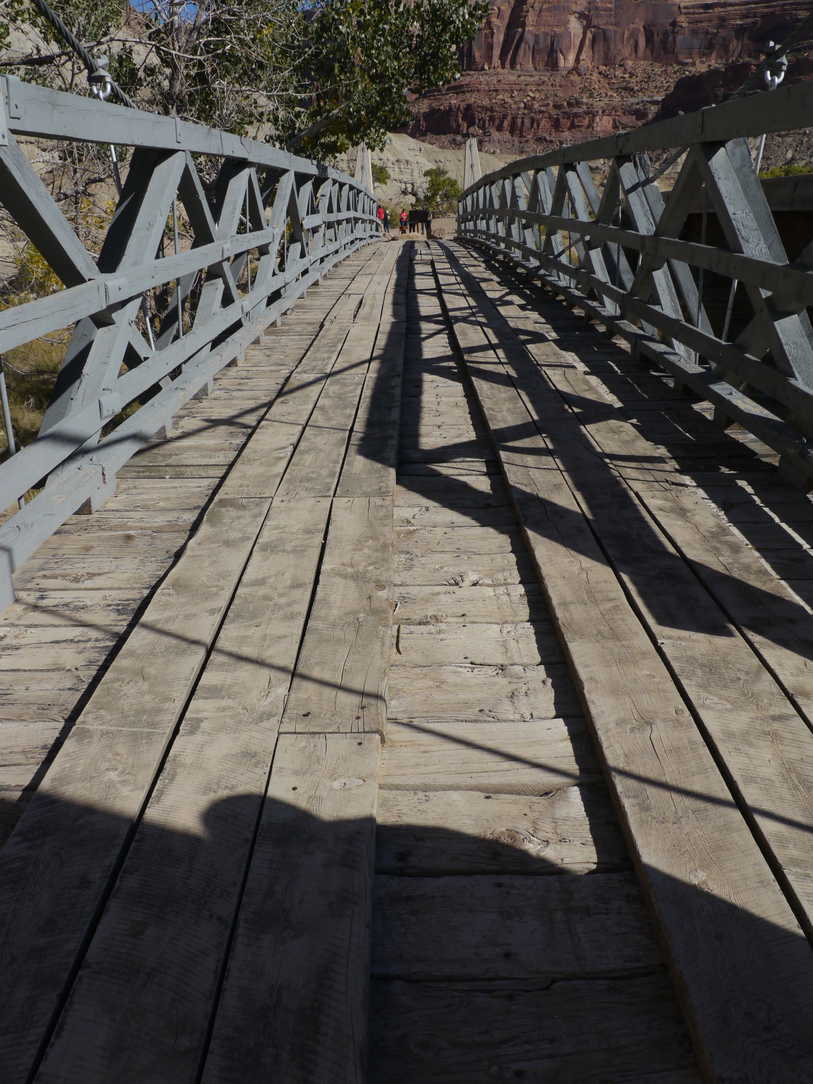
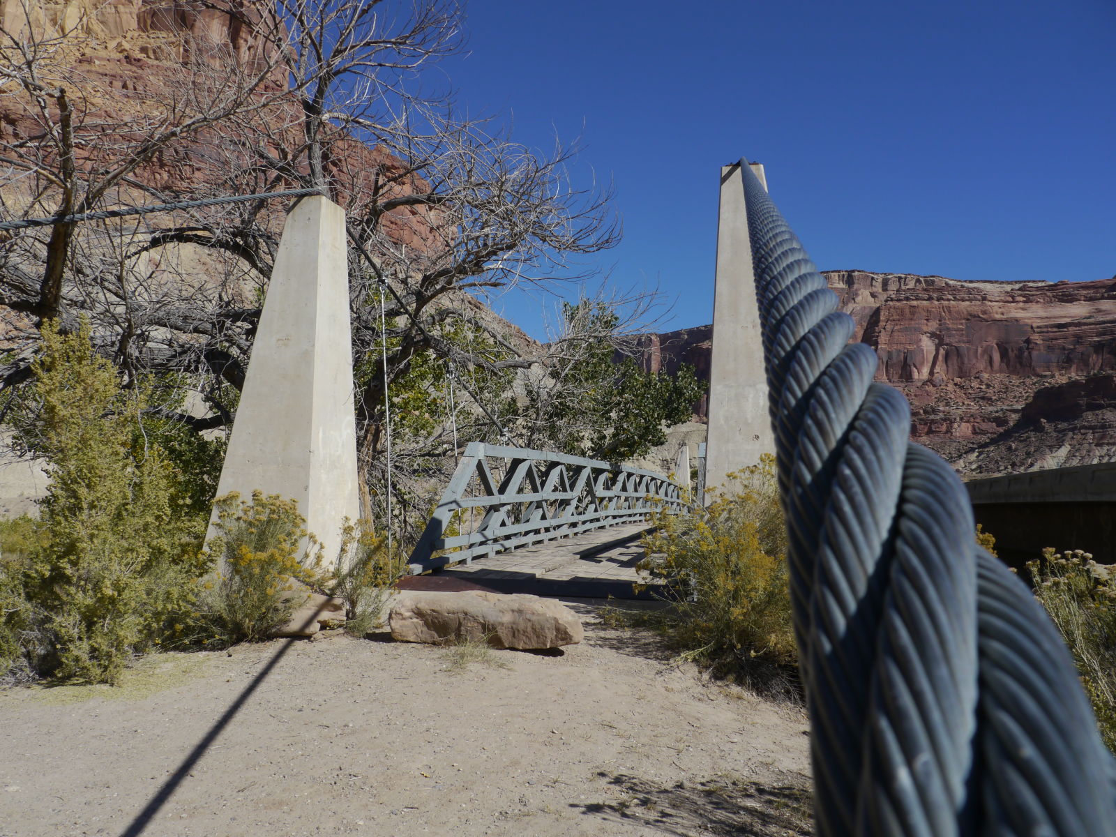
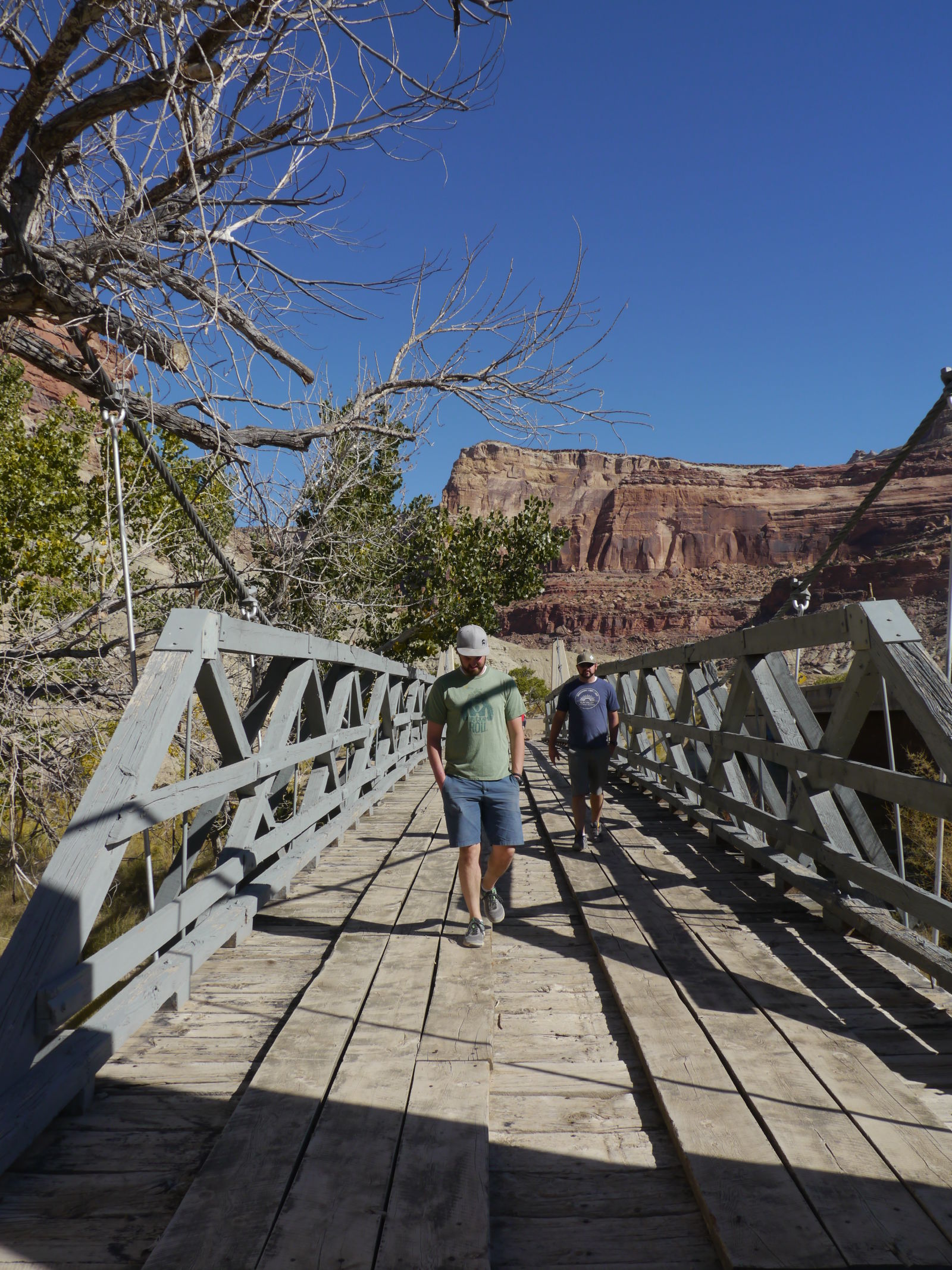
On the road, and it is more a road at this point, we aim our convoy north up cottonwood and then buckskin gulch. We stop along the way to visit the bridge which, in real life, isn’t as spectacular as I had built up in my mind.
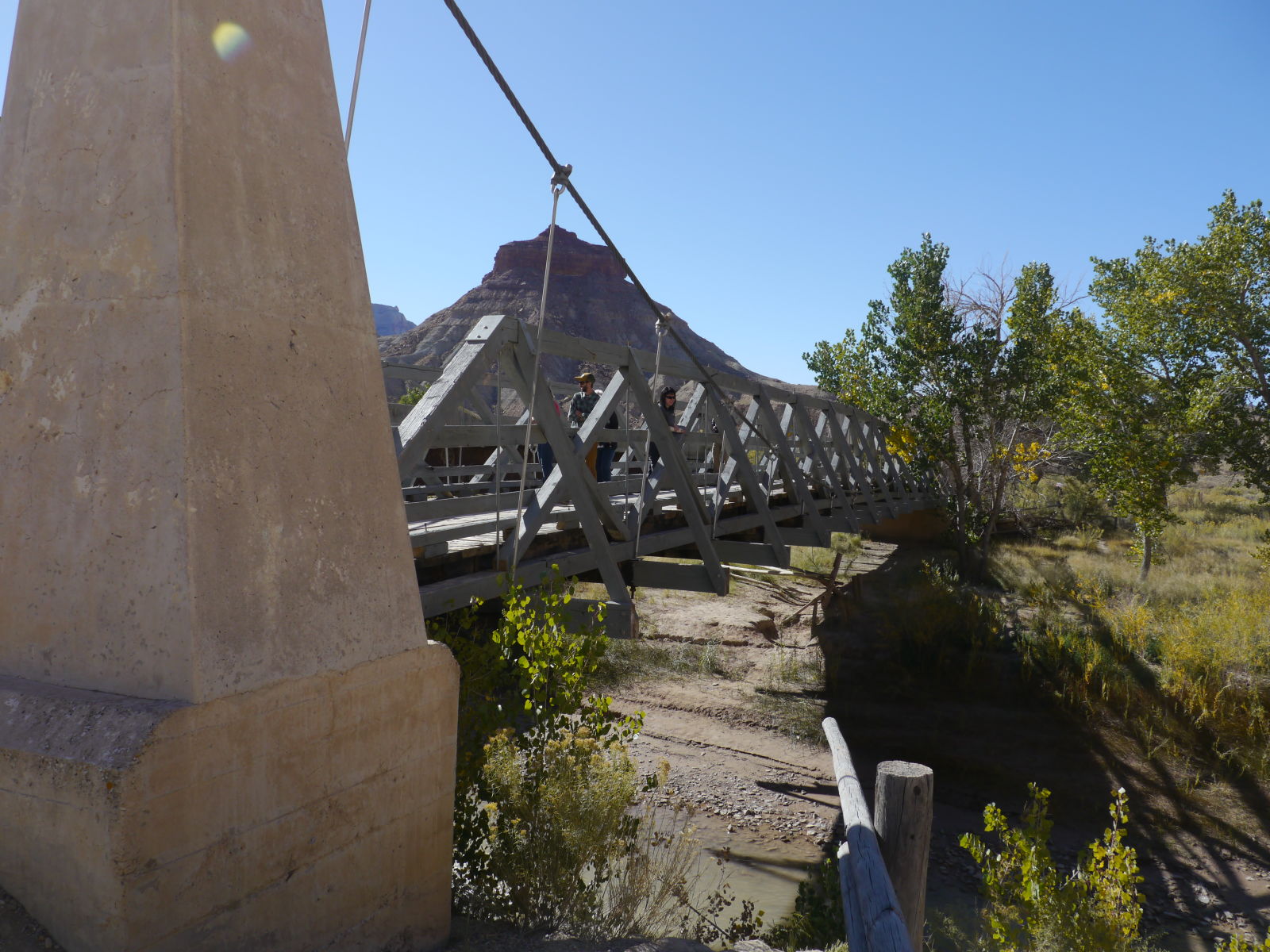
Still, a neat little bit of history
We suddenly find ourselves not alone here as a group of heavily modified Xterra’s show up. Its funny because we were having a conversation about the exact type of people just yesterday and now here we were face to face across the bridge. I’ll save you the details but to say that if your truck has any kind of “zombie apocalypse” theme...you and I might not hit it off.
These guys though? They alright.
Its too bad they don’t let you use the old bridge, it looks and feels solid.
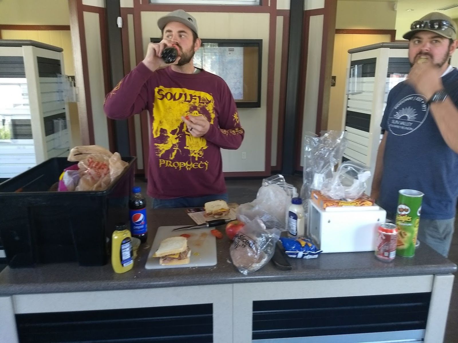
From here is a short drive to Cleveland (Utah) bypassing the dino quarry for another trip with the kiddos. Price canyon on highway 6, inexplicably, is supposed to be one of the most dangerous highways in America or even the world? Its steep, long, winding and gets some weather near its summit but really? its very pretty BTW. Its also known to be consistently windy, as evidenced by the large wind farm at its mouth and today its earning its rep. gusting 40+ mph winds that are making it less easy for our tired bodies to make it home. We stop at a rest stop midway that for some reason looks like a stable. Inside there main round there is a table, some brochures and a video on loop some hopeful person at the tourism office though would be viewed by millions endlessly playing for the wind.
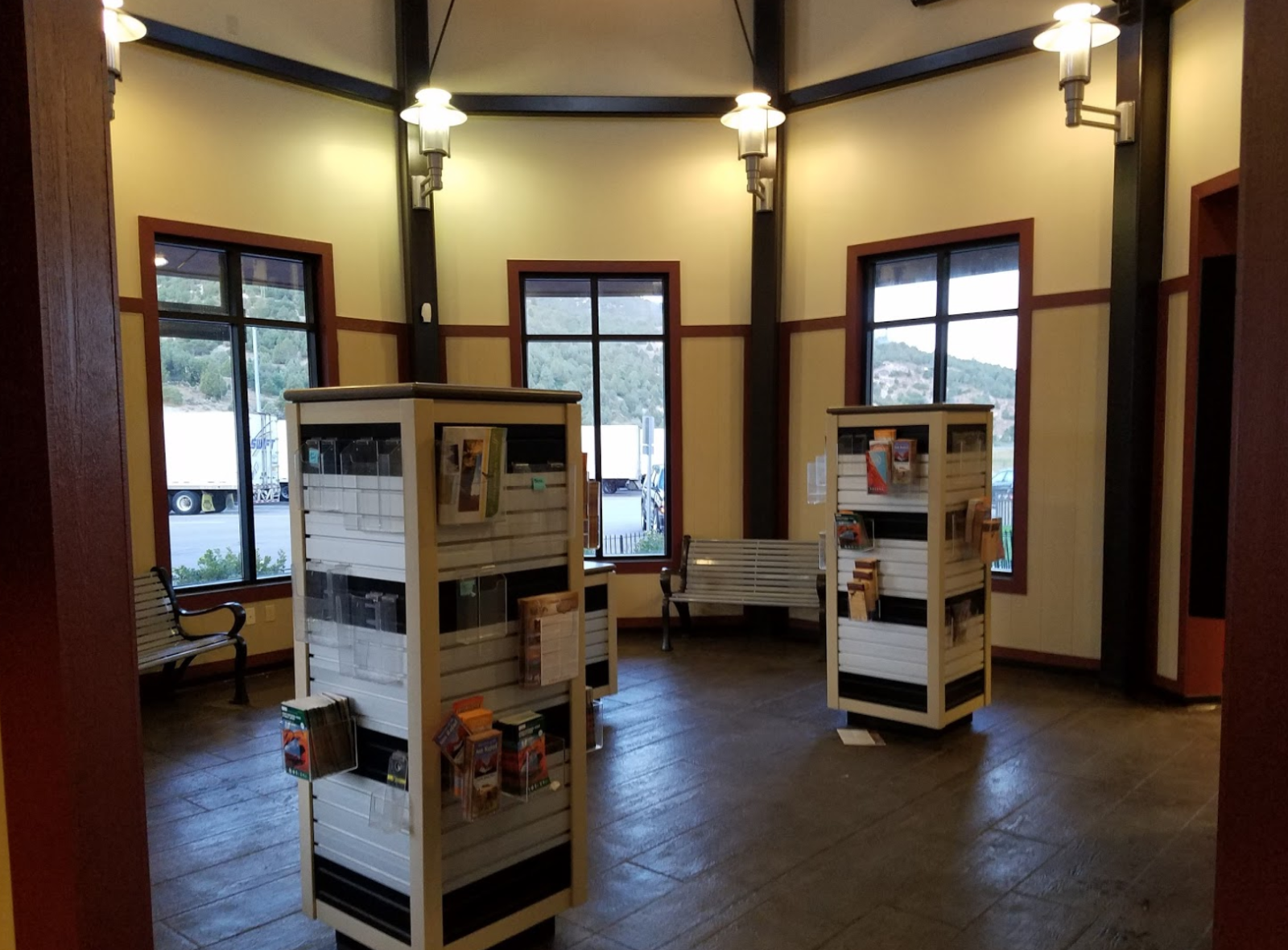
This felt like a perfect place to setup shop for a break. We made sandwhichs using brochures as plates as we relaxed on the benches and marveled and the beauty of Utah B-roll.
So in part 1 I said 2 things.
1. I wanted to be brief (HA!)
2. Why do people rave about the swell?
Because its pretty amazing. Its as large or small as you want to make it, its as tame or wild as you can handle. It feels remote and connected. Its a contradiction and a contrast to the more popular parts of Utah and its 100% worth a revisit.
The video
If you haven’t seen the series its worth watching as there is stuff in here that isn’t in pictures and vice versa.
Thanks for indulging my content explosion, it felt good to have some again.