
With a handful of shorter adventures under our belt this summer, it’s just about time for a longer trip.
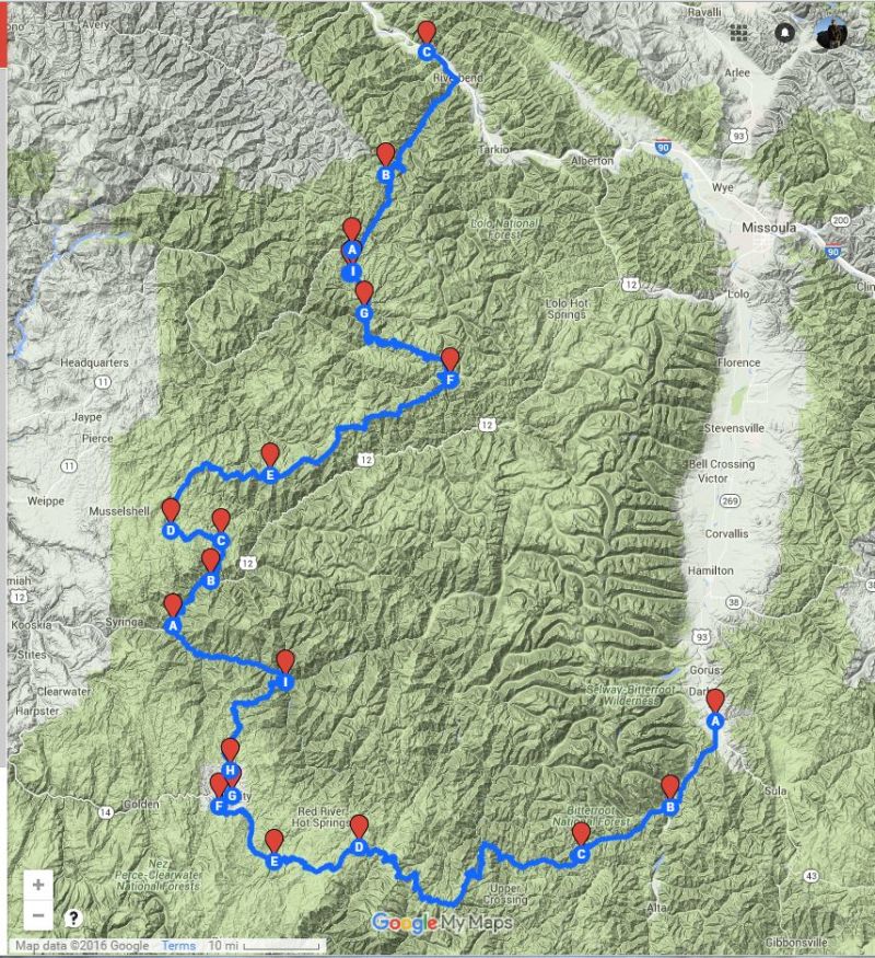
I’m planning something closer to home this time around, just over the Bitterroot Mountains in Idaho from our home base in Montana. You can see the Google interactive map of my draft route here.
We’re looking at 345 miles of backroads that zig-zag in and around some of the wildest and most remote terrain in the Lower 48. The vast majority of this sprawling landscape is protected wilderness: the Frank Church-River of No Return Wilderness Area (the most badass name for a wilderness area ever) and the Selway-Bitterroot Wilderness Area. Nearly 3.8 million acres of rugged mountains, deep canyons, and rushing rivers.
This doesn’t mean, however, that it’s completely inaccessible. A number of USFS roads cut through the mountain passes, some of which retrace the historic travel corridors used by Native Americans for thousands of years, and more recently, by white settlers.
These include:
My intention is to link these three historic roads together in one long traverse of the Bitterroots. Let’s call it the “Historic Wilderness Trip”.
***
The Magruder Road Corridor straddles the boundary between the Frank Church-River of No Return Wilderness to the south, and the Selway-Bitterroot Wilderness to the north. Primarily a one-lane, sparsely maintained track, it does boast several scenic campsites along the way.
It’s a classic overland route in Idaho, and it’s named after this guy. Lloyd Magruder, Jr.:
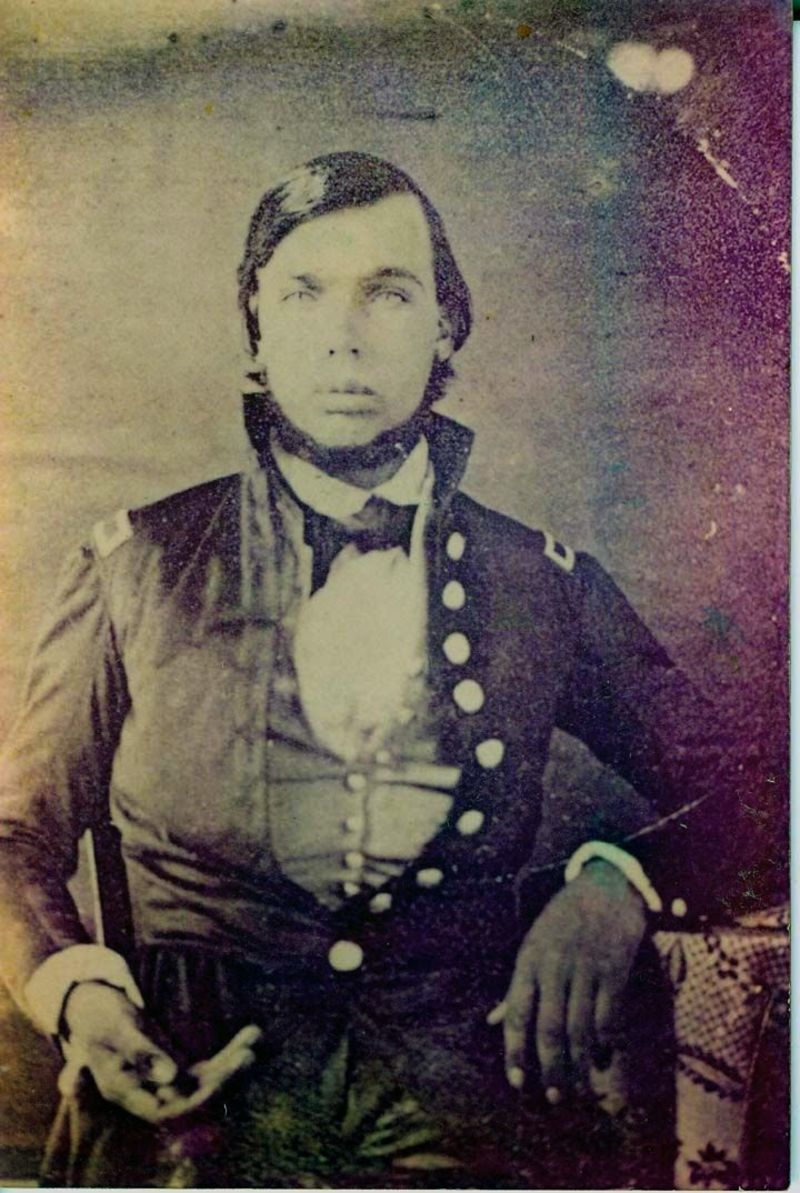
In 1863, the unfortunate Lloyd was a successful dry goods merchant serving the mining towns and cities in Idaho and Montana. He had been in Virginia City, Montana selling his wares, and was traveling to Lewiston, Idaho over the southern passes of the Bitterroots. In his possession was approximately $30,000 (in today’s dollars) of gold and paper money.
Lloyd was betrayed and murdered on the road by his traveling companions - they split his skull open with an ax, stole the money, and fled to California, where they were eventually captured, returned to Idaho, tried and hanged.
***
The Lolo Motorway roughly follows the route of the Lewis and Clark expedition over Lolo Pass into Idaho. It had also been used as a road by Native peoples for centuries before.
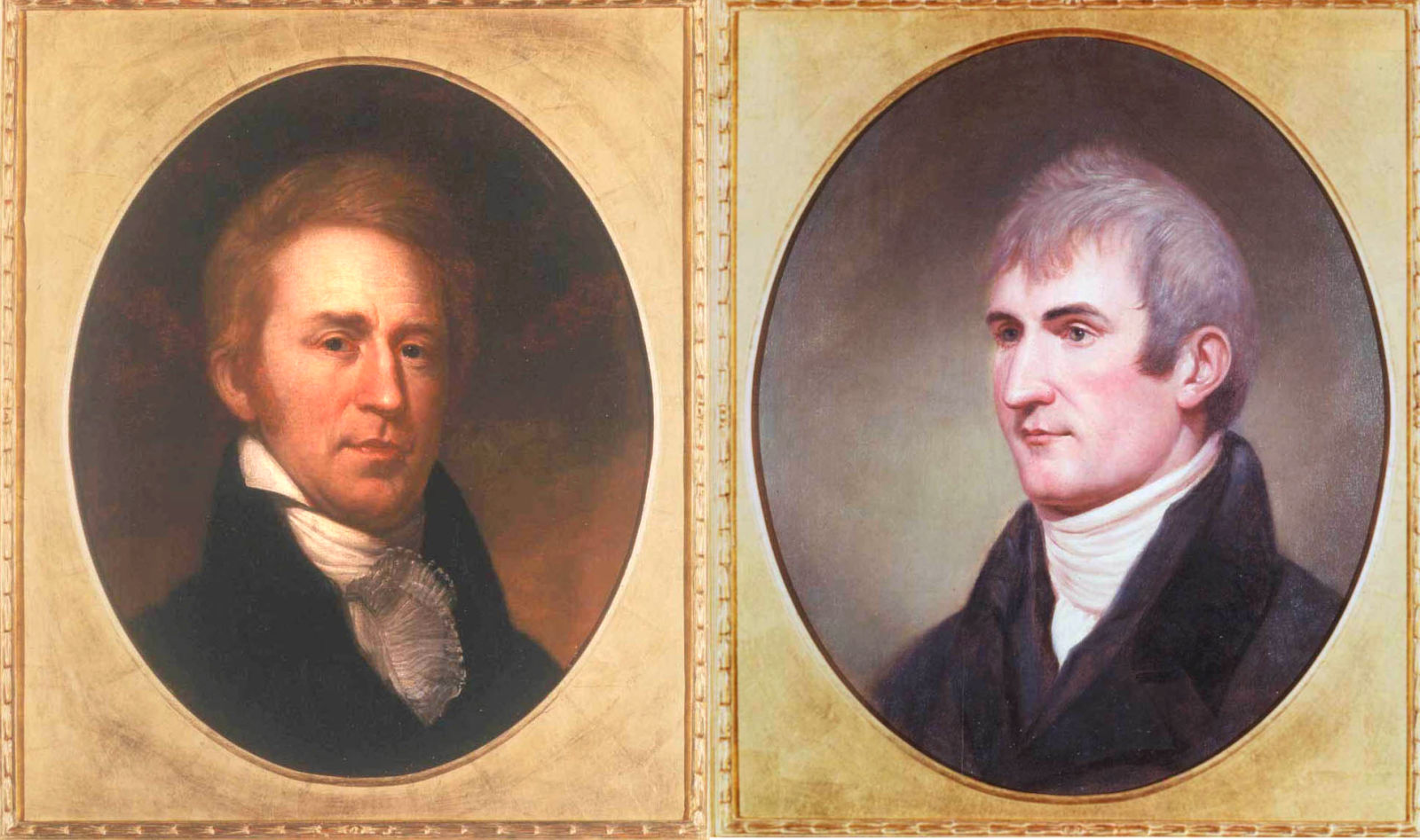
The expedition nearly perished in their first crossing of the Bitterroots in September of 1805. Beaten down by an early season blizzard, and forced to eat their horses, they were saved by a small band of Nez Perce Indians who offered them food and shelter. 70 years later, descendants of those Nez Perce who came to Lewis and Clark’s aid would be ruthlessly hunted over the very same mountains, and ultimately massacred at the battle of the Big Hole by the US Cavalry.
Lewis and Clark struggled through eight feet of snow on Lolo Pass again in June of 1806 on their way home, with William Clark writing,
“Descended the mountain to Travellers rest leaveing those tremendious mountanes behind us–in passing of which we have experienced Cold and hunger of which I shall ever remember.”
Nice. Today, the route is primarily for ATV’s and other OHV’s, but is usually cleared enough for full-sized trucks (we hope).
***
Finally, Hoodoo Pass traces a route through the terrain that was leveled by the largest forest fire in American history: The “Great Fire” of 1910.
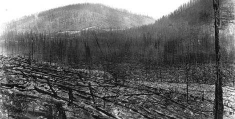
I’m currently reading Timothy Egan’s stunning account of the 3 million acre, three-state fire that killed almost 90 people in only two days. Hoodoo Pass cuts through the heart of the landscape that was leveled by the giant inferno.
It’s also part of a swath of land that has been a proposed Wilderness Area (The Great Burn Wilderness) for some time. Rumor has it that Ronald Reagan vetoed a bill that would have created the Wilderness Area as a personal favor to then US Senator from Montana Conrad Burns (irony!), who was protecting timber interests.
***
So there you have it - lots of death and suffering. Hopefully we won’t be reduced to eating the Jeep, because I’m pretty sure it’s not edible.