
Welcome to Episode Three of this Tale of Two Weeks in the Top End (to the Left of it anyway) in the Antipodean Winter. Links to the previous episodes are below if you feel the need for a recap.
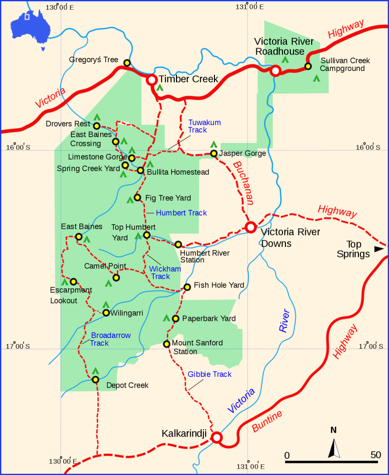
There’s a highway route across northern Australia that was created by a piece of genius marketing back in the day. They called it The Savannah Way. It runs from Cairns in Queensland to Broome in Western Australia, about 3,700 kilometres. And we were on it! Our bit is called the Victoria Highway. Or Highway 1. The bit between the Western Australia/Northern Territory border and the town of Timber Creek in the Northern Territory on the banks of the Victoria River. We were in the middle of bumfuck nowhere and it was great.
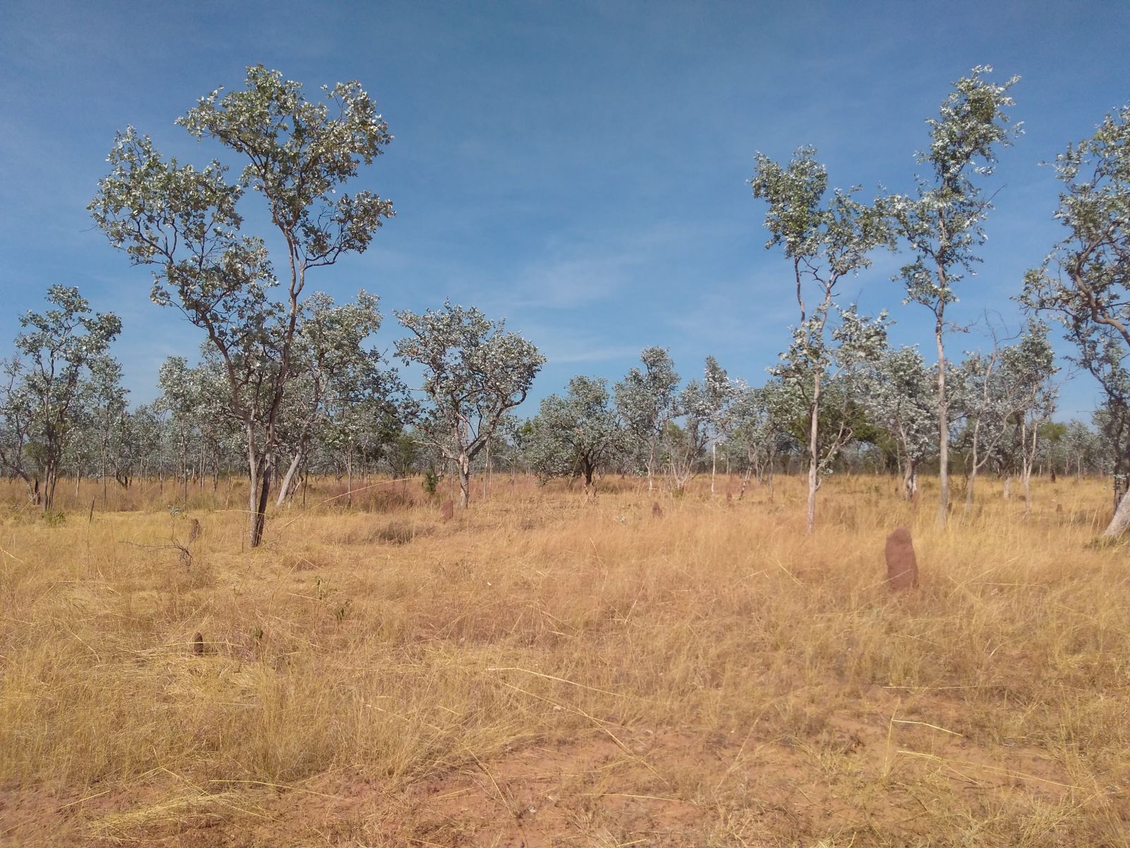
It was also beautifully and desperately dull. Tropical savannah can be a bit repetitious if you aren’t into biophysical landscapes, geomorphology and What Bird/Flower/Tree is that? Fortunately we are. So that was quite cool.
The other major conversation points were our fellow denizens of the road. If it weren’t for the almost biblical numbers of Grey Nomads, European travellers and southern families (like us) on the road, the highway would have been…very quiet. We were everywhere. It was a little sobering. Plus my bush salute fingers were getting such a workout I was getting cramps in my right hand.
For those who don’t know, a bush salute is when you keep your right hand (right hand drive remember) on the steering wheel but raise your index and ring finger to acknowledge that typically rare oncoming motorist. It is both a greeting and a way of saying it’s all good with you and your vehicle to your fellow traveller without stopping and sharing three tinnies and your life stories. I should point out that you should never give a full on hand wave – it not only looks stupid but I am neither your friend nor a long lost lover. Restrain yourself.
Timber Creek hasn’t really got a lot of the qualities of a town. It is more a disparate set of community compounds sprinkled along the road in some haphazard way but each dominated by the infrastructure it was created for. The school. The nursing home. The police station. The ranger station. The roadhouse and pub. And the traditional owner communities themselves. Back when I first came here in 1998 there were two pubs, one of which was open 24/7. That one is now gone and has been replaced by a massive above ground tank that dispenses diesel 24/7. Somehow I was both disappointed and amused at this turn of events. Timber Creek seemed a better place than it was back then and it now had a sense of humour.
We fuelled the Land Cruiser here because it appeared to have a prodigious appetite for diesel. We’d only done 350 kilometres since leaving Kununurra, towing a tonne and a half of trailer at 100 km/h and yet it scoffed 70 litres of fuel in the process. We weren’t keen on using the sub-tank as the way Toyota sets the filler with the factory tray means it is a dead set ergonomic disaster and a potential chemical incident every time you go near it with a fuel nozzle. Other issues were the wheels, which all seemed to have shed balance weights at some point so the vehicle tended to thrum and wobble, and the air conditioning, which only had one speed (tepid) and neither the recirculating nor direction functions worked. Given that this was a single cab this was not a disaster merely a quirk. Oh and the UHF radio didn’t work very well because the aerial had (like all wire aerials in a vibratory environment) fallen off. The tyres, on the other hand, stayed up.
Refreshed with fuel, sandwiches and ice creams, all three teams left the tar and lurched southward on the dirt, headed for the heart of Gregory National Park at Bullita Outstation, about 80 kilometres away.
Gregory National Park came about because, like a lot of National Parks in this country, it was almost completely useless for agriculture. Most of northern Australia is cattle country. The massive riverine flats and Wet season rainfall combine to produce copious amounts of grass that, by virtue of its productivity, makes up for its lack of nutrients and nourishment. Cattle do okay as long as they keep eating and there is grass to eat. Bullita Outstation was not quite as well blessed. It was largely situated on limestone karst which not only held little water on the surface in the Dry but also produced only relatively sparse grass that dried off early. It was also a rough and rugged area in which to muster, manage and transport cattle. It was huge but mostly useless. The penultimate owners finished up trying to make a quid running goats and even they couldn’t make it pay. When they were flooded out in the late 1960’s it was all over. One of the neighbours bought the lease but then sold it back to the NT Government just a few years later. More recently it has become known by its local name, Judbarra.
https://nt.gov.au/leisure/parks-reserves/find-a-park-to-visit/judbarra-gregory-national-park
As I said, Judbarra is centred over a huge limestone karst system that gives rise to the East and West Baine Rivers (flowing North) and the Humbert River (flowing South). Bullita sits on the East Baine River next to a rock bar that acted as a cattle crossing point on the stock route out of the Victoria River Downs and across to the sea port at Wyndham (north and west of Kununurra). Cattle could also go in the other direction and back in the day were routinely walked across the country to Brisbane on the East Coast. That was then. Now the karst is quieter. It has given over some of its secrets, having recently been found to contain some of the longest contiguous cave systems known to humans.
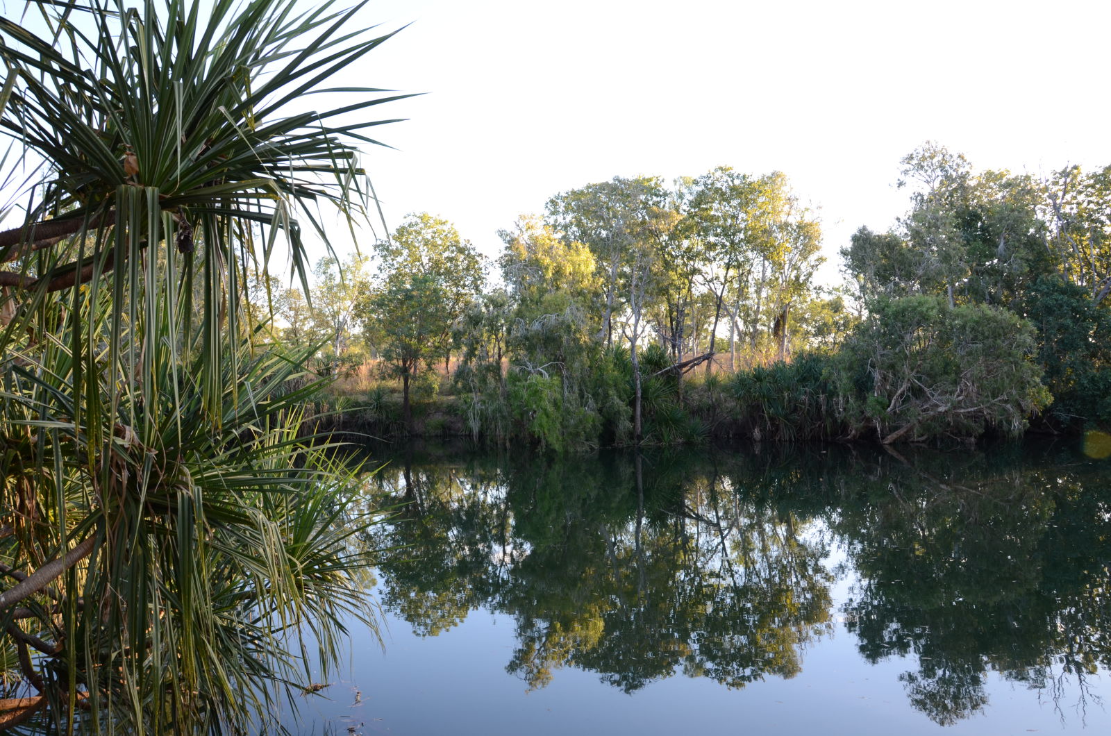
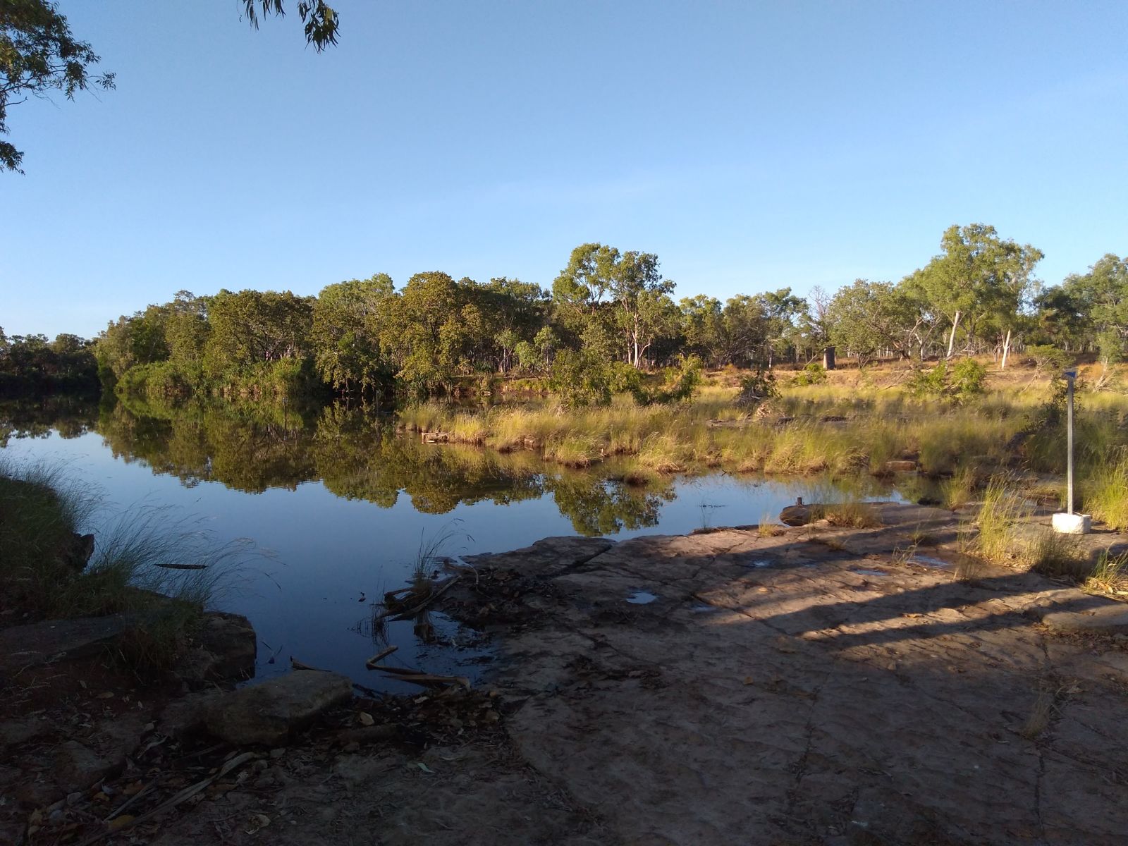
We found ourselves having an easy punt down the dirt access road. It was in pretty good nick and rarely tested the vehicles or drivers. There was still water in many of the crossings due to the late Wet and the fact it finished with a blast. There were even patches of green grass scattered about the damper parts of the landscape. It was pretty. Eventually we came to the Bullita campground, right on the banks of the East Baine overlooking the crossing. This was a new campground to me and the Boss as it hadn’t existed when we were here last in 2004. The only place you could camp (near the main access road) back then was Limestone Gorge and that was both small and a chore to get to. The campground is small, neat and nearly empty. There’s no services here except a pit dunny, a small water tank and a few fire pits.
We set-up our camp, drew some water from the river and had our first showers in four days. That was rewarding! As it got dark we wandered down to the crossing to see what we could see with the torchlight. The eyeshine we got back from the three freshwater crocodiles on the river’s edge was well appreciated. Wandering back to camp we picked up more distant yet widely spaced eyeshine in the bush. Careful focusing demonstrated we were blinding a very large feral bull with horns like upstretched arms…so we beat a hasty retreat.
The next day we headed up to Limestone Gorge. Here the creek has cut through the karst to form a wide shallow gorge that falls down towards the East Baine River. A series of tufa dams marks the entrance to the gorge. This network of natural dams was empty when we arrived but fill to the brim in the Wet before quickly emptying as the rains cease. Further in there is a short climb up the side of the canyon to a point that overlooks one of the canyon tributaries which glows starkly white in the sun due to calcite crystals that precipitate out of the landscape when the water is running. The same outlook also provides a view over the canyon proper.


I checked out the crossing too. This was a spot that had some history for me as the crossing marks the start of the Bullita Stock Route which is a 70 something kilometre loop trail through western side of the park. The last time I attempted it back in 1998, my vehicle failed 20 km in which led to an exhausting recovery exercise and some expensive waiting in Kununurra for repairs. I wanted to attempt it again. Unfortunately, neither of the other teams were keen. They were put off by the 8 to 10 hour trail time and their recent experiences – they weren’t prepared to risk it. Given our Land Cruiser wasn’t ours and wasn’t equipped with anything other than two spares and a jack, we weren’t prepared to attempt it alone. So it wasn’t to be.
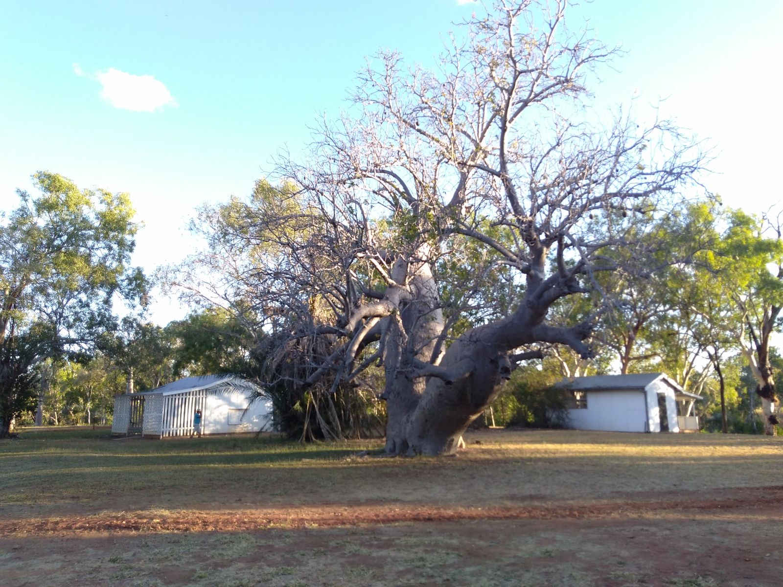
Right at the end of the day, we checked out the old Bullita homestead. It’s really just a four room corrugated iron house sitting on a concrete slab on the edge of the East Baines River. Nothing fancy. It’s dominated by a ridiculously sized windmill and a massive boab tree, carved full of names from station owners, staff and property visitors from back in the day. Some of these names are the stuff of legend in the Kimberly and in modern Australian folklore (usually the sort of folklore that scrubs up the past to make it presentable for modern sensibilities).


The plan for the next day was to travel out of the park back up to the highway, head east for a bit and then come south again on the Buchanan Highway (fancy name for a wide dirt road!) till we got to a place called Jasper Gorge. One of our party thought another of our party would be chuffed to see a place that was his namesake and the rest of us figured why not. Hindsight later suggested a couple of why nots. There was the option of a short cut via the Tuwakam Track which would cut 80 kilometres out of each way of the journey but again the prospect of spending three hours covering 20 kilometres to save 80 kilometres that we could do in an hour was enough to sway two of the three teams to not taking the shortcut. And I wasn’t going to do it in an unsupported vehicle.
So the Land Cruiser set the pace out on the main access road instead. We waited at each junction for the other teams to catch up which meant a bit of waiting for Team Legal as their main driver preferred to keep the Prado revs below 2000. Once on the Buchanan, we opened the taps on the Cruiser and enjoyed the ride. Despite the shredded tyres, the beaten up suspension and the dodgy air con it was enjoying the open dirt and we were enjoying where it took us. We weren’t going rapidly (typically around 80 km/h) and we were in high range 4x4 so it was easy as. The karst domes and slabs gave way to deep red rocks in jump-ups and break aways and like many roads out here we gradually looped and weaved our way around and between (but never through) every difficult piece of country until we came to a small piece of flat ground beside a creek surrounded by low red cliffs that slowly came almost together. The road seemed to run towards the ‘almost’ with the promise of something. There was also a new campground being made here and which has since been opened as the Jasper Gorge Campground.

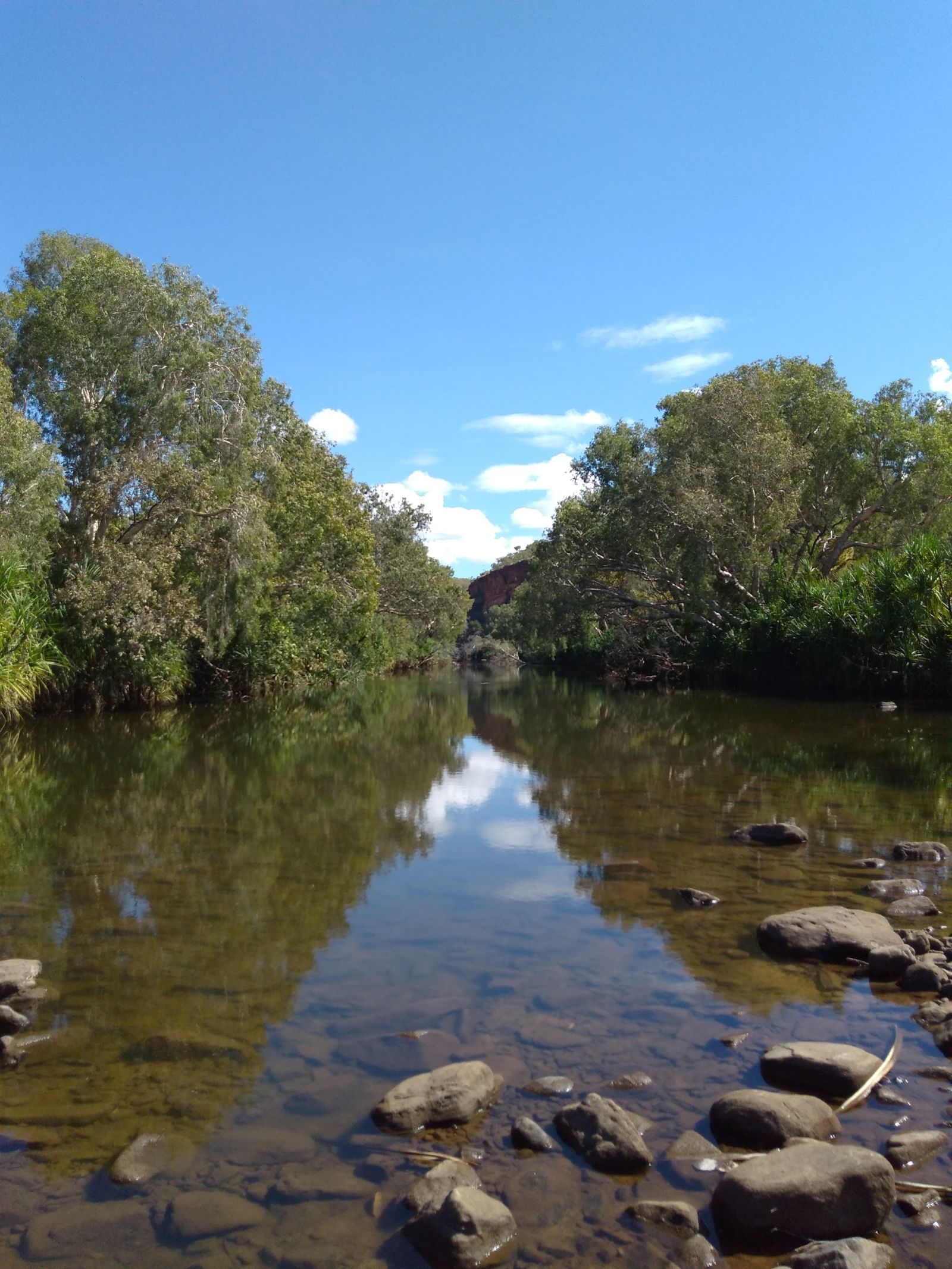
We headed though the gap and found ourselves at the end of a rather spectacular gorge system that fell out of the higher ground we were on back down onto the flats that eventually disappeared out into the Tanami Desert. Surrounded by deep red rock cliffs the road follows the creek down, keeping as much as possible to the mid wall, looping over crests and ridges in the gorge walls, staying above the Wet season flood zone, crossing only rarely. The position of the road provided some epic views of the cliff walls and the pandanus lined creek plus some fun corners and the odd blind crest. Very much a hoot. We eventually found ourselves at the canyon bottom where there is another rough campground situated beside a deep, long pool in the creek overlooked by an orange and red cliff and shrouded by pandanus and paperbarks. And there we waited. And waited. And had a look around. And waited a bit more. Eventually, Team Uncle showed up with a tale of woe as he’d punched a rather large hole in the side of one of his middle aged Hankook tyres. I kept quiet on my views of deflating tyres on stony roads (40 psi is all right with me). Due to an already damaged but not destroyed tyre from earlier in the trip, he was without a reliable spare.
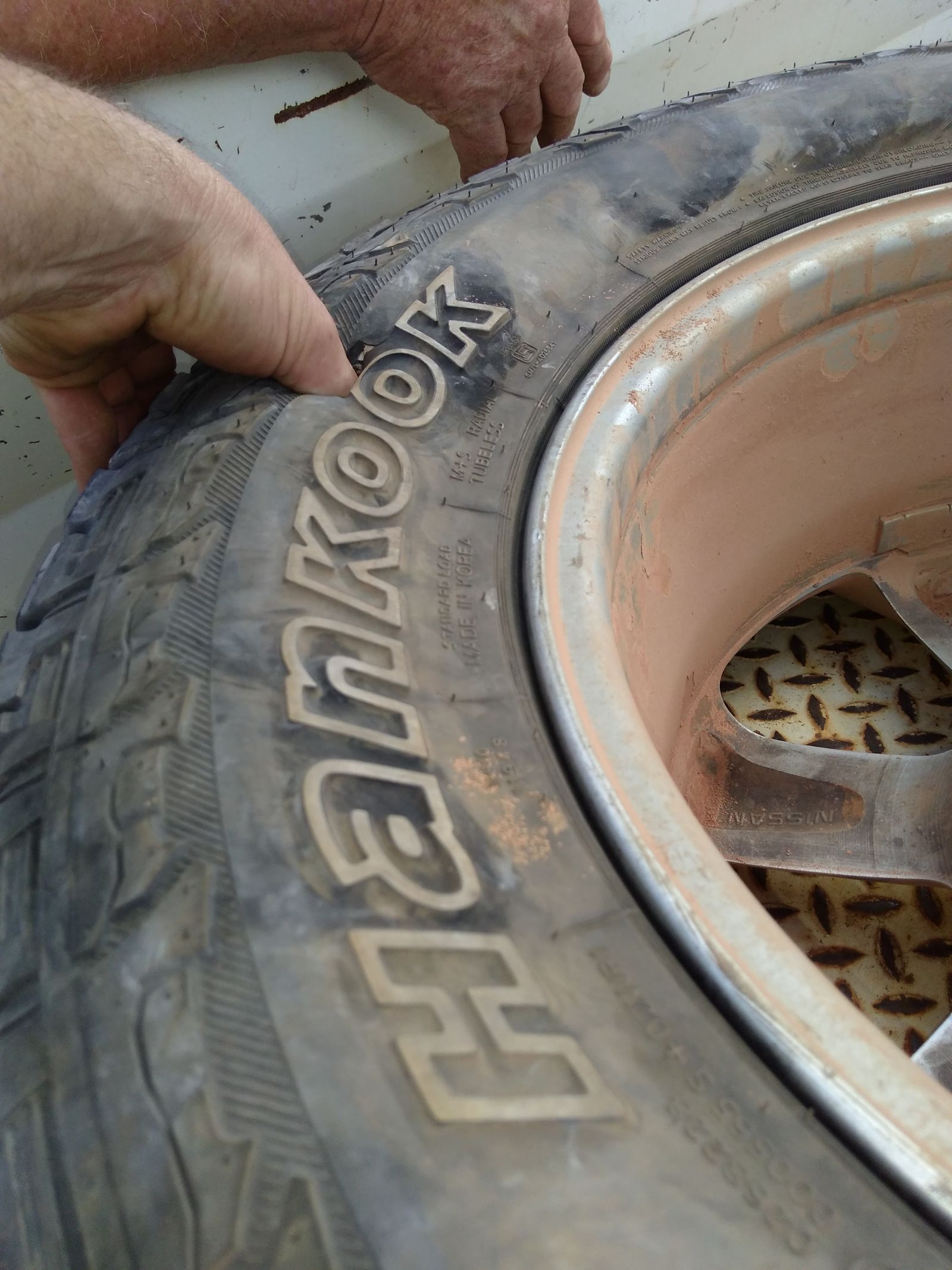
Eventually, Team Legal drew up and we all had a look at the joint together. With the heat of the day belting down on us we decided to return to the campground we had seen earlier to seek shade and some lunch. Then we set about the return journey to Bullita…and a well earned shower. Whilst lunching, we inspected the Cruiser’s tyres and noticed that there was the odd deep chip in what remained of the tread on one of the rear tyres. Nothing significant showing but The Boss and I committed to changing the tyre out if it survived the return journey to camp.
The tyre made it. But it was rooted. It looked like someone had taken a sharp teaspoon to it and everywhere there were fingernail sized holes in the tread that showed the belt of the carcass beneath. So we swapped it out. One spare down and one to go.
The next day wasn’t really planned but we expressed the view that a look down the Humbert Track before the day got too warm might be interesting. Team Legal were happy to play along. The Lad stayed behind to bait for crocodiles in the Bullita Crossing with his grandmother. We loosely formed the idea that punting down as far as Fig Tree Yards (about 15 km down the track) would be a good start and then would we would see what happens.
The run south was rough, changeable, beautiful and hot. Some unburnt remnants of cane grass towered over the Cruiser whilst we ran early parts of the trail. The trail itself had been slashed by Park staff at the end of the Wet – they killed three rear tyres on their tractor doing all the trails in the Park. Hundreds of kilometres, in a tractor, slashing grass…think on that.
The alternate bands of limestone and other rocks made for some very abrupt changes in the vegetation and geomorphology of the trail. And then there was the ever present fire scars from the end of Wet season controlled burns. We poked and inched our way down the trail at around 30 km/h which proved to be a happy medium of seeing stuff whilst still making not so bumpy progress. We were caught and passed at one point by three Prado’s dressed in Queensland plates and each towing T-Van campers at well over 40 km/h…they were on a mission to somewhere but the way they were driving suggested it was only to the mechanic. In the end they turned up at the campground at the end of the day anyway. Nutters.
We found big old boab trees, budgerigars, spectacular scenery and eventually the remnants of Fig Tree Yards sitting in the grass above a long waterhole in a creek. There was a quite pleasant area to camp in nearby but that wasn’t our goal. After a quick look around we decided it was now too hot to do anything much else than bail back the way we’d come and find some lunch with everyone else.

As this was our last day here in Gregory, the Boss and I decided to take a punt. We wanted to check out some of the Bullita Stock Route and see if we could get down to the East Baines Crossing near a campground called Drovers Rest. Technically, this is frowned upon as the Stock Route is ostensibly one way and our chosen route would mean we were doing it the wrong way. We could have done the crossing and travelled up to the Jump-up but I knew this to be rough and slow and if we wanted to descend down the Jump-up to the next crossing of the East Baines we’d potentially be committed to the trail…not a good idea.
So we told everyone where we were going and assumed they were listening. It turned out they weren’t really. We pointed the Cruiser back up the main drag until we came to the unmarked exit of the Bullita Stock Route and then took off west ignoring the old road closed sign! The first ten kilometres was actually quite OK double track through the savannah with only the odd drainage line crossing slowing things down (still we rarely exceeded 50 km/h). Once we were back on the karst though things slowed significantly as the route became a shard strewn rubble filled grind. We finally made the high point at a T intersection to a surrounded piece of private land. This spot gives a wide view of the karst landscape and the shallow valleys that cut it into mad chunks. The intersection is also marked by the burnt out carcass of a Mazda Bongo van that I recall being there nearly two decades ago.
From here we bumped, bounced, groaned, whirred and whined our way across this complicated and broken landscape down towards the river. The Cruiser was in low range simply to keep everything under control. There was little technical about the track so it wasn’t like we needed the crawling capability. But low range makes so much sense if you want to not stress the machinery or the occupants! Eventually we dropped off the karst and back into the valley bottom. But it was only a tributary and we were running out of both time and daylight. Eventually, after warping and wefting our way along 30 kilometres of the Stock Route we hit our agreed time barrier. Somewhere on the lower slopes in amongst the cane grass and low eucalypts, we pulled up and turned around. We were close to the East Baine crossing but not close enough. Bugger.
We inched our way back towards the climb onto the karst. Once there we decided to stop, have a drink, stretch our legs and have a look around the Cruiser. Turned out that this was a good idea. The other rear tyre (the one we hadn’t changed) was still fully inflated but big chunks of steel belt were both visible and collecting grass. Time to fit the other spare as changing a fully flat tyre on a 70 Series is an unpleasant task because the Toyota bottle jack doesn’t fit under the jacking point on the spring pack when the tyre is flat. Since both of us are well versed in tyre changing we were sorted in under ten minutes. Time to climb!

It took us another 40 minutes to get back to the main access road with minimal fuss. The highlight of the return journey was coming across an Australian Bustard (imagine a cross between an emu, a turkey and a supermodel). These things are enormous, beautiful and fly like a Boeing 747. They are also wary and well camouflaged. Turns out they are also considered to be quite tasty. So they are scarce these days and Judbarra is one of their strongholds.
Our return to camp was hailed with statements like ‘Where the heck were you?’. Clearly no-one had been listening to what we had told them so it was probably fortunate that we had not come to grief. Team Uncle had even taken it upon himself to go looking for us by crossing the East Baine in front of our campsite and driving up the wrong end of the trail for a ways to look for us. Of course, we hadn’t gone that way but no matter. He still managed to find himself a suitable candidate log for a didgeridoo despite all this looking for us.
In the end, that was Gregory done. We were headed back to Kununurra for two sets of new boots (one for the Cruiser, another for Team Uncle), clean clothes, more booze, food and fuel and a new goal – Purnululu.
