
Australia is apparently “…a land of sweeping plains/of rugged mountain ranges/of droughts and flooding rains”. Dorothea Mackellar was right when she penned the second stanza of her poem ‘My Country’ in her description of her vision of Australia. However, remarkably few appreciate how sweeping those plains are and even fewer still appreciate them when they find themselves in the middle of one.
Mention the Hay Plain to anyone even remotely familiar with the roughly 1300 kilometre trek between Sydney and Adelaide and you may find their eyes glazing over and their arms unconsciously lifting into the 10 and 2 position in an effort to grip their inner steering wheel. Some people involuntarily fall into a stream of consciousness run through every curse and swear word they can recall. Others merely drift away unwilling to recall something they though forgotten. Me? I think the drive through Western Queensland between Longreach and Barcaldine will steal your soul by pulling it through a cheese grater and then feed it to the pigs but the Hay Plain is just a tease. It plays a stern face but only so you can’t or won’t see the secrets behind it.
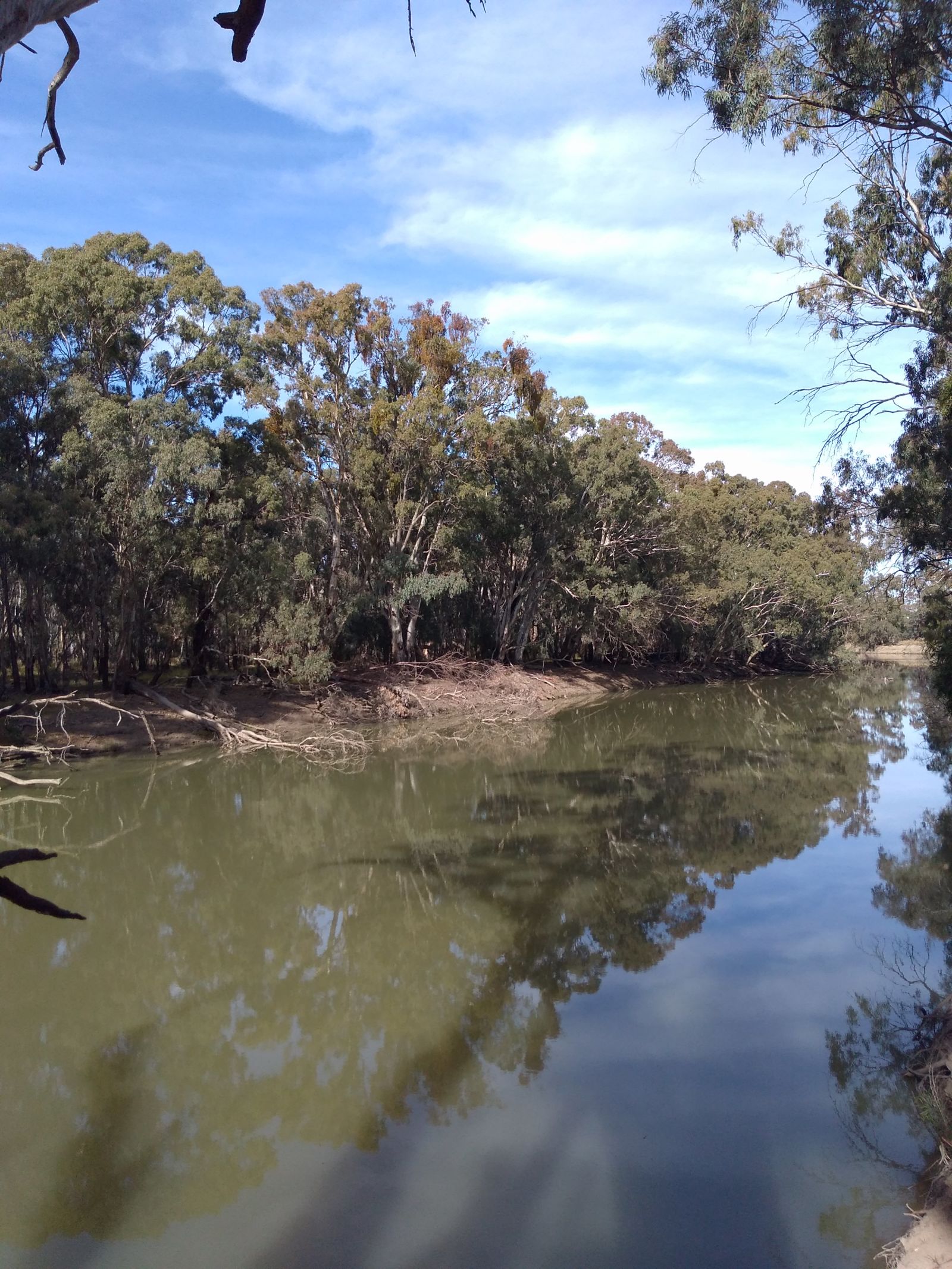
One of those secrets is the lower Murrumbidgee River. It is the heart and lifeblood of the Plain. And the Plain is but a small part of its catchment. The Murrumbidgee (or ‘Bidgee to those Australians like me who think sentences should have more meaning and less syllables but rarely have the English language skills to manage it) rises just to the west of our nation’s capital, Canberra, in the long mess of hills we call the Great Dividing Range.
Incidentally, another name for the Great Divide is the Sandstone Curtain. This is a play on the now largely defunct Iron Curtain between the old Soviet Socialist Republic and the rest of Europe. It refers to the fact that most Australians live on one side of the Range…and they rarely part it to check out those of us on the other side.
Anyway, the Murrumbidgee. It trundles out of the hills and out onto the Riverina Plains. Of which the Hay Plain is just another indistinct component. The Riverina is an incredibly productive agricultural region built on irrigation water taken from both the Murray and the Murrumbidgee as well as, thanks to the Snowy Scheme, the normally east and south flowing Snowy River. Rice, sorghum, grapes, cattle and, more recently, cotton are key outputs.
However, the lower Murrumbidgee (or better still, the Low Bidgee) is at the bottom end of the system. The capacity of the system here to supply irrigation is pretty small so this area has long been about floodplain grazing, timber harvesting and opportunistic cropping. The sort of farming that has long been agriculture by the seat of ones pants and subject to the fickle whims of climate, market and the vagaries of luck. Those who haven’t been able to get big, creative and adaptive have not lasted.
Sometimes even that wasn’t enough. A decade or so back the family enterprise that had ran Yanga Station in the Low Bidgee for decades had finally had enough. Despite compiling the largest freehold property in New South Wales and operating a successful operation based on sheep, cattle and timber…they were done. The problem was they had a massive property that was worth many tens of millions of dollars but the property had no capacity through available water for a more modern agricultural system that would attract that sort of investment.
However, they had another idea. The properties natural and cultural assets were already well recognised and the family had long been open, interested and accommodating to a fleet of ecologists, anthropologists, archaeologists and lots of other sorts of ists. So they approached the State Government to see if they’d be interested in an acquisition. After a lot of argy-bargy and considerable community angst, the sale went ahead and Yanga National Park was born.
Further acquisitions since have now resulted in the formation of both the Murrumbidgee Valley National Park and State Conservation Reserve (this latter designation allows for additional recreational and commercial activities to what is possible in a National Park). There’s been a more recent acquisition using Federal money in an effort to buy back over allocated water which has not been added to the collection, Nimmie Caira. This was a huge suite of properties to the east of the park that occupied a maze of floodplain grasslands, swamps and irrigation activities. Some of it may eventually be added to the conservation mix but in the meantime it is being marketed as leasehold agricultural land or the like.
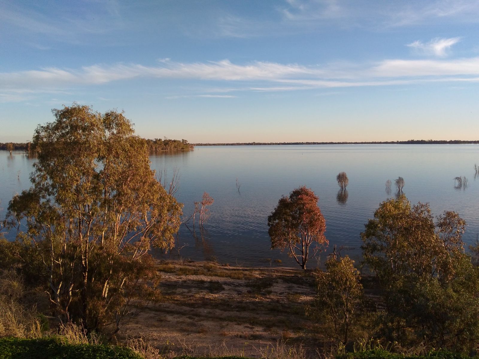
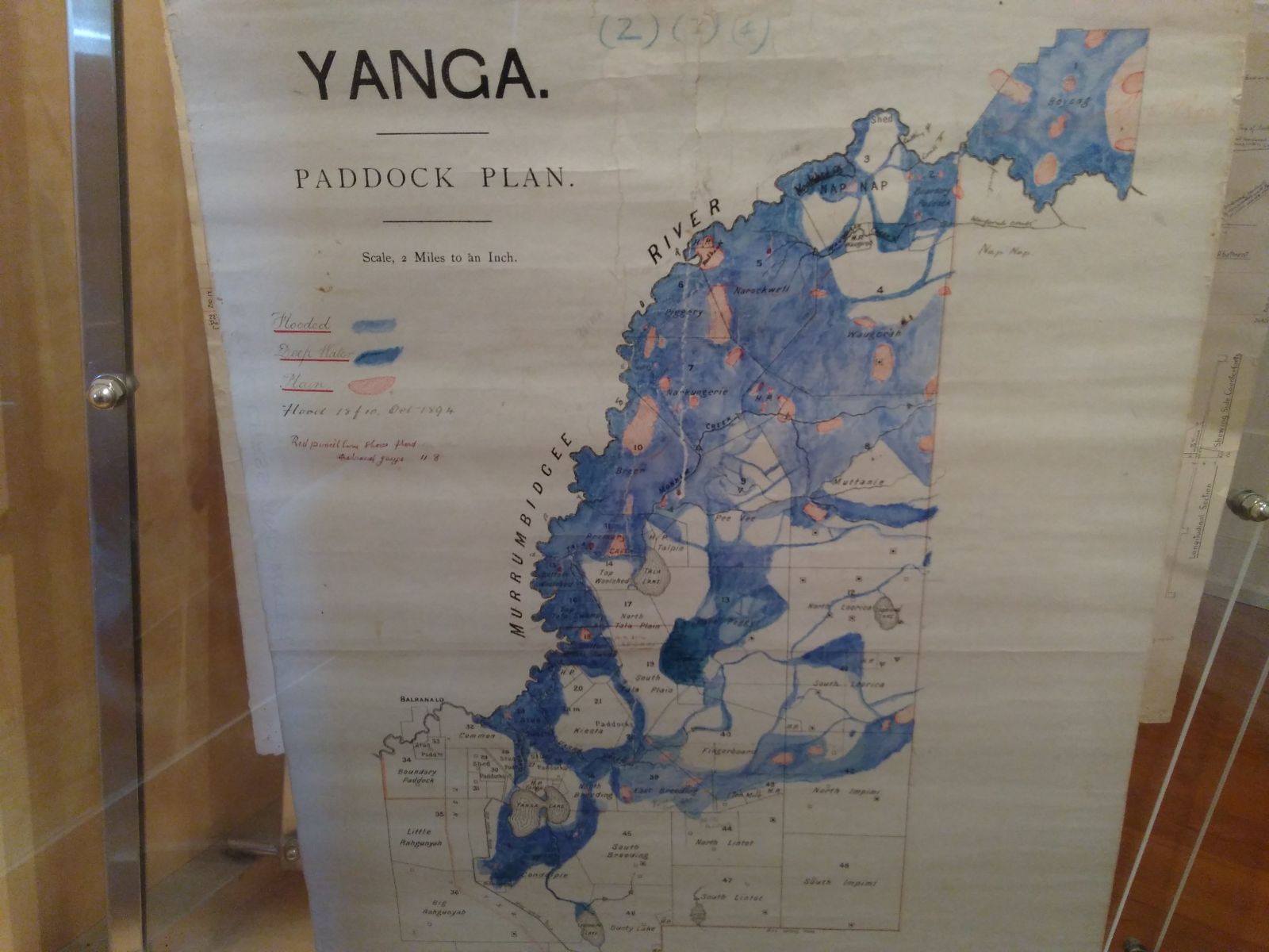
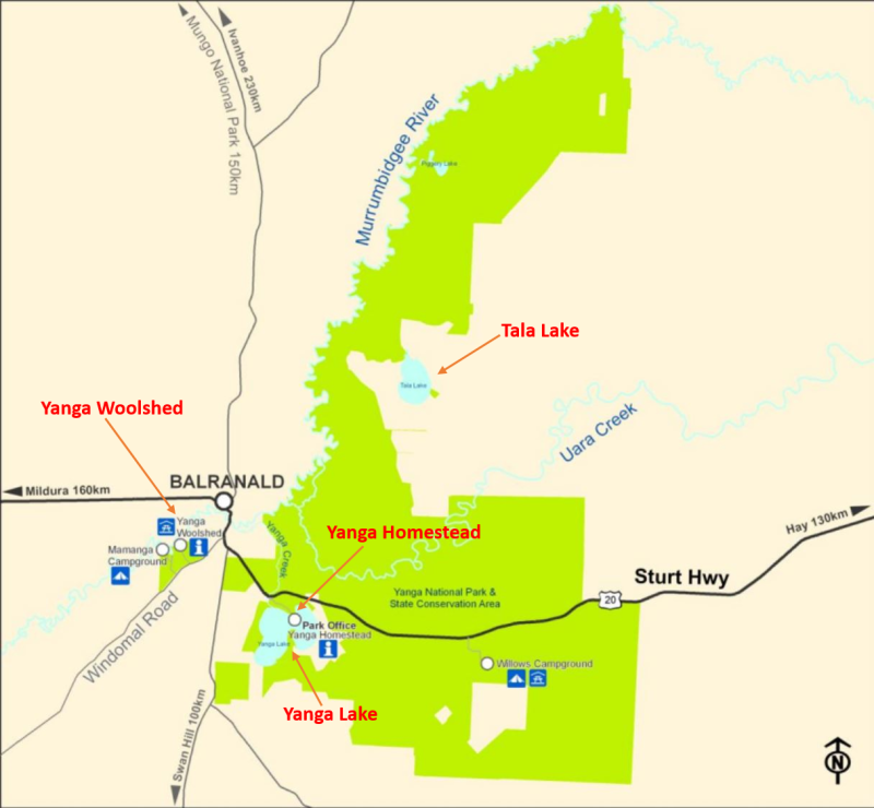
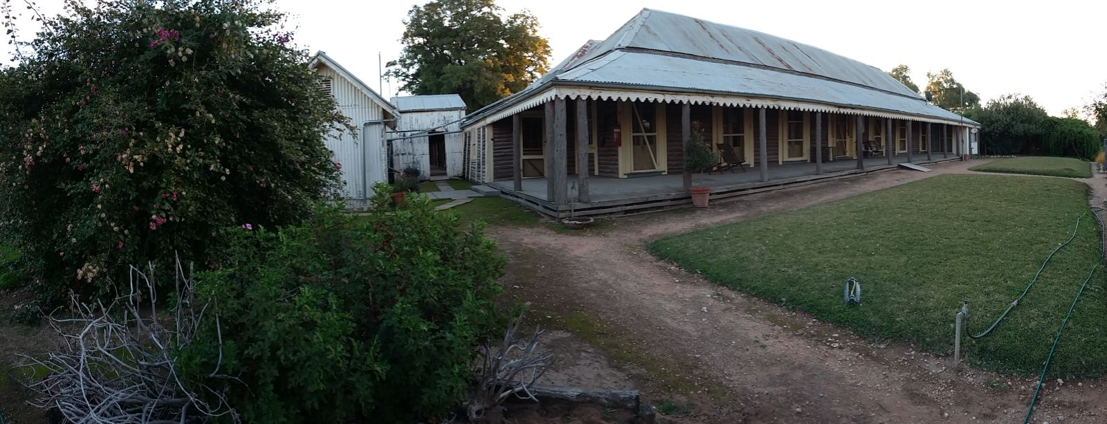
The base of the park is situated on the shores of Yanga Lake, just to the east of the town of Balranald along the Sturt Highway. Yanga Lake is an oddly shaped terminal floodplain lake that fills via an overflow from the nearby Bidgee via Yanga Creek. It only fills when the Bidgee floods. The lake itself is shaped like two delicately conjoined kidneys. The boffins reckon it is actually quite young, no more than 20,000 years old, formed as a result of the shifting mud and sands of the Low Bidgee. The elevated northern peninsula is where one finds the quite remarkable Yanga Homestead. Of course, over much of the last 20, 000 years (perhaps much, much longer), if you’d have been able to visit you’d have very likely also found a considerable Aboriginal community.
We visited the Park for a weekend back in June. Yanga Lake had been recently revitalised by new water from flooding late in the previous year and we’d finally found the opportunity when we weren’t busy and the Low Bidgee landscape was sufficiently dry enough for us to leave the security of the asphalt. We were fortunate enough to be able to stay in the Manager’s Residence behind the old homestead but for anyone else there’s a lovely campground closer in to Balranald on the banks of the ‘Bidgee just near the old Yanga Woolshed. There’s also a couple of other campgrounds but more on them later.
Carp are so plentiful that there’s a business in the Riverina called Charlie Carp that converts carp into organic fertiliser. There was a licenced fisherman that we met at the local ‘beach’ who said in the warmer months he could get a tonne of carp a day out of roughly an acre of water but at this time of year it would take him three to four days of work. There is work afoot to release a virus from Europe into the water to kill the carp but realising the implications of millions and millions of tonnes of dead carp piling up in a few short months along thousands of kilometres of waterway across the Murray-Darling Basin and the impact that a budget of 2 million dollars wouldn’t have had on cleaning it up has somewhat tempered enthusiasm for its release.
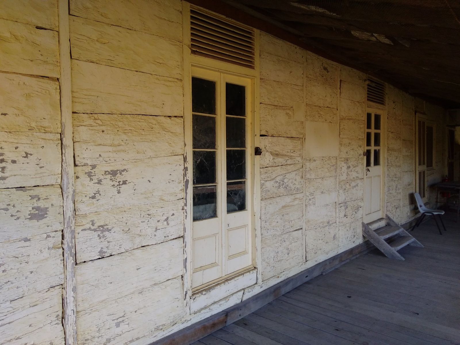
Yanga Homestead must be almost unique in the Australian building vernacular. For starters, it’s made largely of timber, its oldest sections are approaching 180 years in age and it has been a working building until the modern era without significant modification. It’s a drop log construction (which means that logs were dropped into insets cut in post at either end to form load bearing walls) but even that has been done differently.
In the older section (dated around 1840), the drop logs are massive slabs of hand cut and shaped River Red Gum. In the newer section (around 1890), the drop logs are White Cypress (a pine analogue). These cypress logs were quite commonly used for this sort of thing but they’d normally be debarked before they were installed. Not here. For whatever reason, the builders made an aesthetic choice. This is really unusual in agricultural buildings from this era where function typically far outweighed form. This demonstrates to me that this mob had the luxury of choice and the capacity to exercise it so the property must’ve been extremely successful, productive and busy at the time. The barked logs set off the massive formal windows and doors (which were almost certainly shipped thousands of miles from Sydney, Melbourne or even the UK via ship, bullock wagon and paddlesteamer from Goolwa near Adelaide up the Murray and Murrumbidgee Rivers) that still remain in-situ today.
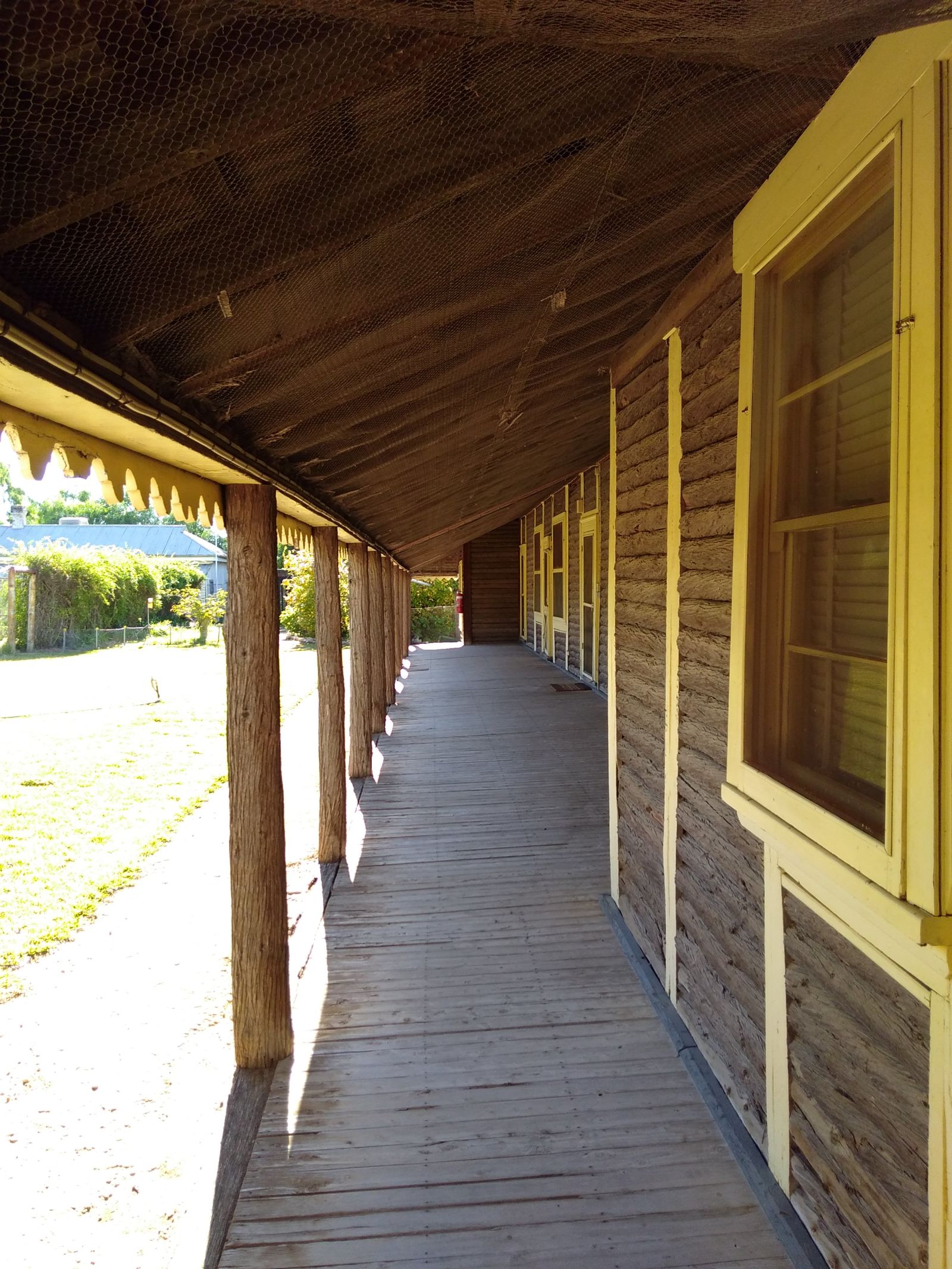
Regular house tours are available however there wasn’t enough staff on Park at the time to offer them while we were there. The inside of the house is a microcosm of property life in the 1950’s, 60’s and 70’s. Yes the interiors are pure faux art deco modernist fifties which is quite a leap when you consider the outside of the building.
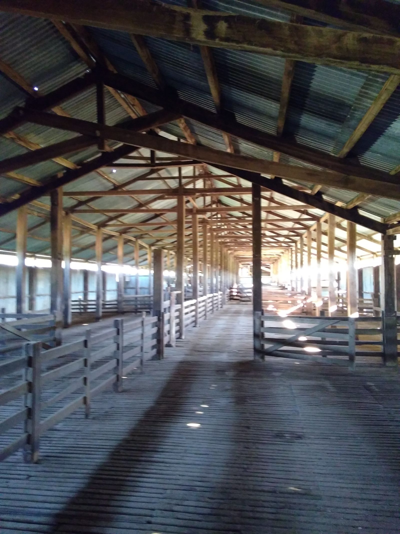
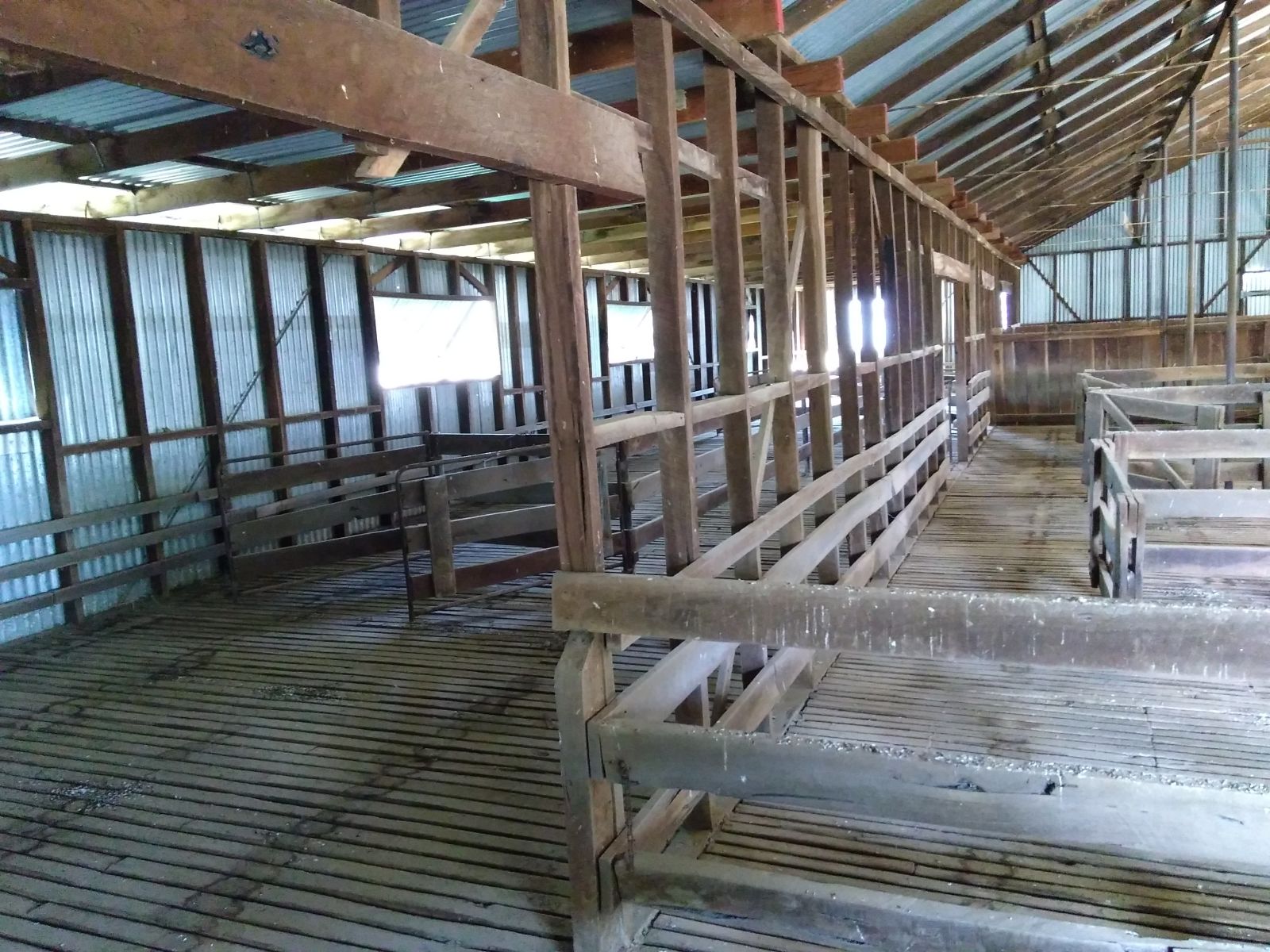
The majority of the Park stretches away to the north and east from the homestead complex. There’s also a small outpost around the massive old woolshed complex closer to town. The sheep were walked or trucked here to the woolshed from all over the property before the wool was loaded onto barges to be towed by the paddlesteamers down to the markets of Melbourne and Sydney. In later years, the train came though and took over but the trucks had long superseded even the train when the woolshed finally fell silent. The woolshed is a huge vernacular timber structure that is carefully aligned to the prevailing winds to try and keep it cool and well ventilated. It dates from the late 19th century and replaced an earlier smaller shed that was burnt down during a shearer’s strike. It is a Church to Sheep and Bloody Hard Work.
East of the homestead, out along the highway, you pass through the State Conservation Area. A little ways along there’s a sign pointing south into the trees. We’ve seen this sign many times over the last decade in our regular travels to the other side of the Sandstone Curtain. However, when one is just a couple of hours into a thirteen hour road trip one tends to simply take note and move on. Same goes on the return journey. We should have made more effort.
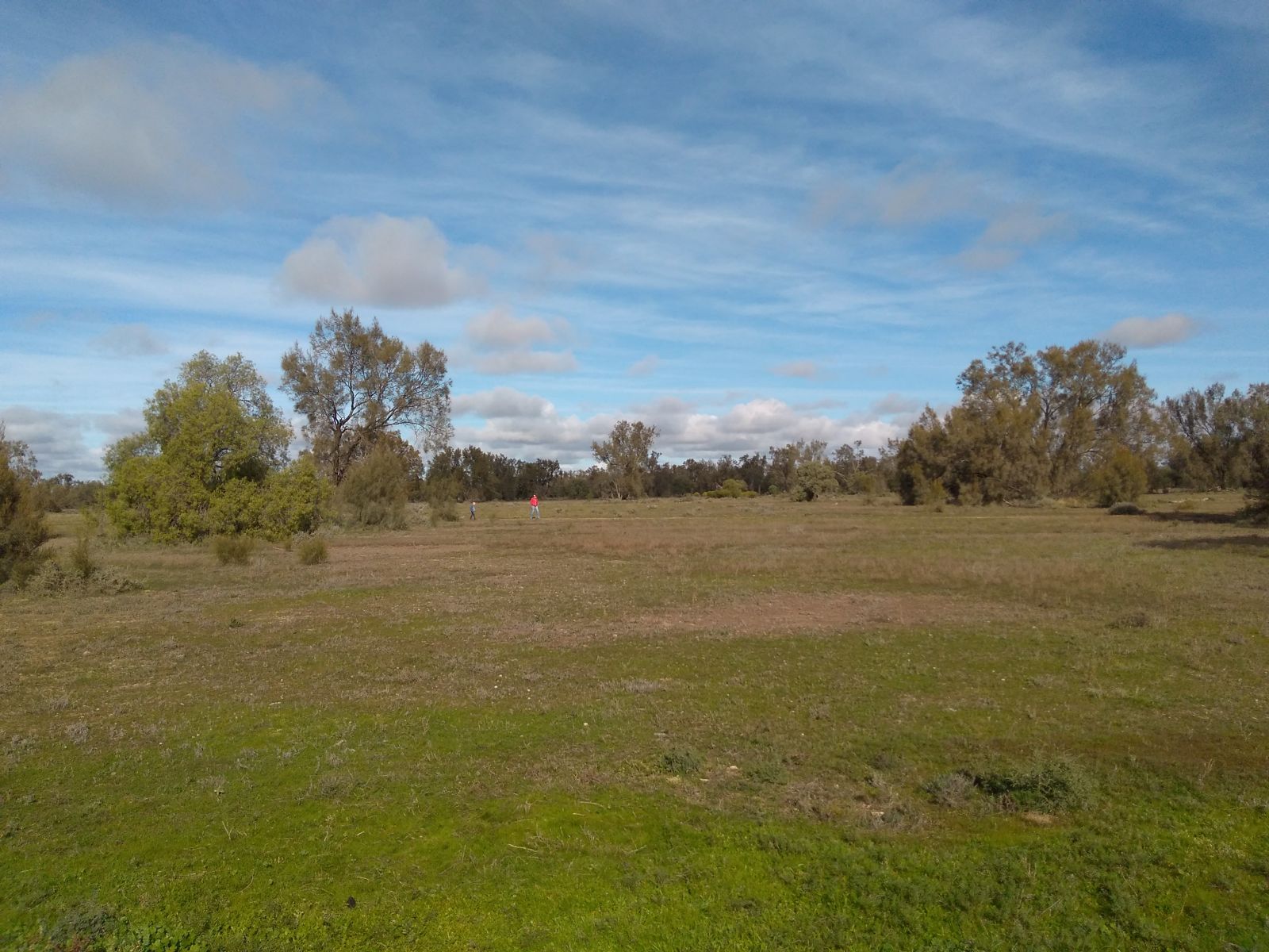
Tucked in off the road, along an all weather dirt road (until one gets to a sign that basically says ‘At the first sign of rain, abandon camp if you don’t want to be stuck here for a few days’) is Wilga Campground. It’s a pleasant little spot in the amongst the cypress, wilga and eremophila trees along the edge of a grassy plain. The road in finishes up at yet another abandoned woolshed though much newer than the Yanga Shed and steel framed as opposed to timber. The open park like vegetation is full of small woodland birds plus a smattering of Emu and Pink Cockatoo. So easy to get to and yet so easily ignored. Despite hundreds of people driving past every day, many of them traveller’s…few stop here, preferring instead the bright lights of Balranald. On the day of our visit there were just three camps in an area that could have swallowed many, many more.
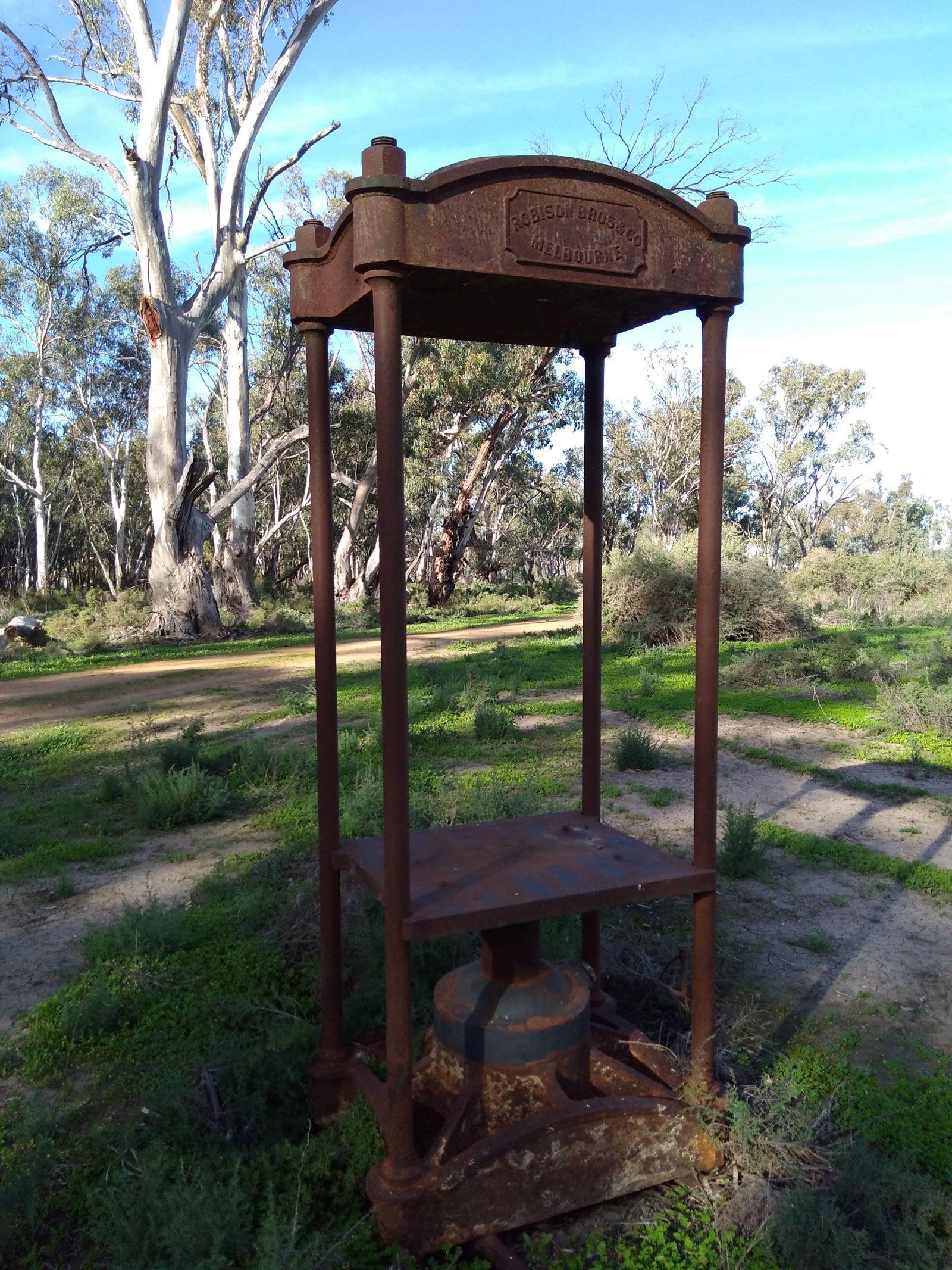
The northern end of the Park is accessed via the Waugorah Road, a half road and half levee bank across the floodplain that also services a half dozen or so remaining private farms off to its east. Much of the Park itself is not legally accessible to the public simply because it’s easier that way. It is possible to do a tag along style tour through the maze of mostly unmaintained trails along the River when the conditions are right but otherwise it’s best not to tempt fate…especially in a Forester. The Waugorah Road cuts a path back to the Bidgee and then a series of access trails fan out to three separate bush camping areas including Woolpress Bend (so named for the cast iron remains of a wool press that stands at the entry to the camp ground. When we were there these places had only recently come back into service after the flooding and were a tad rough and tumble. But the surroundings were very very pretty. River Red Gum forests are glorious places and some of these spots were no exception. Well worth the hike off the highway.
So even in the unmitigating expanse of seemingly sod all, there’s a lesson for us all. If there’s a sign that pointing off into the sod all, take a little time to consider what that sign might be pointing to. Let’s face it. Someone went to the effort to make a sign so the least you could do is see what its pointing to. You never know what you might find, see and learn.
Thanks for reading…