
They were like deer in the headlights. Green eyes glowing in the darkness as the spotlights on the Transporter picked them out behind the bulk of the hut. And they were actually deer. But we were in Coolah Tops National Park. In Australia. Oh dear…
Coolah Tops National Park sits high on a plateau formed by the junction of the Warrumbungle Range (running in from the west), the Liverpool Range (running in from the east) and the Great Dividing Range that runs north/south. Much of the park sits at well over 1000 metres above sea level, hundreds of metres above the surrounding slopes and tablelands. Much of the geology is based on remnants of ancient volcanism, one of many strung out across eastern Australia between Mount Warning on the NSW-Queensland border and Mount Gambier, way down in the very south east of South Australia.
The park itself is barely twenty years old. Previously it had been set aside for over a century for forestry and some grazing leases. As a result, it is little developed and its comparative remoteness means that visitor numbers are relatively low. Most of the accessible camps and walks are found in the fat western end of the park and access is via gravelled all weather roads. The eastern end is strung out along the ridge of the Liverpool Range and is accessed only by a basic natural surface trail that is typically closed in winter. A number of fire trails loop off this main trail.
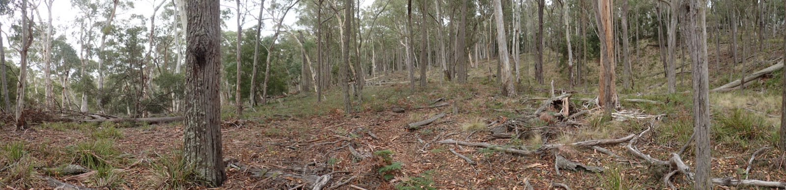
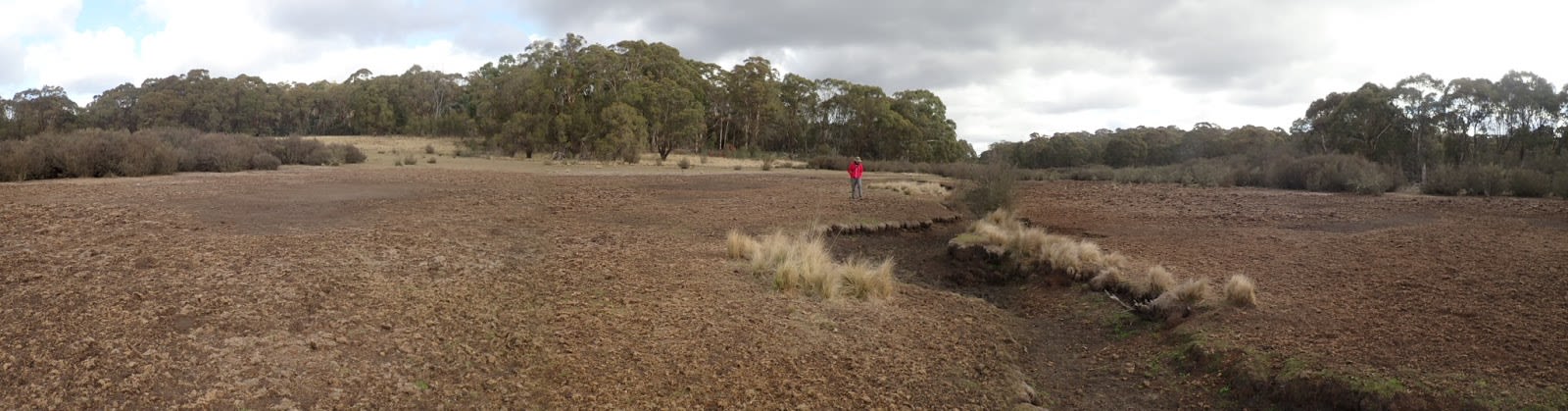
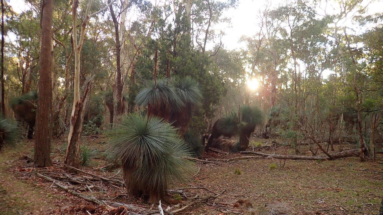
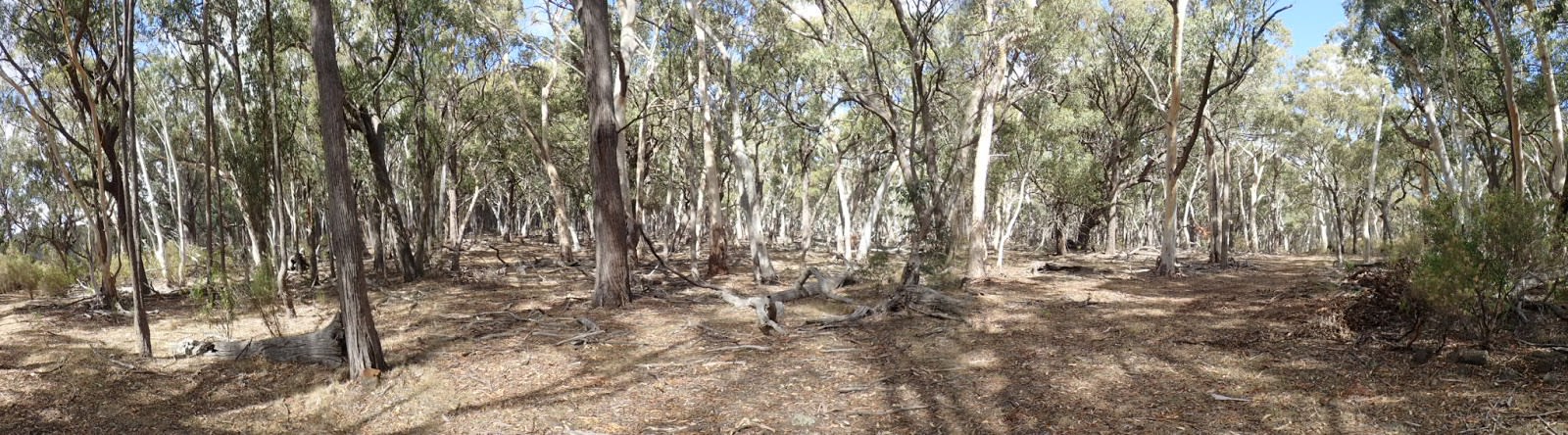
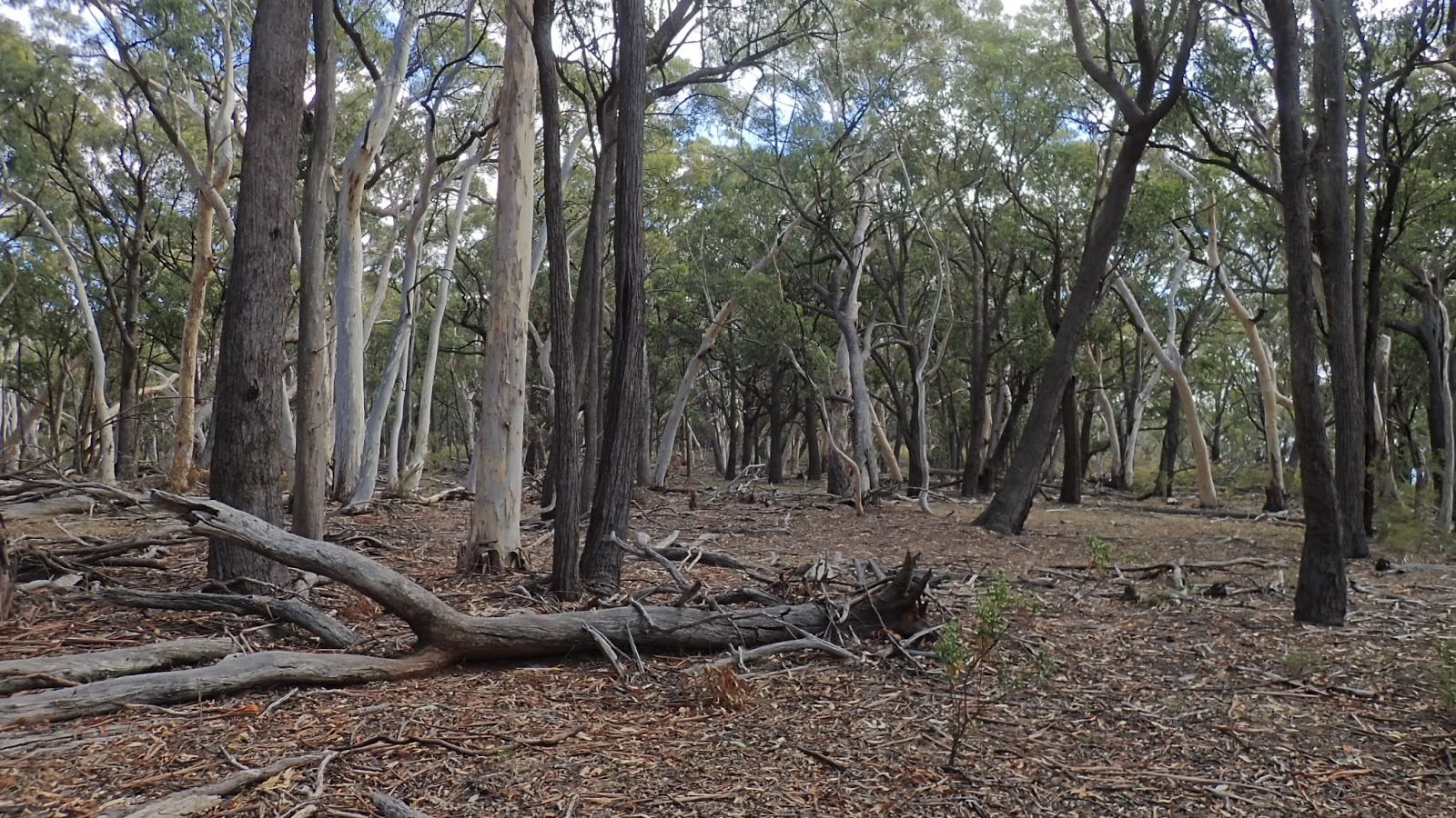
Most of the park is covered by tall open forests dominated by eucalyptus trees such as Stringybark, Ribbon Gum and Snow Gum. However, the centre of the plateau is occupied by a network of open meadows and swampland that follow creek lines amongst the bigger trees.
As we approached sunset one Friday afternoon, we quickly passed through the town of Coolah and headed up the valley road that followed the Coolaburragundy River upstream towards Pandora’s Pass and the access road to Coolah Tops National Park. Being deep into autumn, the light was failing rapidly and we were keen to get to our camp without confronting wildlife in the dark.
This road itself is something of an historical artefact. It was the first route officially found by whitefellas that would get them northwards out of the Central Tablelands and onto the incredibly fertile (due to all that volcanic soil) Liverpool Plains. A bloke called Cunningham led a team that found their way through back in 1823. He called it Pandora’s Pass because he’d been bashing about for weeks up against the range to the east and was a little bit knackered. If he made a little more effort to go one valley further west then this quite precipitous route would never have been necessary.
The other amusing thing about it was that this Pass and much of this end of the Warrumbungle Range sat on a line prescribed by the colonial governor back in 1819 as a limit of development. The idea was that colonial settlers wouldn’t be allowed to get too far out in the boondocks and away from the control of the authorities. Needless to say that this decree failed and, while Cunningham didn’t record it in his official journal, he and his team came across a number of houses and farmed areas developed by whitefellas once they were in so-called uncharted territory on the other side of the pass.
Leaving the valley road, the park access road climbs roughly through private property, dotted with grazing cattle and goats before arriving at the forest wall that defines the park boundary. We lost the last of the light as we cruised across the boundary grid and into the trees. We saw our first deer shortly after…
Feral deer are a developing problem in Australia. They’ve long been here but mostly in small & localised populations. Unfortunately, they’re getting much more abundant. The predominant species are Fallow and Red Deer from Europe and Sambar, Chital and Rusa from Asia. The species we saw in Coolah Tops appeared to be either Fallow or Red Deer...it was a bit tricky to tell in the dark!
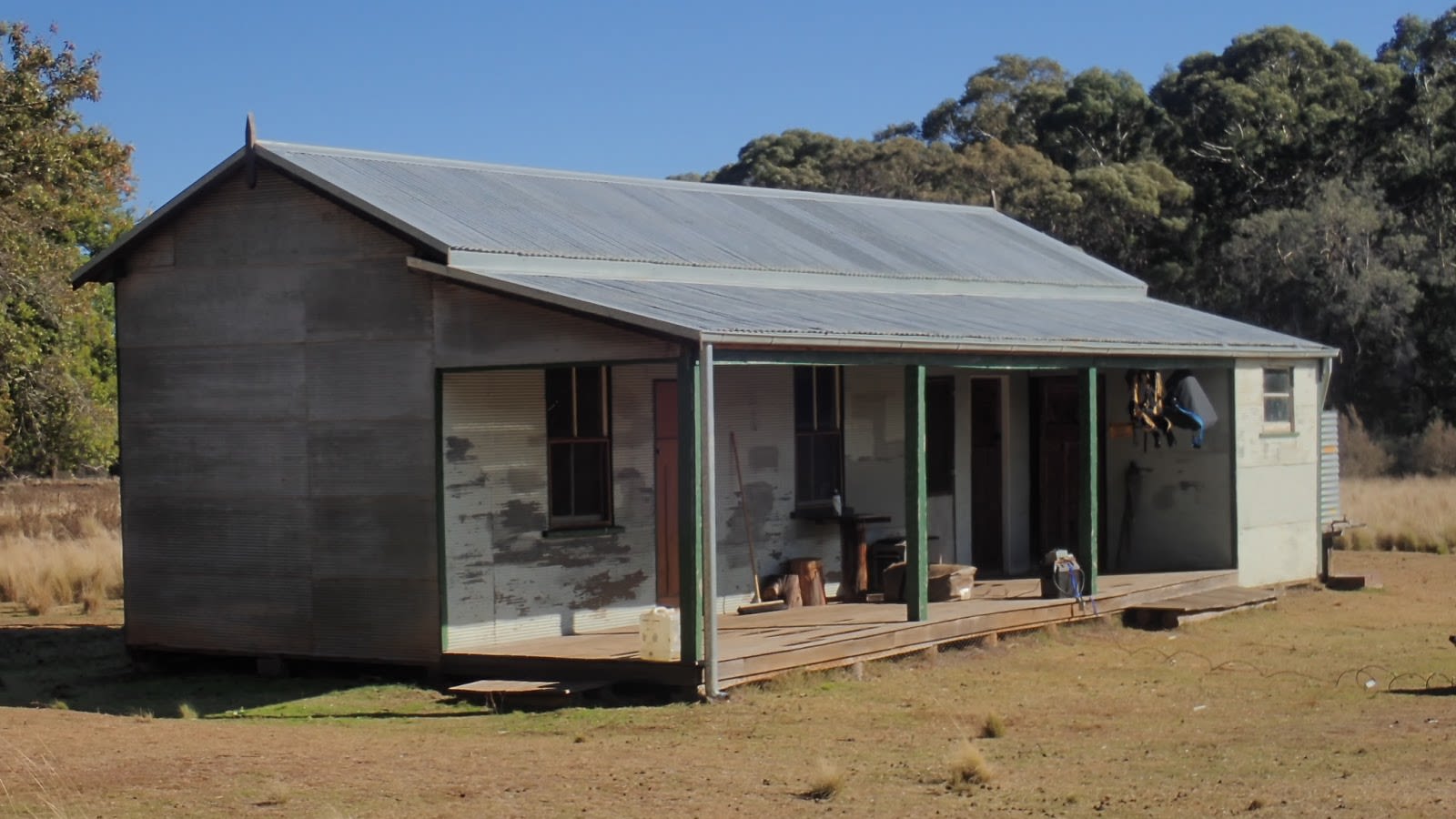
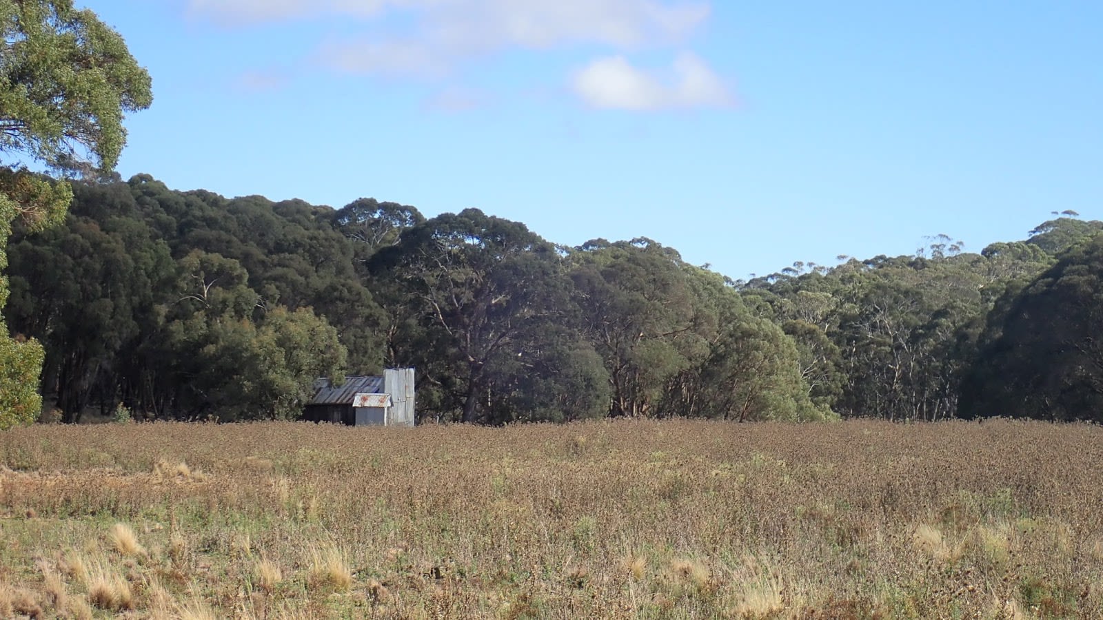
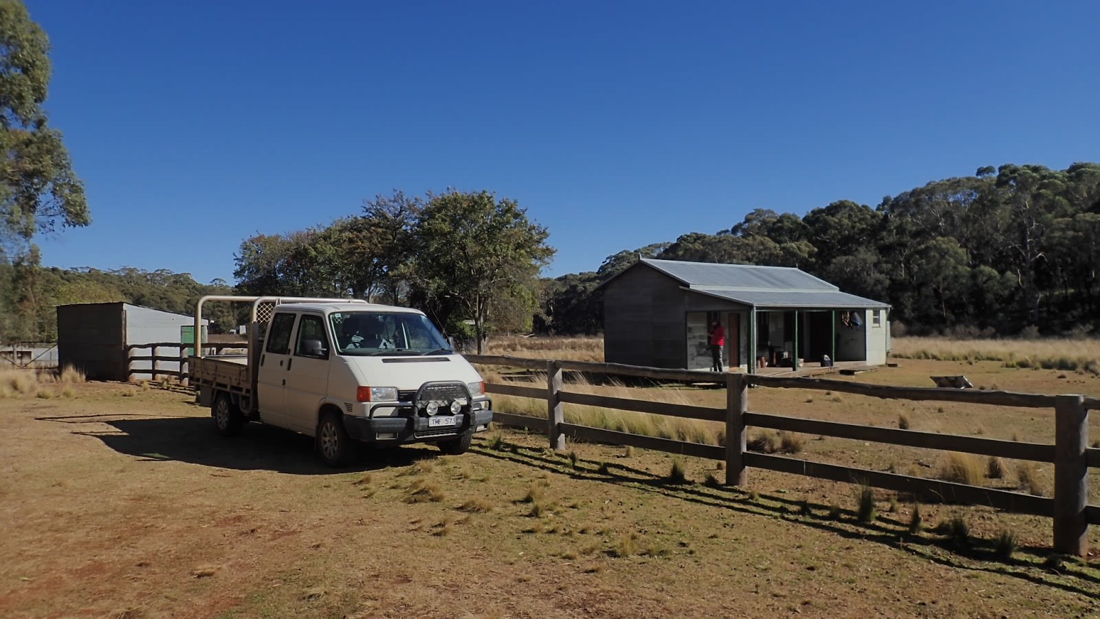
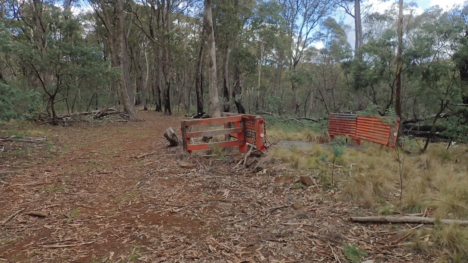
We were headed for Bracken’s Hut. This three room cottage sits at the lowest end of the central swampland beside the curiously named Norfolk Island Creek. It dates from 1937 when the area was part of a grazing lease. By the time the park was established it was fairly run down so it was restored and by 1999, made available for use by visitors. There’s nothing in it bar the main fireplace, a table, a shelf and some bed frames. There’s a long drop toilet out the back plus a small stable. It costs $40 per night to use, regardless of the number of people using it.
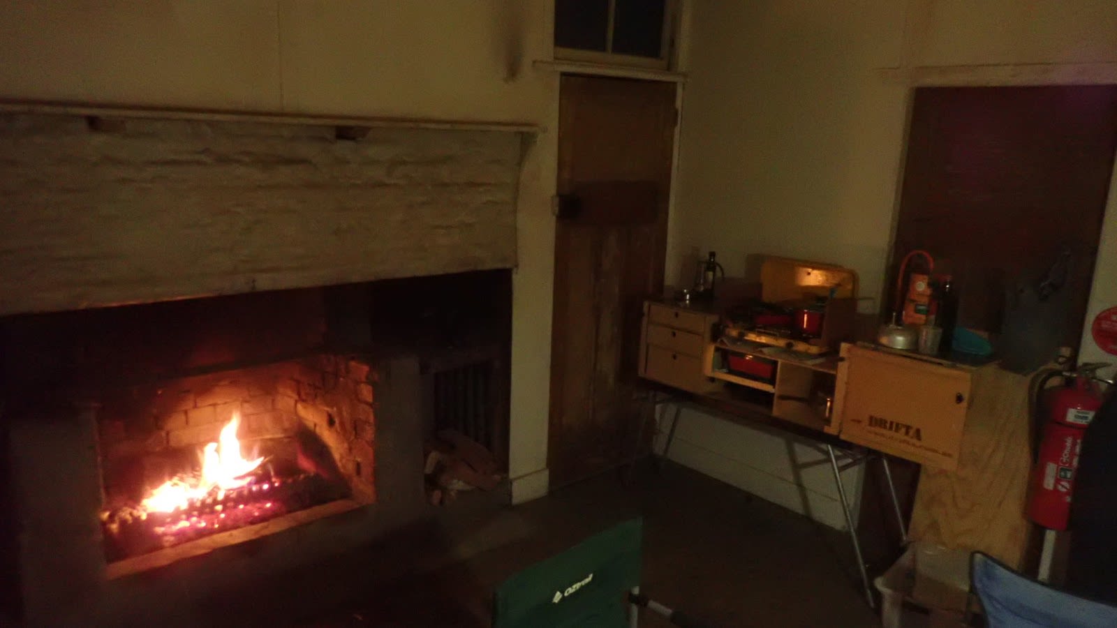
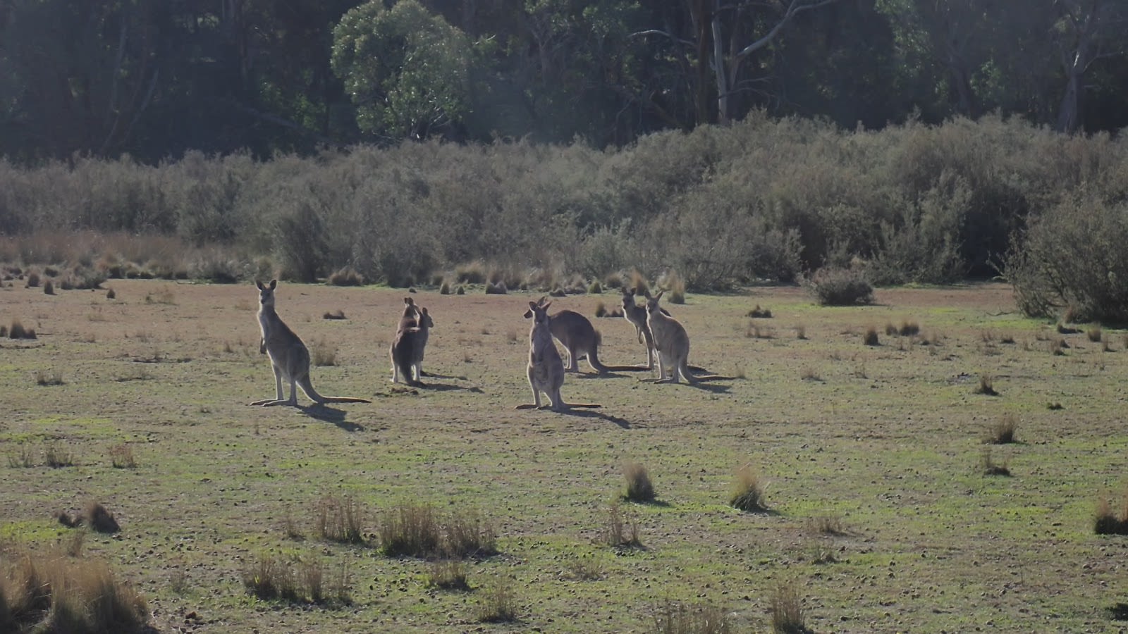
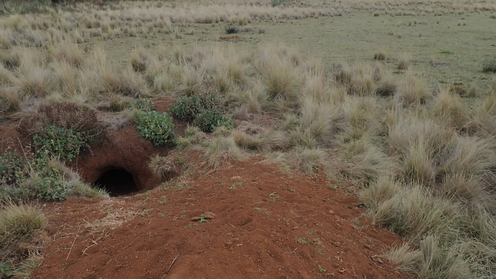
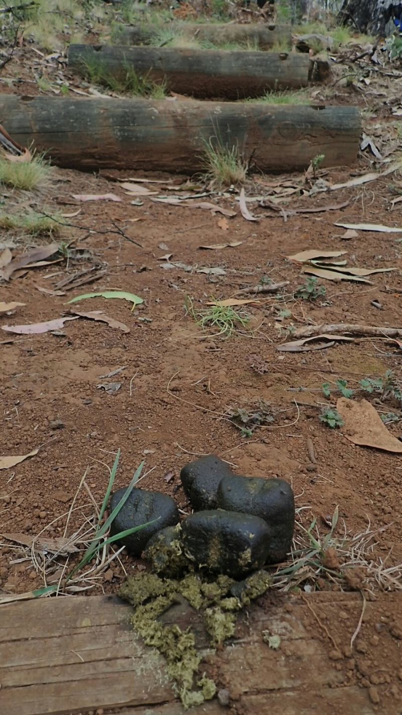
The hut is basic but generally comfortable. Numerous gaps and the lack of insulation mean that it will never be palatial. We bought along our full camping regalia and made ourselves at home. The area around the hut is open and extremely well grazed by kangaroos, wallabies, wombats and the deer. The volume of droppings scattered about was testament to their abundance. A large crew of Crimson Rosella (a rich red/blue parrot) roamed about chewing on thistle seeds.
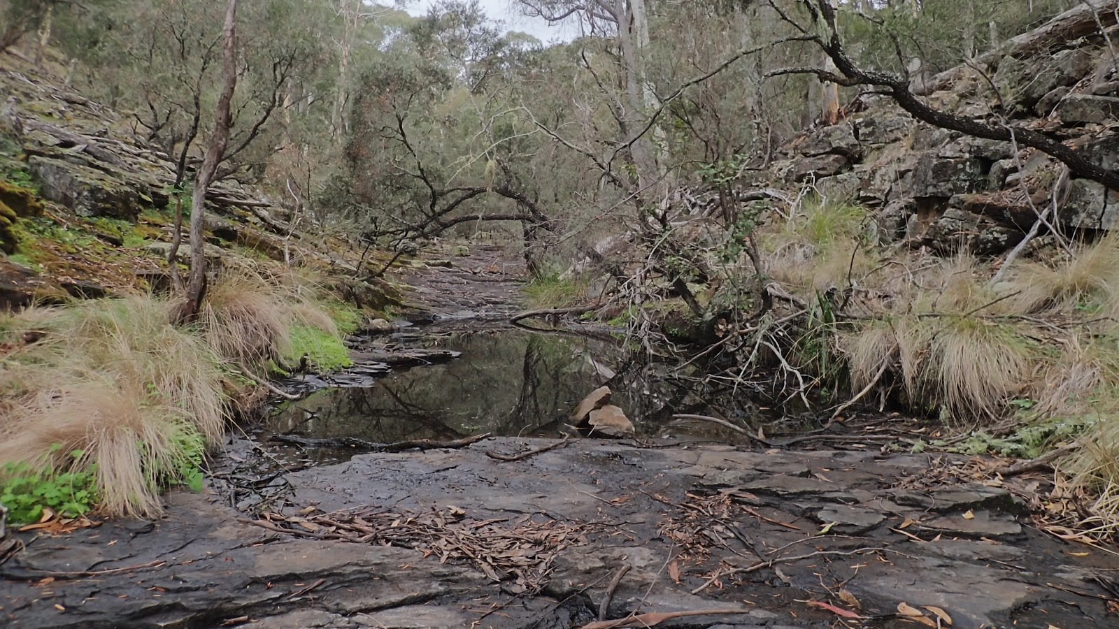
We hadn’t been in this Park for 15 years and were surprised to see that little had changed in that time. If anything it appeared that even less people were using it now than they were back then. The main difference was down to the climate. This area has been subjected to drought conditions for much of the last two years and very little surface water remains. The swamplands were firm, dry but still vaguely green meadows rather than soft, soggy, iridescent green peat bogs. The creeks these swamplands fed were dry.
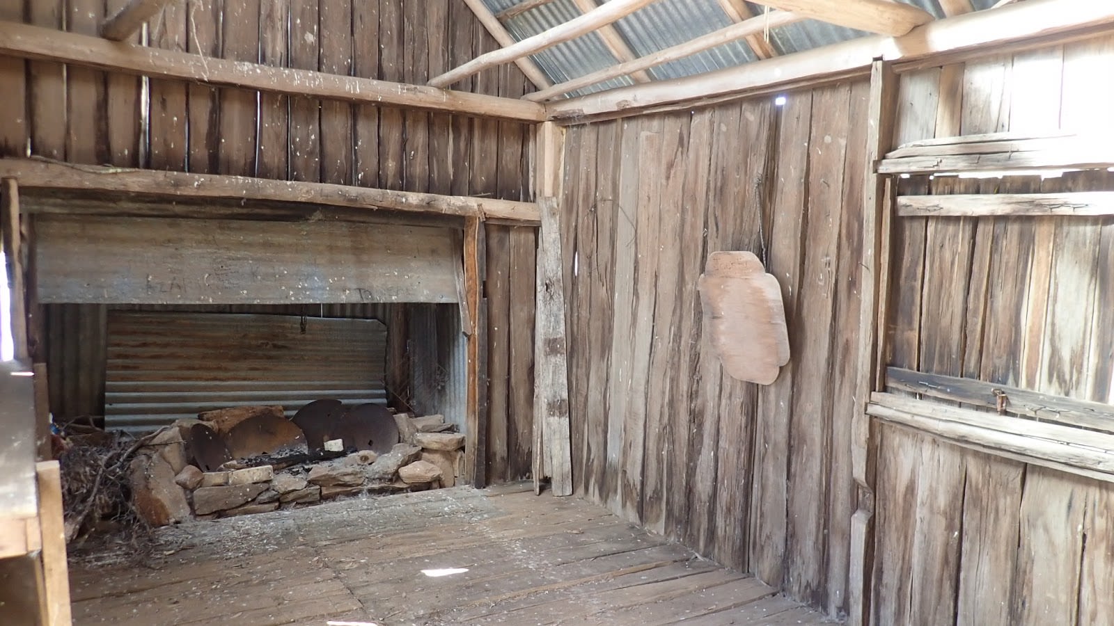
The first morning we wandered down the meadow to check out the other hut nearby. Joe’s Hut is a more basic structure than Bracken’s and is currently unavailable and inaccessible to punters to use. It would certainly be more uncomfortable than Bracken’s, especially during winter!
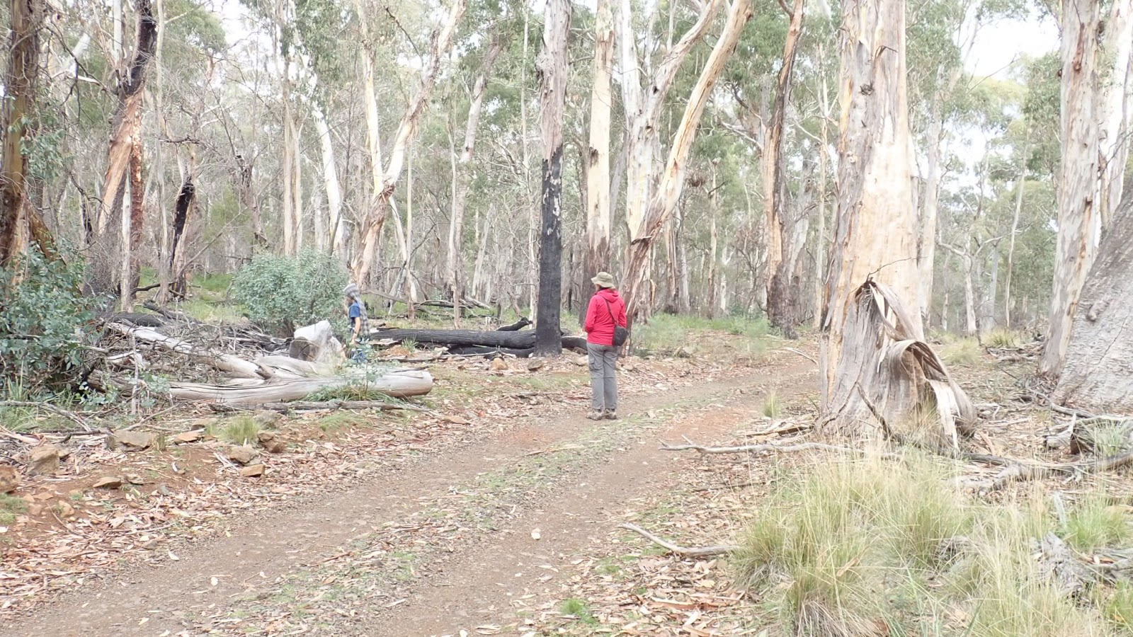
From there, we strolled down the access road to the Bald Hills campground. The falls in the creek below has only the merest dribble of moisture running over them. The access road was part of a longer fire trail that loops around through the forest at this end of the park back towards Bracken’s Hut and, while closed to vehicles, it would be excellent to exploit on mountain bike. There’s a walking trail from this camp across the ridge and down to Norfolk Falls (on Norfolk Island Creek) so we followed that until it crossed the Bundarra Fire Trail which took us instead back towards the hut (one must remember that the littlest legs in the walking party dictate how far we walk).
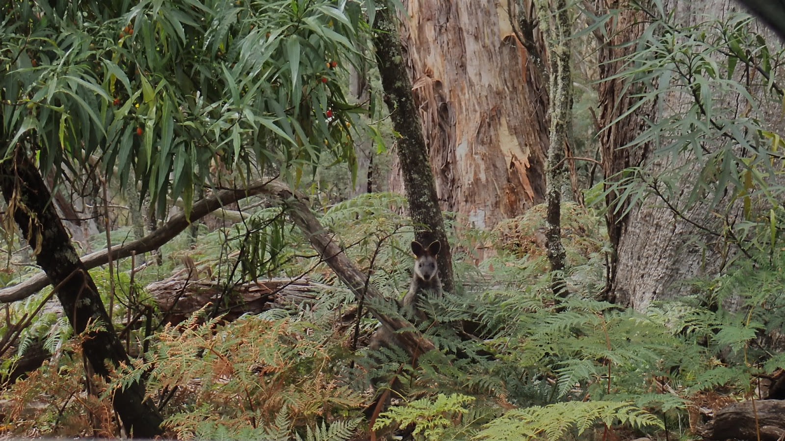
After some lunch we struck out in the other direction, following a vague old fire trail along the edge of the swamplands. Our map suggested that we would come to the Red Ramp Trail which would then loop back onto the Hildegarde Trail and then back again to the hut. It was a beautiful walk along the swamp edge, through wattle groves and eucalypt forest. We came across numerous Eastern Grey Kangaroos but we’re also fortunate to sight Red-necked Pademelon (a type of wallaby) and a fleeting glimpse of a Swamp Wallaby. Sadly, we also came across a vast area of meadow that had been churned up by feral pigs, another bane of the bush.
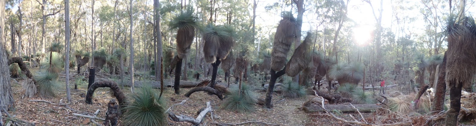
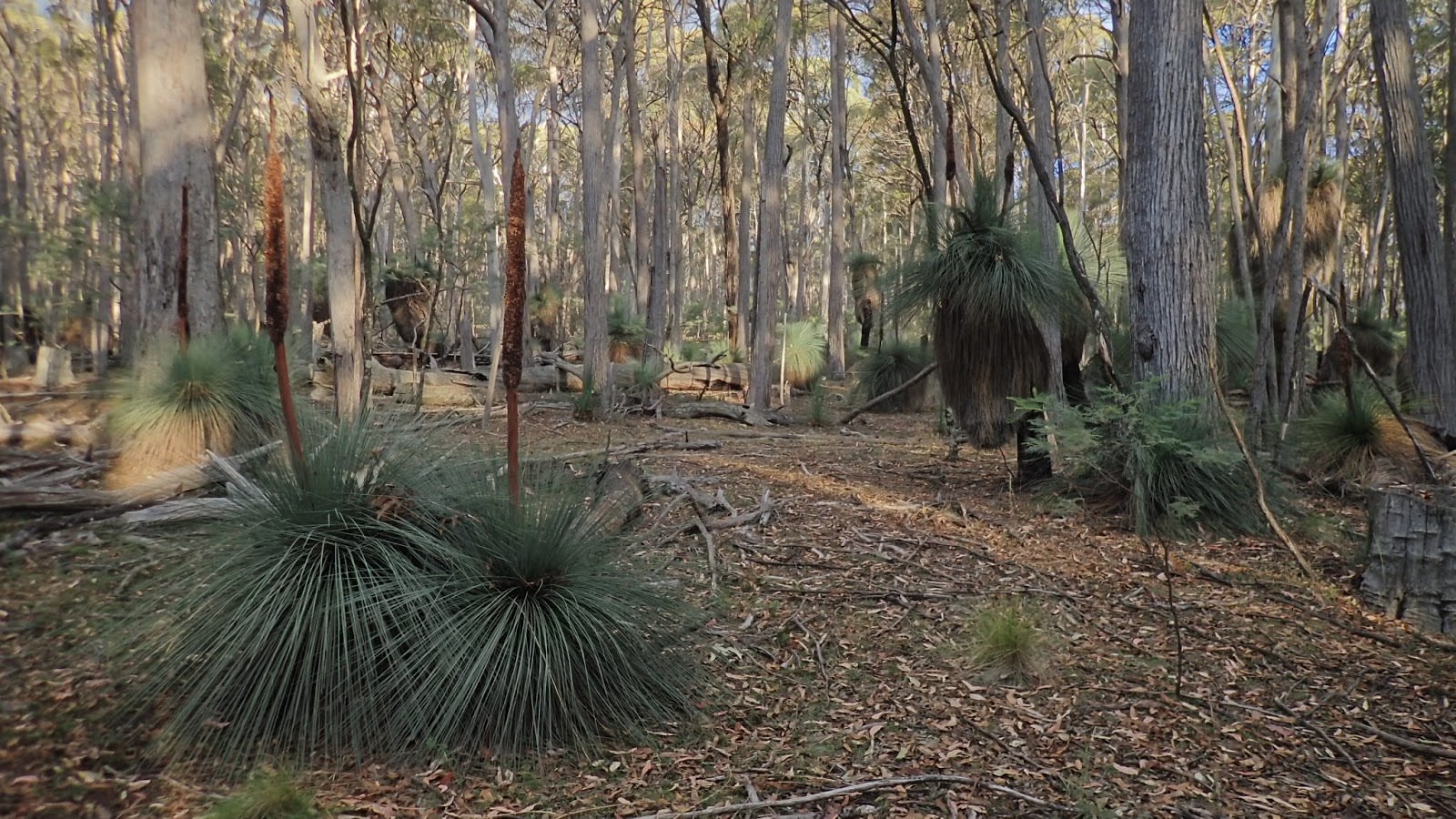
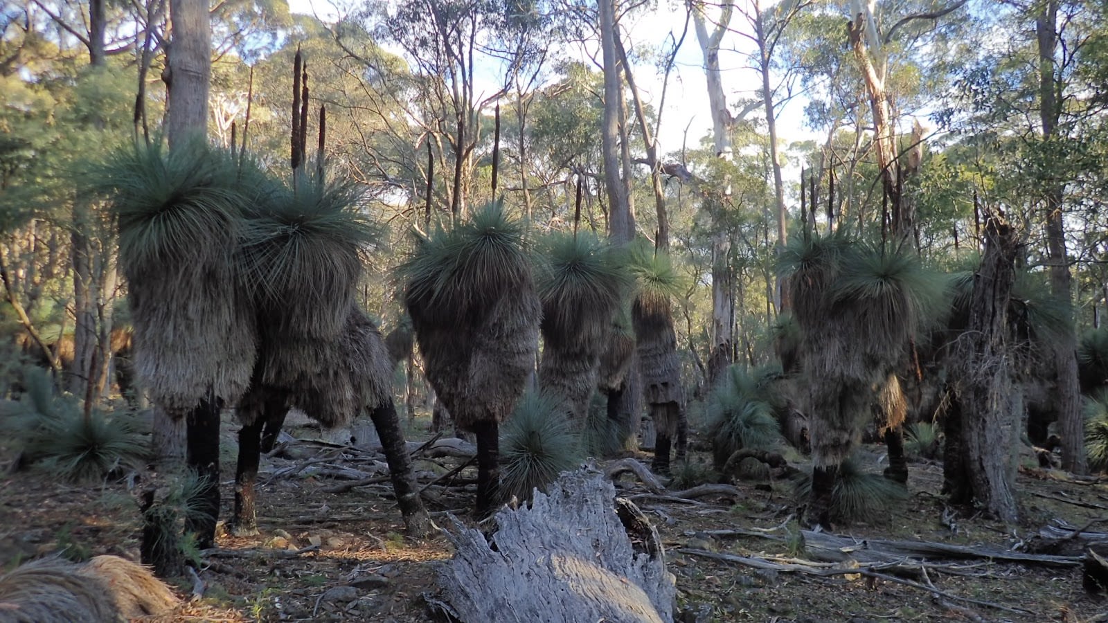
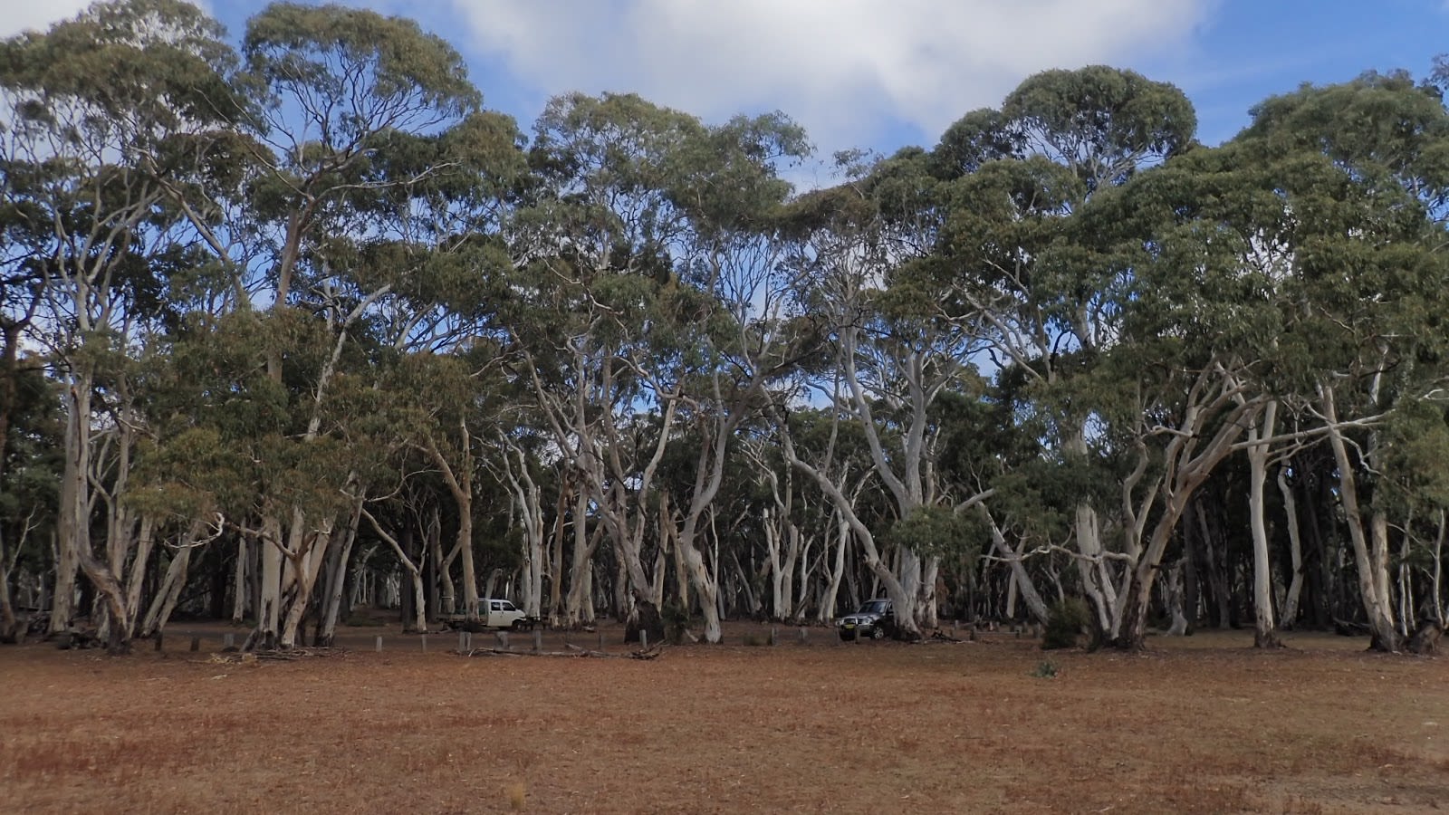
Towards the end of the day, we finally jumped in the truck and headed over to the Barracks campground on the Pinnacle Road in order to wander along the Grass Trees Walk. Barracks is the only camp in the park where water is available (rainwater harvested from a picnic shelter) so this is where most people seem to camp. The Grass Trees Walk is a short but spectacular trundle through a grove of extremely tall and probably quite old Southern Grass Trees (Xanthorrhoea australis).
The following morning, we packed ourselves up, tidied up the hut and struck out for the 26 kilometre long Forest Road and the wilder eastern end of the park. However, it didn’t take long to get distracted by a side road (4wd recommended!) that claimed to head to the Talbragar Falls.
The Talbragar River rises in Coolah Tops before heading south west across the tablelands via the major towns of Mudgee and Dubbo and falling into the Macquarie River. This, in turn, dribbles into the Barwon River, which becomes the Darling River, which then joins the Murray River to flow out into the Southern Ocean a little south east of Adelaide, South Australia. The water here has a long way to go...
The trail down to the falls is basic but in reasonable shape. Its steepness meant there where many water bars across it to prevent erosion and a couple were tall enough to suggest taking it easy lest we dragged our belly across one. But in the end, no worries. The trickiest part was finding the trail actually crossing the river in the form of a steep sided ditch. There wasn’t much water but the tight looking inverted parabola gave me pause before giving it a go. And we sailed through and then dispatched a couple of stony switchbacks before arriving at the parking bay for the walk to the falls...which was more of a wet cliff in a gully.
No matter. Onward, upward and outward as we made a guess that the trail continued back out towards the Forest Road. The map wasn’t being totally helpful or reassuring at this point. Nor were the many fallen trees, some recently cleared from the trail. It would only take one to stop us in our tracks and send us back past the falls again.
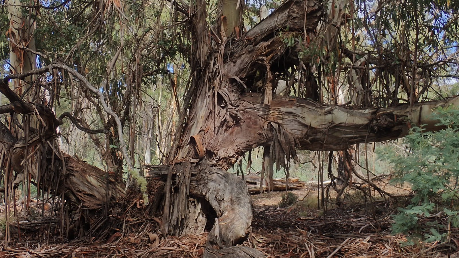
Sure enough we soon popped back out onto the road and continued eastwards. We were slowed only by a very accommodating Swamp Wallaby and signs marking the intersection of the three mountain ranges that form Coolah Tops. However, shortly after rounding the ridge occupied by a feature known as Lava Rocks, we were stopped. A large Ribbon Gum on the roadside had had enough in the overnight breeze and fallen across the road. There was a way around it but it was too much for the Transporter to handle. Nothing else to do but a six point turn to wander back the way we came and to make a mental note to bring a pruning saw next time (chainsaws are forbidden here).
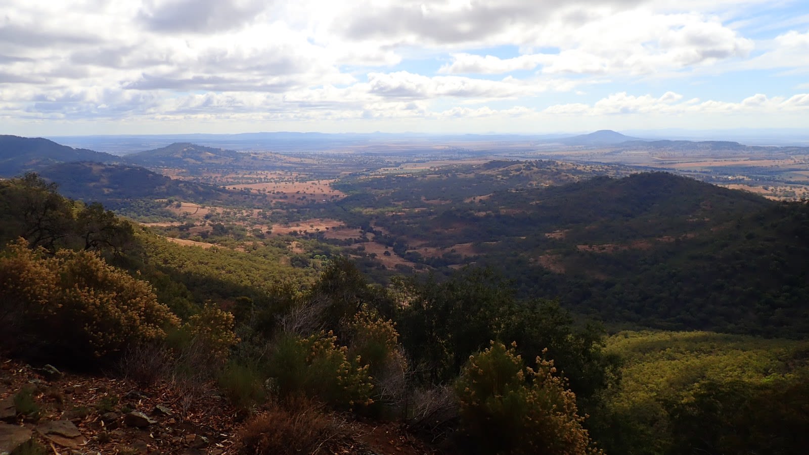
We returned to the Pinnacle Road and headed out to its namesake situated a short walk past the roads end. It’s less pinnacle, more rocky promentry. Regardless, it affords a spectacular view of the southern reaches of the Liverpool Plains. The area around it is cloaked in an odd form of eucalypt forest based on Stringybark or similar. Imagine formal parkland under a scattered canopy of consistently sized trees...then imagine much of the grass covered with windfall timber. It looks rather odd but still attractive.
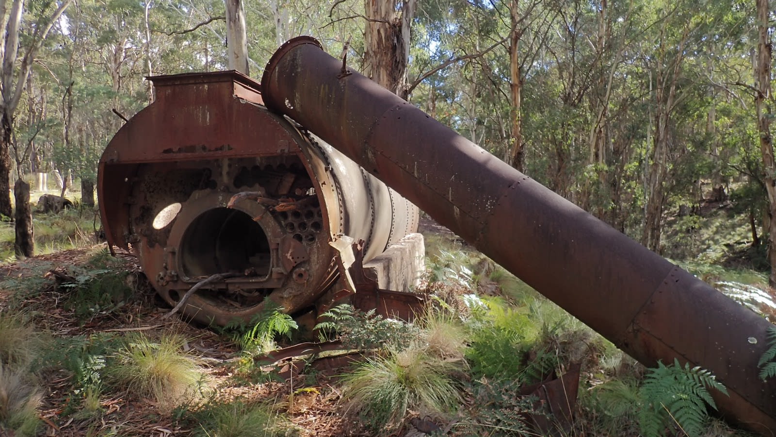
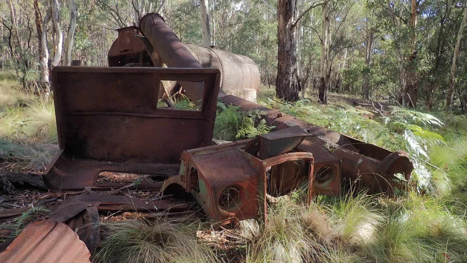
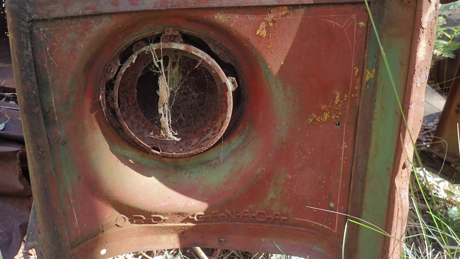
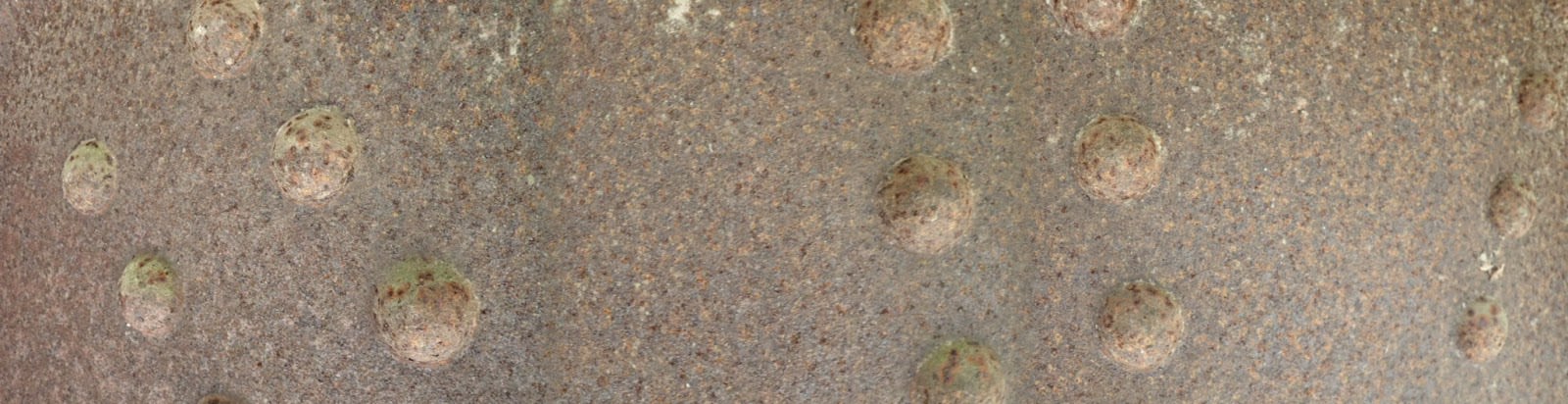
Next stop was the site of the Cox’s Creek sawmill. All that remains of it is some foundations dominated by the carcass of a huge steam boiler (with most of the boiler tube removed) and the cabin of what looked like a Chev ‘blitz’ truck...and yet is marked as being of Ford Canada. I still haven’t sussed that one out!
After that it was home time. Time to get down out of the park and head out across the plains. We chose to go over Pandora’s Pass for the first time which paid dividends in scenery and dirt roads but is not a practical approach route if one is being chased by the dark. The road is winding, narrow and rough while, down on the flats, numerous dips, creek crossings and wandering cattle make for the sort of amusements than one doesn’t need in a dark that’s also occupied by the odd roo.
Given it’s only a short hop away from home, Coolah Tops is a place we will be spending more time in. No bad thing to my mind.
Thanks for reading!