
With new fires burning in the Northern parts of the Bay Area/in “Wine Country,” I started poking around NASA’s satellite imagery for tracking wildfires. Realized I could go back a few days and captured a few images that better illustrate what we’re talking about when we say “onshore” and “offshore” winds, what that means and how quickly the wildfire situation changes when the weather conditions are just so.
First image is from Saturday September 26, 2020:
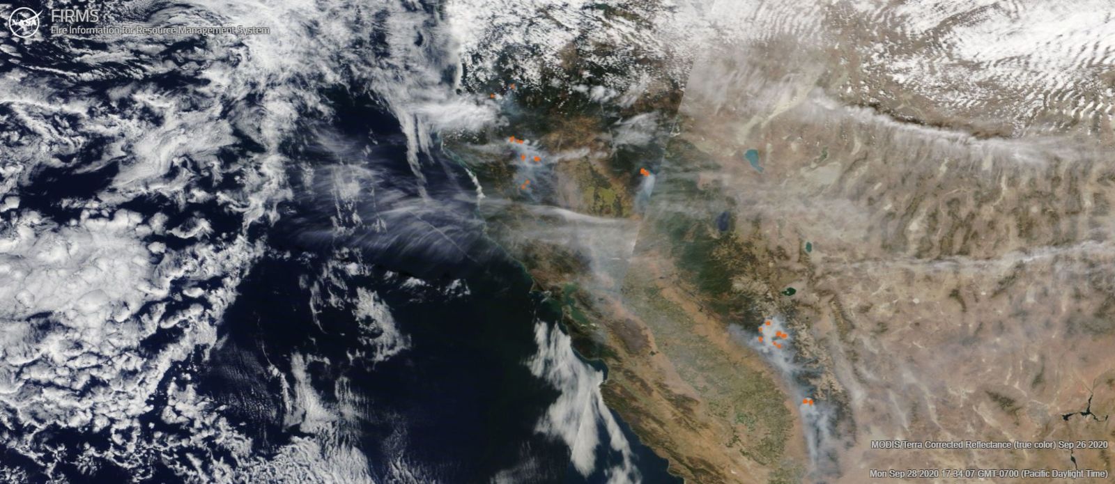
“Offshore” winds had actually already started for a good chunk of California, but you can see at the North end of the map in particular how much cloud cover there is and how relatively close the clouds are to California’s coast still. It does at least illustrate that there is indeed a fair bit more moisture in the air when the winds are blowing from off the ocean to the inland areas. This also brings a nice drop in temperature, as the ocean off our coast is quite cold. When we get a nice cool day from a healthy onshore wind, some of us like to say “the ocean air conditioner is working well today!”
We still had a number of fires burning in various areas in the Sierras and the Trinity mountains.
Sunday September 27, 2020:
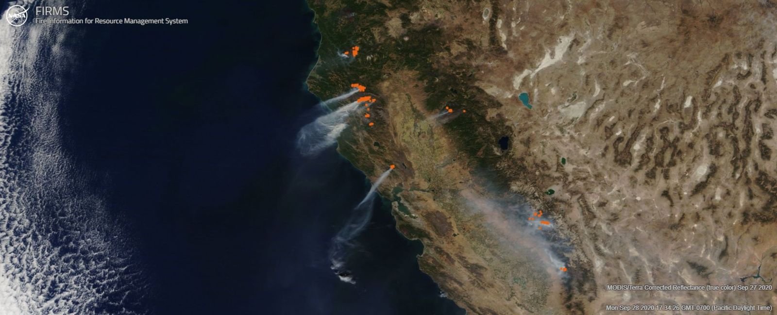
The offshore winds strengthened greatly later in the day Saturday and in the overnight hours. You can see the moisture has now pushed VERY far away from the shore and note the direction of the smoke is now heading ESE. A new fire came out of nowhere in the heart of wine country (just North of the Bay Area, center of image). No official cause has been issued yet. You notice the fires growing more rapidly in the Trinity mountains much further North as well as a fire right on the border between California and Oregon.
Today, September 28 2020:
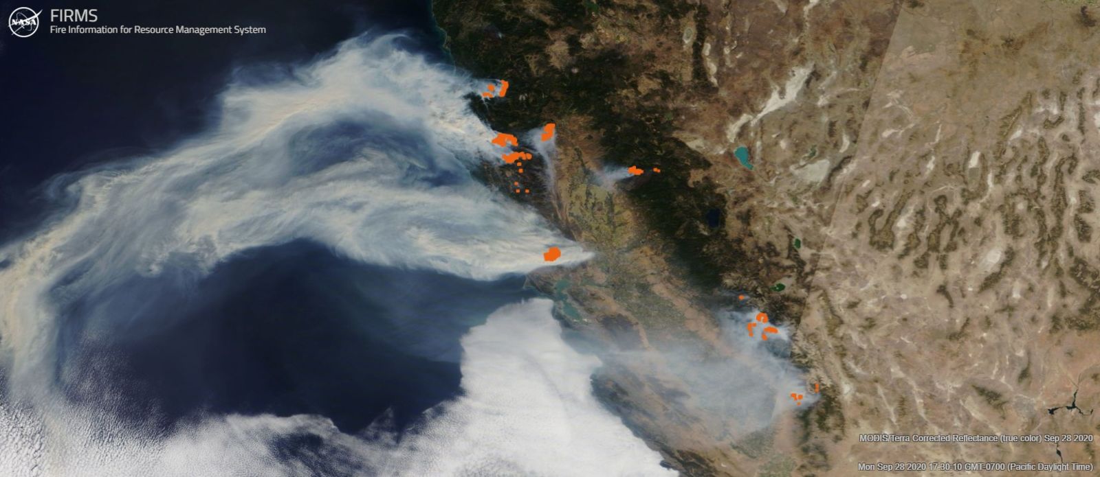
Offshore winds remain strong in the overnight hours, fires have grown very noticeably and yet another new fire has jumped up directly East of the fire in the Trinity mountains. It’s directly South of Whiskeytown Lake, which itself is just barely West of Redding.
With onshore winds, temperatures are lower and humidities are higher, this makes for slower fire spread and much less chance of a new fire sparking.
With strong offshore winds, temperatures go way up, the humidity reaches extreme lows (in the teens, usually), new fires spark easily, fires that are already ripping expand much more quickly.
Sadly, we can’t do much about the weather. The only thing we can do is change our strategy for fuels management and shore up the electrical grid to try and prevent the main reason why many of our worst fires in recent years started.
But weather is what is making this much worse than it ever has been before. These offshore wind events are happening with greater frequency and often times with stronger and stronger winds and higher temperatures than they used to.
Even places right on the coast, where average highs this time of year are around 65, they’re right at or above 90 degrees today, breaking records.
But, as Nick Allain pointed out, that’s not something we can make immediate effectual change with. But we can do something about fuels management and causes of ignition.