It’s not really the weather, it’s interpreting the weather conditions as reported by the weather services. Shorthand is great, but I’m having trouble wrapping my brain around it. Why am I bothering with it? It’s a required skill for getting a pilot’s certificate.
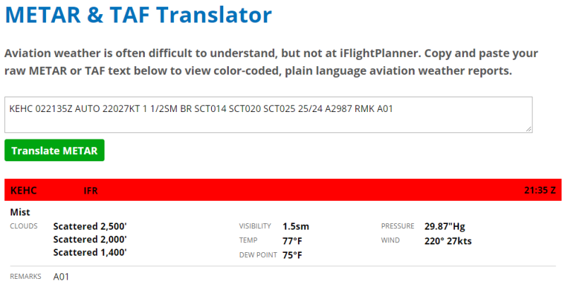
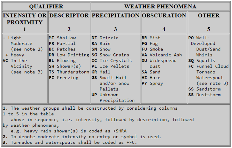
Really, just look at this. KEHC stands for the station. 022135Z is the date and time: second day of the month, 21:35 hours zulu (Greenwich time). AUTO means an automatically generated report. 22027KT means the wind is coming from 220° at 27 knots. 1 1/2sm is the visibility - 1.5 statute miles. BR means that the current weather is “mist”. This comes from a big table of different weather conditions (which we’re supposed to memorize).
SCT is short for scattered clouds. It’s in there three times: 1,400' (014); 2,000' (020); and 2,500' (025), to indicate three levels of clouds at different altitudes. The 25/24 is the temperature and the dew point in celcius. Temps this close together means it’s easy to form clouds. A2987 is the barometric pressure - 29.87" of mercury. RMK is remark, and there’s a long list of those too:
Volcanic Eruptions are in plain english
TORNADO, FUNNEL CLOUD, or WATERSPOUT
Peak Wind (PK_WND)
Wind Shift (WSHFT_time)
BINOVC (Breaks in Overcast)
BINOVC denotes a few, small clear patches in the overcast sky
Tower or Surface Visibility (TWR_VIS SFC_VIS)
CIG (Ceiling=Lowest BKN/OVC layer or height of VV)
V (Variable)
i.e. BKN V SCT, VIS 2V3 [2 variable 3 miles], CIG 025V030 [2500 ft-3000ft])
...
That was partial list of the “important and common” possible remarks. It’s not even close to all of them!
Thankfully, someone at the College of DuPage built a translator. You paste the METAR, it spits it back at you in plain English. I spent part of my afternoon just grabbing METARs from around the country, translating them myself, then pasting them into the translator to see how I did.
It looks like I’m going to need a lot more practice.